A Road Trip On This Scenic North Carolina Highway Leads Through Many Iconic Outer Banks Destinations
Few things are more quintessentially American than the classic road trip: Writers from Steinbeck to Kerouac have described the thrill of moving through diverse landscapes on the open road. North Carolina's Outer Banks — famously abbreviated OBX — make for one such great American road trip. Connected by approximately 148 miles of highway — and a few epic bridges — the barrier islands and peninsulas fringing the Atlantic seaboard comprise a calming, coastal route known as the Outer Banks Scenic Byway. From the artsy beach town of Kitty Hawk where the Wright Brothers made history as the "first in flight," reaching to its southernmost point at one of the most captivating, least-visited of the Outer Banks, Ocracoke Island, this scenic road trip might have you checking local real estate listings by the time it's over.
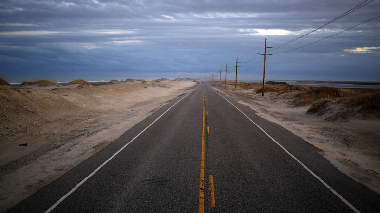
N.C. Highway 12 is the thread of the Outer Banks Scenic Byway. Sand dunes and wild grasses surround the two-lane road, flanked by the intracoastal estuaries of the Pamlico Sound on one side and the Atlantic Ocean on the other. You'll catch glimpses of seagulls and maybe sandpipers, and small towns that dot the journey with local color.
There's a distinctive summertime vibe in the Outer Banks. This is the kind of place that draws tourists during the warmer months, but hibernates much of the rest of the year. If you make the trek during off-season, businesses are likely to be quiet or closed, and sun may give way to dense marine fog, giving the area a mysterious but cozy feeling. The area's natural beauty has a calming presence on those who experience it. The Outer Banks is inarguably one of the most beautiful places in North Carolina, and as Our State magazine declared, "Traveling N.C. 12 is a uniquely Outer Banks experience."
From wild horses to renowned donuts, Outer Banks appeals to all types of travelers
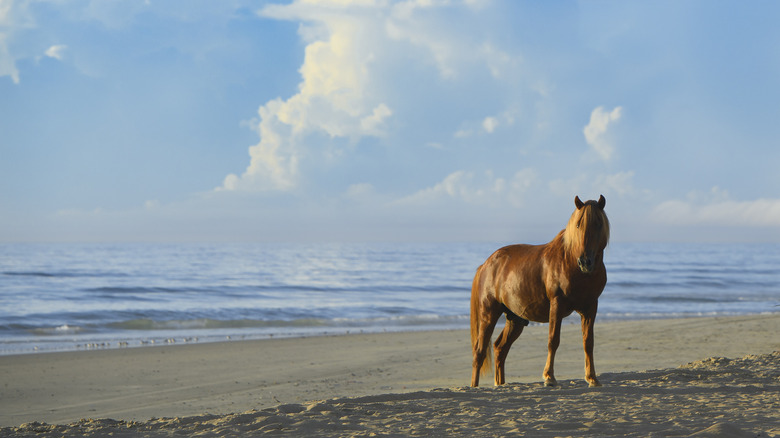
Although the Outer Banks Scenic Byway officially begins (or ends) at its northern end in Nags Head, one of North Carolina's best beach towns, you can start your trip where Highway 12 ends literally on the sand at Corolla. It's a unique, windswept beach where you can experience majestic, wild horses that roam freely, as well as a gorgeous, red-brick lighthouse in Currituck Beach. If you're driving a 4WD vehicle, you can even drive directly onto the beach, just be sure to deflate your tires slightly so you don't get stuck.
Make your way 30 miles down Highway 12 through coastal towns like memorable Duck, with its iconic shop-lined boardwalk along the Currituck Sound. Don't miss road-trip favorite Duck Donuts, with 4.6 stars on Tripadvisor. Continuing south, you'll go through tranquil neighborhoods filled with stilted homes and pass Whalebone Junction in Nags Head, where U.S. Highway 64 intersects from the mainland. This is where the Scenic Highway route officially begins. The full trip is a 137-mile, one-way route that's estimated to take 5.5 hours. It includes two ferries, which you can drive on or take as a passenger: one from Hatteras to Ocracoke Island, and a longer ride from Ocracoke Island to Cedar Island.
The entirety of Outer Banks was once referred to as Nags Head or the Dare Beaches, a nod to Dare County, which encompasses much of the area. Hatteras and Ocracoke were considered the center, and the coastal range below Ocracoke was considered Down East. A 2000s-era rebrand instituted the now widespread Outer Banks, aka OBX, as a unifying identity. Even road signs were updated, and each of the different coastal towns started leaning into their unique personalities.
Highway 12 has wildlife refuges, great eats, and romance, but the land is at risk
Take your time exploring the Outer Banks. The area has more than 300 square miles of nature preserves, including Jockeys Ridge State Park, home to some of the tallest sand dunes in North Carolina. Stop at Alligator River National Wildlife Refuge and Milltail Creek for paddling, geocaching, and birdwatching, or detour onto the Murphy Peterson Wildlife Drive to see black bears and alligators. Pea Island National Wildlife Refuge is also a must-see haven for over 300 species of birds, loggerhead turtles, and other coastal wildlife.
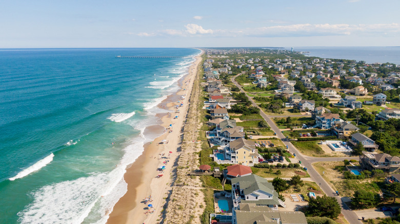
Much of your trip will be in the first designated national seashore in the country. Cape Hatteras National Seashore is a 70-mile stretch of coastal beauty along the easternmost edge of North Carolina, where you can find Bodie Island Light Station and the romantically-linked village of Rodanthe. Avon Fishing Pier is a world-class fishing spotand the only operational pier in Hatteras. Restaurants abound, often serving up locally sourced seafood. In Nags Head, stop for frozen yogurt at Surfin' Spoon, which donates to an autism organization. In Kill Devil Hills, have fried ravioli and mussels at the Jolly Roger, the Outer Banks' original Italian restaurant.
N.C. Highway 12 isn't just a pleasure cruise for vacationers — it's a lifeline to its residents, and the singular escape route from hurricanes. But as sea levels rise, all of the Outer Banks beaches are slowly eroding, putting the coastal highway — and thousands of homes and businesses — at risk. Some experts say the timeline may not be as long as people think. The Outer Banks is a giant, shifting sandbar, and as the region's residents grapple with how to stabilize it and address erosion, challenging conversations lie ahead.