This Ancient New Mexico Hiking Trail Is An Exhilarating Route Across Rugged, Rocky Terrain
The 7.5-mile Zuni-Acoma Trail, or Acoma-Zuni Trail, depending on which way you're coming from, has served as a lifeline between the Zuni and Acoma Pueblos for generations, traversing what is now the El Malpais National Monument. Derived from the Spanish term for "badlands," it's easy to see why Spanish explorers considered the land treacherous; however, there is immense beauty in this particular stretch of volcanic country.
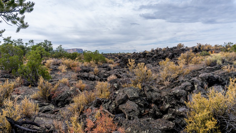
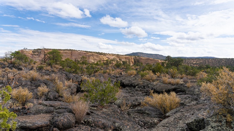
Gazing across the lava-wrought landscape, you'll spot hardly any shrubs or trees. Instead, what awaits you is a backdrop of cracked earth and charcoal-colored lava. Further along, you'll encounter grassy depressions or spiny cacti surviving in the unforgiving environment. Although the McCartys lava flow formed between 2,000 and 3,000 years ago, it's just the blink of an eye in geological time. Human history is what makes this difficult yet rewarding trail feel ancient. Many of the rock cairns marking the trail were stacked before Europeans ventured into the Americas, and the route crosses bridge-like formations that the ancestors of present-day Acoma and Zuni people built.
Despite the remote feel, the trailheads are less than a 1.5-hour drive from Albuquerque, New Mexico. Although there are currently no park-sponsored tours or hikes listed for the Zuni-Acoma Trail, adventurers can learn more about the regional indigenous heritage by visiting the Zuni Visitor Center or the Sky City Cultural Center & Haak'u Museum.
Everything to know before hiking the challenging Zuni-Acoma Trail
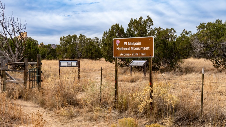
Start your hike from either Highway 117's Acoma-Zuni East Trailhead or Highway 53's Acoma-Zuni West Trailhead, both marked clearly on Google Maps and the park's interactive map. It's up to you which trailhead you choose; however, the western option has picnic tables and vault toilets. Because the trail is 7.5 miles one-way, the National Park Service recommends parking a car at each trailhead and creating a shuttle system between the two.
If you've hiked the ancient lava fields at Valles Caldera National Preserve, a New Mexico park situated on a dormant super volcano, or attempted the slopes of Earth's largest active volcano in Hawaii, you may have an idea of what to expect, but the Zuma-Acoma Trail presents unique challenges. For instance, the trail is marked by stone cairns that blend in with the lava fields. Once you reach a cairn, make sure you have the next cairn in sight.
This will prevent you from getting lost in a landscape where one jagged outcropping looks very similar to the next. Most importantly, never build or take down cairns, as doing so alters the path and destroys an important piece of the area's cultural heritage. Even though the elevation gain is minimal, you must watch your footing to avoid tripping on the extremely uneven ground. Expect to spend around five hours on the trail, and bring hiking boots that cover the ankle, trekking poles, and plenty of water.
The best time to hike the Zuni-Acoma Trail
Although the trail is open year-round, some times are more favorable than others. Due to the overall intensity of the hike, consider planning your trip during the cooler months, between October and May. In December, January, and February, temperatures range between a chilly 32 and 50 degrees, and you might encounter a light snow. October and November are ideal with temperatures around 65 or 75 degrees. The spring months have some warm days but are extremely windy.
Although your clothing will vary slightly depending on when you hike, it's a good idea to dress in layers and to wear breathable pants that protect your legs from sharp rocks and spiny branches. In terms of the time of day, start your hike early to avoid getting caught out in the midday sun. You'll find little shade, and the black volcanic rocks absorb the sun's heat. If you have any concerns about trail conditions, stop at the El Malpais Visitor Center before starting your adventure, or consider a more approachable hike in New Mexico's "Land of Ice and Fire."