South Carolina's Paddling Paradise Is A National Park Creek With Some Of The Tallest Trees In The Eastern US
America's extensive river systems, lakes, and waterways create some of the world's greatest spots for paddling. Whether you're looking for peaceful journeys across calm waters or thrilling excursions over Class V rapids, the countless paddling and rafting routes across the United States have something for everyone. In fact, the United States boasts excellent urban paddling destinations with stunning city views right from the water.
Still, many of America's premier spots for kayaking and canoeing are found in its extensive public lands, particularly the many iconic national parks found across the country. One of the nation's best paddling routes happens to be located in a national park that few give much attention to. South Carolina's overlooked Congaree National Park does not have anywhere near the lofty profile of epic parks like Yellowstone or the Grand Canyon. However, hidden among the remarkable ecosystem of this underrated treasure is one of the best paddling routes you've never heard of: the serene Cedar Creek.
Cedar Creek does not have the whitewater thrills of the Snake River or the monumental views of the Colorado as it flows through the Grand Canyon. And yet, Cedar Creek provides a one-of-a-kind eco-tour through one of America's most remarkable ecosystems, with superb scenery to match. Thanks to Congaree National Park's unique old-growth forest environment, a paddling tour along Cedar Creek will take you past some of the most impressive trees you're likely to ever see. With generally placid currents combined with a comprehensive length, Cedar Creek is the perfect destination for a relaxing, yet breathtaking, paddling trek in one of the country's most important forests. A sitting just 30 minutes from the Columbia Metropolitan Airport and an hour and a half from Charleston International Airport, Cedar Creek, and Congaree bring pristine wilderness wonders to the heart of the Southeast.
Cedar Creek flows through the heart of Congaree's underappreciated beauty
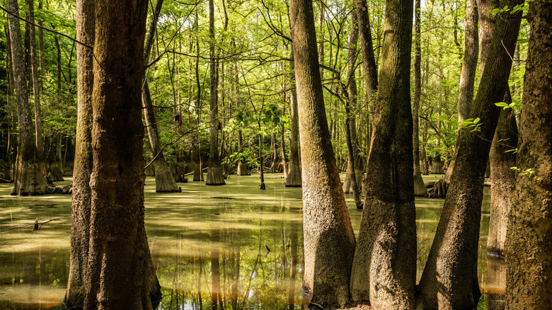
Congaree National Park does not often rank among the top tier of America's national parks. Many attempts at ranking U.S. national parks even go so far as to place Congaree among the "worst" national parks in the country. However, these arbitrary rankings fail to capture what makes Congaree National Park so special. Growing from the flood plain of South Carolina's Congaree River and its tributaries, Congaree National Park contains one of America's very few remaining examples of a type of ecosystem called an old-growth bottomland hardwood forest. Thanks to regular flooding from the Congaree River, the ancient trees in Congaree reach heights found nowhere else. While they don't quite reach the record-breaking heights of the otherworldly Redwoods in California's Redwood National Park, many of the individual trees in Congaree are the highest examples of their species on Earth, reaching heights of over 100 feet on average. The result is an uncrowded national park with one of the world's tallest tree canopies.
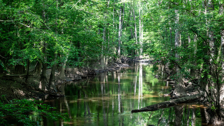
Many visitors may fail to appreciate Congaree National Park because it is a destination best experienced on the water. To this end, gorgeous waterways like Cedar Creek are essential to the park's character. While Congaree has many intricate waterways that cut through the park's vibrant ecosystem, Cedar Creek may be the best for getting the most comprehensive Congaree experience. Cedar Creek is a blackwater stream that flows through the heart of the bottomland forest, providing a thorough tour of all of the major ecosystems found within the park. From the water, Cedar Creek provides up-close views of many of Congaree's titanic trees, plus cypress swamps, floodplain forests, and others. The Cedar Creek paddling route also gives you great views of the park's many animal residents — including alligators.
Cedar Creek is one of America's best paddling trails
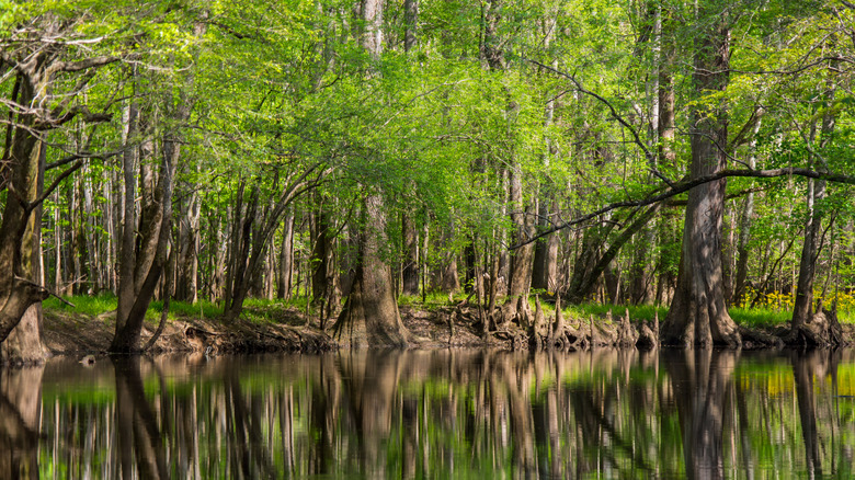
While Congaree National Park does have some on-foot hiking trails (including a well-maintained boardwalk loop), paddling trails like Cedar Creek are ultimately the best way to experience the park. The Cedar Creek Canoe Trail is about 17 miles long in total. However, thanks to the gentle current, canoers and kayakers can easily explore a few miles of the creek and then paddle their way back to their starting point. Most paddlers will enter Cedar Creek from the Bannister Bridge Canoe Launch, which is conveniently located just off Old Bluff Road, a short distance from the main park entrance. The basic Cedar Creek Paddle Route is a 7.5-mile out-and-back excursion that takes paddlers through Cedar Creek's amazing forest canopy, while still getting them back to their starting point. You can also disembark at Cedar Creek Landing, which is marked by a scenic iron bridge and extensive hiking trails. If you're looking for a much longer excursion, the full length of Cedar Creek eventually empties into the Congaree River, where it merges into the 50-mile Congaree River Blue Trail.
In general, the basic Cedar Creek paddling route can be completed in about four to six hours. Do note that water levels and conditions on Cedar Creek are prone to change depending on precipitation and flooding. While Cedar Creek and other Congaree paddling routes are generally calm and free of debris, excessive flooding can create more hazardous conditions. Therefore, would-be paddlers should check the current Cedar Creek gauge before their trip. For overnight stays, Congaree also has two frontcountry campgrounds at Longleaf and Bluff. While camping is prohibited along Cedar Creek between Bannister Bridge and Cedar Creek Landing, beyond that, the creek becomes designated "backcountry" in which primitive camping is allowed.