Utah's Once-Massive Ancient Lake Boasts A Scenic Wildflower-Lined Trail
The Beehive State is known for its impressive red rock formations at Capitol Reef National Park, but it could've had a whole other reputation — only if its massive Pleistocene lake wasn't reduced to a dry bed. Lake Bonneville once occupied a large part of northern Utah. There was no one reason that caused the desert to swallow a lake whole — several natural phenomena led to its disappearance. If swimming was the most popular activity back in the day, Lake Bonneville is now better suited for hiking and biking. A trail now allows visitors to follow the long-gone lake's shoreline, a path lined with stunning scenery and colorful wildflowers in summer.
You might be familiar with the Bonneville Salt Flats near the Nevada-Utah border, which were part of what was once an enormous lake that spanned 325 miles long and 135 miles wide. No one would have imagined that this volume of water would simply vanish. But that's precisely what happened about 10,000 years ago, and the little that was left of it shrank into the Great Salt Lake.
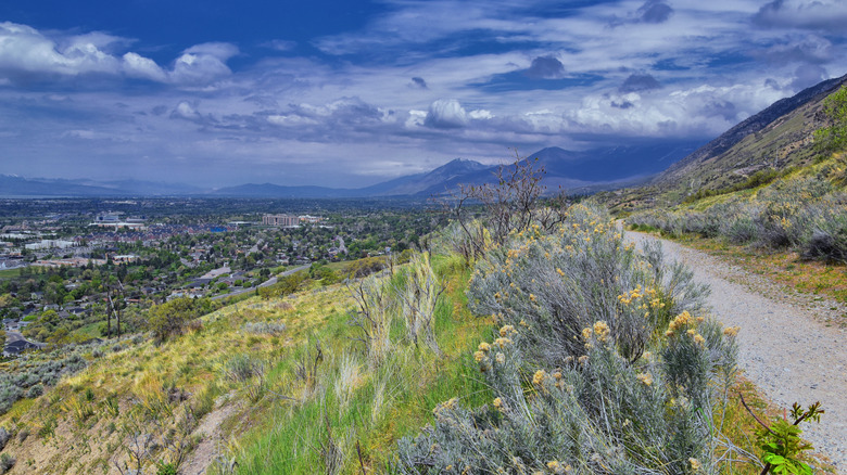
The Bonneville Shoreline Trail (BST), a work-in-progress, was established as a recreational path for hikers and bikers to trace the former lake's shore. Now, it boasts diverse landscapes lined with kaleidoscopic wildflowers. First conceived in 1990, the trail has greatly expanded over the years. As of 2023, 170 miles are officially recognized as a part of the BST, with the goal of reaching more than 280 miles in length. You'll hike past mighty mountains, wildflower fields, lush valleys, and even haunting deserts, with panoramic views of valleys peeking out every now and then.
Follow the Bonneville Shoreline Trail for scenic vistas
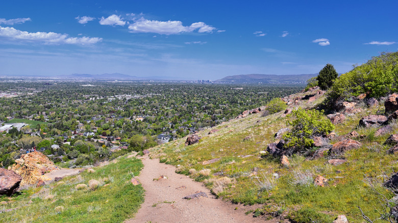
With more than 75 trailheads available to access the various sections, you can hike and bike portions of the Bonneville Shoreline Trail or plan a multi-day journey. The trail follows the western front of the Wasatch Mountains, beginning at the Idaho border and running south, offering stunning views of the Salt Lake Valley. The section that runs from Pleasant View to Interstate 84 takes you past canyons, reservoirs, wildflowers, and verdant hills. From Interstate 84, you can move onward toward Farmington on a leg that features bridges, creeks, and rolling hills.
The BST then runs along Salt Lake City's eastern edge, guiding you toward Parley's Canyon, where you'll ascend ravines and race down hills near Limekiln Gulch. The multi-use trails allow you to explore the Foothills Natural Area on an out-and-back route that goes from the University of Utah to Emigration Canyon Road. According to AllTrails, this 3.5-mile trail is popular and easy. The BST then continues south from Draper to Provo, and then from Provo to Santaquin.
While there's a ton to explore on the BST, there are a few things to keep in mind. Your best chance of seeing showy wildflowers will be in June or July. Most of the trails are relatively level, but there are some challenging sections with elevation gain to reach the BST. For the most part, there's no shade on the exposed hillsides, so consider the conditions before you head out. Since the BST is an ongoing initiative, new sections are being added, with the hopes of it reaching a total of 300 miles. And if you were hoping to get up close to the water, check out Stansbury Island, which boasts one of America's only pink waters.