America's 5 States With The Most Mountain Ranges

There are thousands of named mountain ranges in the United States of America. From the East Coast to the West Coast to the fringes of the Arctic, peaks and summits are one of the great defining natural characteristics of the stars and stripes. They spike the clouds in Alaska with the colossal rock of Denali, and string from the Canadian border in the north to New Mexico in the south with the Rocky Mountains.
But what corner of the U.S. is crisscrossed by the most runs of summits? Which state has the highest number of named collections of peaks? This guide has the answer. After consulting the geographic names database of the United States Geological Survey (USGS), it offers a list of the five states that lay claim to the most mountain ranges.
Many of the states on this list will be predictable — but you might be surprised to see exactly where they rank. Everything from the sequoia-sprouting Sierra Nevada to the distant glacier-topped massifs of the Last Frontier gets a mention here, along with some southern states that are perhaps better-known for sun-kissed deserts than soaring peaks.
California
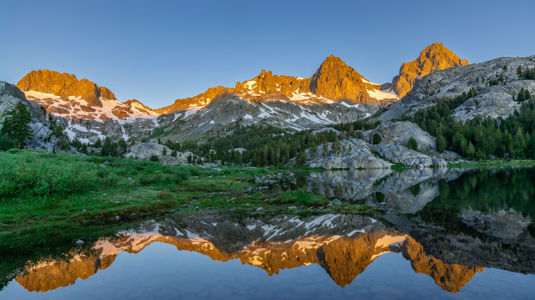
The great state of California comes in above all other corners of the United States as the only territory that counts in excess of 300 separate mountain ranges according to the USGS. That probably won't come as a huge surprise to veterans of this West Coast gem, since many of its most iconic natural wonders exist in the form of jagged mountaintops and snow-covered highlands.
Yep, this is where you'll find the fabled sawtooth of majestic Mount Whitney, the highest mountain in the Lower 48. That's but one peak in the 400-mile string that is the Sierra Nevada, a range of continuous summits that has a hallowed place in the folklore of the American West — it's a land of pioneer trails and old California Gold Rush towns that have inspired more cowboy movies than you can shake a boot spur at.
And that's just the tip of the proverbial iceberg. California is crisscrossed by countless ranges that aren't quite so famous as the snowy backbone of the Sierra Nevada. Make your way to the cozy gateway to the Marble Mountains that is Happy Camp, and you'll step into one of the oldest designated wildernesses in the state, where the legendary Pacific Crest Trail weaves between rock-studded hills and meadows. Go south to the Sawtooth Mountains to find peaks patrolled by hawks and eagles and horned lizards, all rising a mere 21 miles from the Mexico border. Mountains abound!
Nevada
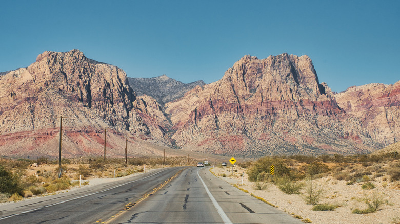
By some ways of counting, Nevada is the state with the most named mountain ranges in America. However, USGS numbers put it second on our list, trailing California's 300-plus with a total of 272 ranges in all. That's a pretty hefty level of mountain coverage for a place that's mainly famed for the neon-lit casinos and hedonistic gaming halls of Sin City.
But, move over Vegas, for the geography of Nevada is undeniably highland-heavy and superlative-rich, rolling from the banks of Lake Tahoe through yucca-covered desert plateaus. Strings of mountains rise and fall basically everywhere, from what they call "Nevada's Yosemite" in the Ruby Mountains, a place whittled by ice fields that has snow to rival Switzerland in the winter, all the way to the hoodoos and caves of the Red Rock Canyon National Conservation Area on the doorstep of Las Vegas itself.
Boundary Peak marks the highest point in the state, as it rises 13,140 feet along the crest of the White Mountains as they spill across into California, hosting some of the oldest trees in America, rugged canyons, and exposed tracts of tundra to boot. The second-highest point, meanwhile, sits in the eastern Nevada Snake Range. That's Wheeler Peak, a scree-covered massif with views ranging out 100 miles in all directions on cloudless days.
Alaska
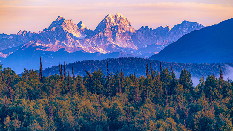
No list of the most mountainous parts of the U.S. could possibly be complete without a mention of the vast, vast frontier of Alaska. The largest state by a country mile, this one encompasses a whopping 665,000 square miles of land between the Bering Strait and the Canadian Yukon. And much of that is covered in peaks and summits, it seems, since the USGS lists an impressive 268 individual ranges in these parts.
The fabled Alaska Range is perhaps the most famous of the bunch. It cuts across the state for 400 miles, hosting the great Denali National Park and Preserve, which, in turn, hosts the highest peak in the whole United States — that's the colossal height of Denali, a mighty 20,000-footer that's haloed in boreal forests and ice.
South of that, major runs of mountains fan out like a caribou herd fans out across the plains. The point at which they meet the Pacific is particularly spectacular. There, you have huge slabs of rock that lurch from sea level to glacier. They're carved through by fjords, like the ones on the Kenai Peninsula, where 40 ice sheets flow into the ocean. Closer to the state capital of Anchorage, Flattop Mountain, Alaska's most visited mountain, awaits in the Chugach State Park, where there are summit hikes and less-challenging loop hikes for all abilities.
Arizona
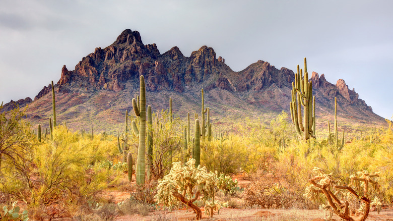
Arizona's often called the "Grand Canyon State," but that hardly tells the full story of a land that lays claim to a whopping 151 individual mountain ranges according to the United States Geological Survey. Turns out that there are soaring peaks aplenty around the great mile-deep gorge on the Colorado River. In fact, according to Encyclopedia Britannica, upwards of 50% of the land here sits at over 4,000 feet above sea level. Meanwhile, the Desert Mountaineer blog reports that only California and Alaska can match the sheer number of individual peaks in Arizona — a mind-blowing 7,515 over 300 feet of prominence in total! That number can drop to around 4,100 depending on how you count, but no doubt it's chock-full of epic peaks.
The San Francisco Peaks are where the roof of Arizona tops out at over 12,000 feet. You can hike to that on Humphreys Peak Trail, a 9-mile round-trip adventure that crisscrosses ski runs and wildflower meadows to take you to where the air is thin but the views are fantastical. Meanwhile, the Colorado Plateau straddles the Utah-Arizona border in the north, offering quintessential Wild West stuff in the form of cathedral mountains, bluffs, and rust-hued canyons.
Arizona is also peppered with so-called "Sky Island" mountains. These are ranges that sit in relative isolation, surrounded by the deserts and plains, creating unique habitats for rare plant and animal species. They dominate in the southeastern corner of the state, dotting the Coronado National Forest with biodiverse forests and summits over 10,000 feet tall.
New Mexico
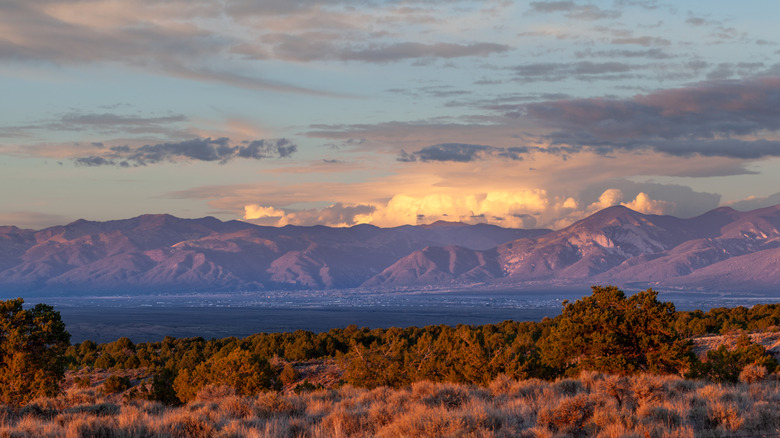
Last but most certainly not least are the 131 named ranges that the United States Geological Survey counts in New Mexico. They combine to offer up in excess of 2,900 named mountain summits, which exist across a veritable smorgasbord of terrains and climatic regions, from desolate volcanic plateaus to small stretches of the Rocky Mountains, one of the most defining ranges on the continent of North America.
If you want the highest location of all, you'll need to look far to the northwest, where Wheeler Peak sits in the Sangre De Cristo Mountains. The rock climbs up to 13,161 feet, and the popular Williams Lake Trail offers an 8.3-mile route to the summit of Wheeler Peak itself, navigating woodlands and then exposed switchbacks to get to the top.
Just below Wheeler Peak, the town of Taos attracts skiers and outdoor enthusiasts all winter long. It's the gateway to the Taos Ski Valley, now ranked as the leading ski resort in New Mexico by Onthesnow.com. Go there to enjoy 110 marked trails on a mountain with upwards of 3,000 feet of vertical. Oh, and this particular ski region gets over 300 days of sun each year!
Methodology

We went straight to the U.S. Geological Survey to get data on states with most mountain ranges. Using its Geographic Names Information System (GNIS), we were able to search the whole country for any feature tagged as a "range," which the USGS defines as "a single mass of hills or mountains; a complex, interconnected series of mountain ranges having a well-defined longitudinal trend (cordillera, mountain belt, sierra)." With that, we then sorted the dataset by state, counting each individual occurrence of a range within each territory. The list above corresponds to the five states that had the most ranges overall.