The 5 Longest Hiking Trails In North Carolina's Blue Ridge Parkway
The Blue Ridge Parkway has long been an icon of America's scenic driving tradition. Following the ethereal Blue Ridge Mountains of Appalachia, the parkway covers 469 miles through Virginia and North Carolina, passing some of the East Coast's most stunning mountain views the entire way. Alongside its breathtaking scenery, the Blue Ridge Parkway also connects drivers to numerous national parks, state parks, and national forests throughout the region.
The parkway begins and ends with two magnificent national parks: Virginia's Shenandoah National Park at one end and North Carolina's Great Smoky Mountains National Park on the other. This kind of scenery unsurprisingly draws plenty of visitors (the parkway is actually the second-most-visited National Park Service location, with more than 16,700,000 visitors in 2024 alone). However, while the Blue Ridge Parkway is obviously perfect for drivers, the entire 469-mile route is also dotted with some of the East Coast's most stunning hikes.
The Blue Ridge Parkway's various mileposts connect to all sorts of amazing trails, from epic segments of long-range hikes like the Appalachian Trail to the short but scenic Erwins View Trail and its superb waterfall views. Most of these trails are relatively short, though, as they usually connect a roadside parking area with a specific scenic feature in as short a distance as possible. However, a few notable Blue Ridge Parkway trails do hit more formidable lengths, especially on the North Carolina side. With most of the parkway's highest summits and notable scenery, North Carolina's half of the Blue Ridge Parkway is the perfect destination for lengthy, technical, but ultimately rewarding treks through this one-of-a-kind landscape. These are the five longest trails found along North Carolina's Blue Ridge Parkway, their locations, and their main scenic viewpoints.
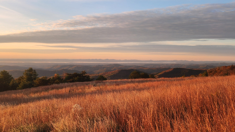
Flat Rock Ridge Trail
The Flat Rock Ridge Trail is a scenic, point-to-point hike located at milepost 244.7 of the Blue Ridge Parkway. The trail's core hike traverses 5 miles between the Basin Cove Overlook and the Basin Cove Creek. More daring hikers can complete a longer 13.3-mile route that covers a semi-circle between the parking area at North Carolina's Thurmond Chatham Gameland and the Blue Ridge Parkway's Brinegar Cabin historic site.
Both the short and long versions of the Flat Rock Ridge Trail traverse the stunning Doughton Park. As the Blue Ridge Parkway's largest recreation area, Doughton Park is a wonderland of wildlife, camping, and gorgeous meadows, all surrounded by epic Blue Ridge Mountain views on all sides. Though Doughton Park has several exceptional (and lengthy) hikes, the Flat Rock Ridge Trail is particularly rich in spectacular scenic overlooks, natural attractions, and historic sites.
The trail's evocative scenery does not come without a cost, however. As with many trails in Doughton Park (and the Blue Ridge Mountains in general), the Flat Rock Ridge Trail begins at a lower-elevation area and quickly climbs up several thousand feet in a relatively short distance. Even the short version of the trail, therefore, requires a good deal of uphill climbs and all the effort that comes with that. Still, many reviewers on AllTrails.com note that the climb is "steady" and "never too hard." Plus, your effort will be rewarded with spectacular views. The Basin Cove Overlook, located near the beginning of the trail, provides striking views of the namesake cove and the remnants of a mountain village that was destroyed in a 1916 flood. Other amazing sights along the Flat Rock Ridge Trail are the Doughton Park Picnic Area (and its adjacent Wildcat Rocks Overlook) and the 2,408-foot Bell Knob.
Boone Fork Trail
The Boone Fork Trail is a lovely and (relatively) less strenuous hike that covers a 5.5-mile loop through North Carolina's Julian Price Memorial Park. Located at Milepost 297 of the Blue Ridge Parkway, Julian Price Memorial Park is a lovely, 4,200-acre preserve of lush mountainside scenery, complete with picnic areas and campsites. Julian Price Memorial Park's many trails stretch through the scenic forests at the base of the popular Grandfather Mountain, a Blue Ridge Mountains icon best-known for its Grandfather Mountain Park and breathtaking swinging suspension bridge. Far from the perilous heights of Grandfather Mountain's summit, however, the Boone Fork Trail provides a much more low-key (and less strenuous) jaunt through the woods and waterways right next to the Blue Ridge Parkway.
Unlike other Blue Ridge Parkway hikes, the Boone Fork Trail only covers a cumulative elevation gain of around 554 feet. Such a comparatively easy hike means that visitors can enjoy Julian Price Memorial Park's superb scenery without breaking too much of a sweat. Though the trail's lower elevation means fewer scenic viewpoints, Boone Fork makes up for it with some of the best water features of any Blue Ridge Parkway trail.
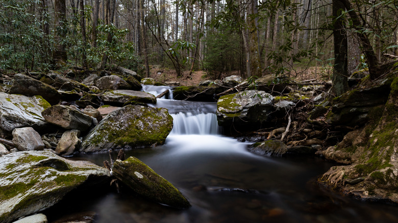
Much of the Boone Fork Trail circles past the gorgeous, 47-acre Price Lake, where hikers can give their legs a rest by renting a kayak or canoe for an adventure out on the water. Away from the lake, the Boone Fork Trail covers tons of lovely mountain streams, creeks, and cascades. The highlight of the trail, particularly for waterfall lovers, is the ravishing Hebron Falls, a 25-foot cascade pouring over massive boulders in one of the most picturesque waterfall scenes along the entire Blue Ridge Parkway.
Grassy Gap Fire Road Trail
Returning to Doughton Park, the Grassy Gap Fire Road Trail is a much more tranquil and scenic jaunt than its rather technical-sounding name would suggest. At around 6.5 miles long, the Grassy Gap Fire Road is a perfect way to spend a few hours admiring Doughton Park's superb scenery. And while gorgeous scenery is something of a given on any Blue Ridge Parkway trail, one advantage that the Grassy Gap Fire Road has over other Doughton Park hikes is difficulty — or, rather, a lack thereof.
Given the nature of the Blue Ridge Mountains, elevation gain is pretty much unavoidable on any trail of measurable length. However, the Grassy Gap Fire Road draws particular acclaim for its much more moderate gradient, allowing hikers to slowly gain elevation at a much less strenuous rate. The trail is also notable for being quite wide, which makes it ideal for heavier foot (and horse!) traffic during busy Blue Ridge Parkway summers.
The Grassy Gap Fire Road's 6.5-mile length also features abundant scenes of wildflowers, small waterfalls, and Appalachian peaks on all sides. This route alone is probably sufficient for the average hiker. However, if you are feeling particularly adventurous during your Blue Ridge Parkway trip, you can also combine the Grassy Gap Fire Road Trail with the nearby Flat Rock Ridge Trail into one single, 12-mile scenic loop through Doughton Park's best sights. This loop is a great way to hit Flat Rock Ridge Trail attractions like Flat Rock Knob and the Basin Cove Overlook, while also enjoying some more relaxed downtime on the Grass Gap Fire Road's less challenging terrain. If you feel like roughing it overnight in primitive conditions, the Grassy Gap Fire Road also provides access to the Basin Cove Backcountry Campground.
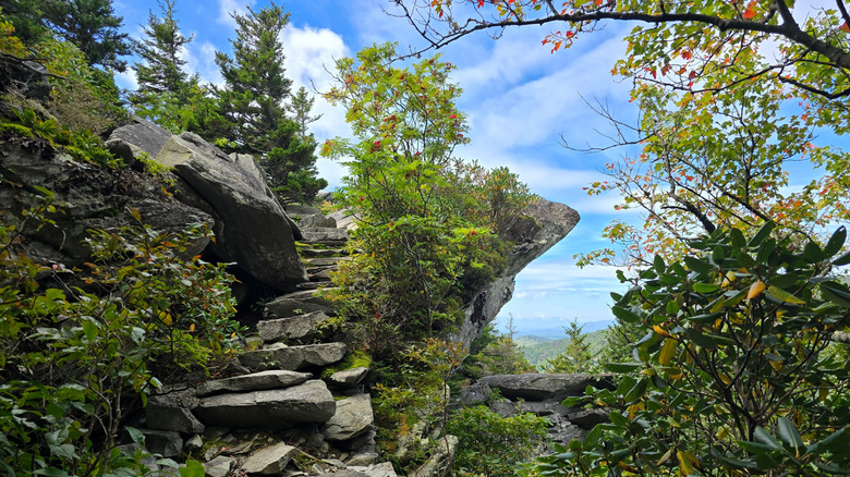
Bluff Mountain Trail
Coming in at 8.5 miles out-and-back, the Bluff Mountain Trail is the longest singular trail in Doughton Park—and may be the best overall. Bluff Mountain's length alone means that it has more miles of gorgeous Blue Ridge Mountain scenery than any other nearby trail. However, the Bluff Mountain route is also arguably the best Blue Ridge Parkway destination to experience an actual summit ascent without encountering too many disqualifying challenges. The trail's 8.5 miles do involve around 1,036 feet in elevation gain, but this ascent is largely steady and consistent, without any precariously steep or treacherous sections to contend with. As Hikingproject.com describes it, the Bluff Mountain Trail is "the easiest trail in Doughton Park and the one with the most views."
These views correspond to the heavenly Blue Ridge summits that make up most of the trail's terrain. Beginning from the historic Brinegar Cabin just off the Blue Ridge Parkway, the trail twists around the base of the 3,615-foot Fodder Stack, providing exceptional mountain views with limited elevation gain. Eventually, the trail begins its ascent to the top of its namesake feature, the more than 3,720-foot Bluff Mountain. Here, hikers can reward themselves with stunning views of many notable Blue Ridge peaks nearby, including Brooks Knob, Sheep Rock, and Little Grandfather Mountain.
The area's panorama of mountains includes the notable Alligator Back Overlook, so-named because its vista of mountain summits resembles the ridged back of an alligator. Of course, the Bluff Mountain summit area is also accessible via car directly off the Blue Ridge Parkway (but where's the fun in that?). The parking area next to the overlook features the Bluffs Picnic Area — one of the Blue Ridge Parkway's first picnic areas — where hikers on the Bluff Mountain Trail can take a much-deserved snack break.
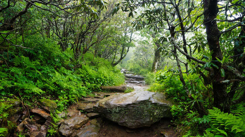
Tanawha Trail
The extraordinary Tanawha Trail is the longest single trail along North Carolina's entire Blue Ridge Parkway. And though the trail's 13.5-mile length doesn't seem like much compared to the vast Appalachian or Mountains-to-Sea Trails, Tanahwha's outstanding blend of park areas, elevations, and eco-regions is epic in the truest sense of the word. The name "Tanawha" itself comes from the Cherokee for "fabulous hawk or eagle," an apt comparison for the majestic scenery the trail protects.
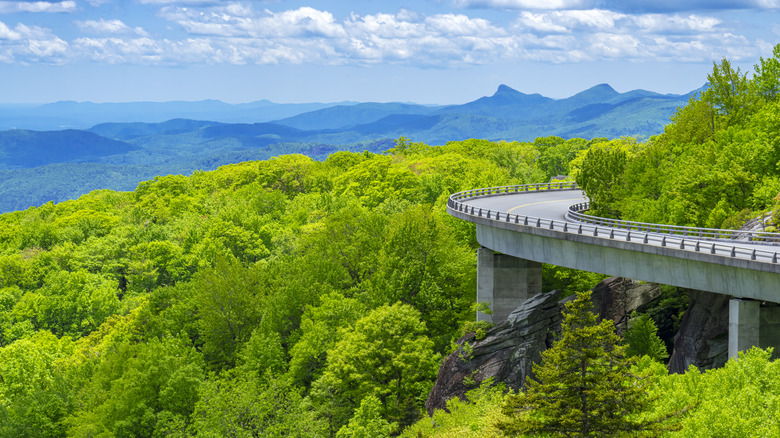
The Tanawha Trail's 13.5-mile route connects Julian Price Memorial Park with the stunning Beacon Heights area high above the Blue Ridge Parkway. Long before it gets there, the trail passes underneath the monumental Grandfather Mountain, plus other notable summits like the 3,800-foot Ash Bearpen Knob and the 4,800-foot Pilot Knob. Throughout the route, the Tanawha Trail also passes through several distinct (yet equally scenic) environments. Over the course of a few miles, hikers will travel through open meadows, thick hardwood forests, lush groves of rhododendrons and mountain laurels, postcard-worthy forests of spruce and hemlock, and dream-like glens of birch and beach trees encircling magical mountain creeks.
Eventually, the Tanawha Trail takes hikers to one of the most scenic human-made attractions along the Blue Ridge Parkway. The Linn Cove Viaduct is both a marvel of engineering and a beautiful complement to the grand mountain scenery surrounding it. The Tanawha Trail goes directly below the Linn Cove Viaduct, giving hikers up-close views of how well the viaduct protects the natural environment it was designed to coexist with. Further along the trail, hikers can turn back and see sections of the viaduct from above. After leaving the viaduct area, the Tanawha Trail hits the challenging (yet breathtaking) Stack Rock Overlook, before culminating at the immense panorama of the 4,220-foot-high Beacon Heights Overlook.
Methodology
One of the major challenges in compiling a list of the "longest" trails along North Carolina's Blue Ridge Parkway is determining which specific trails qualify as being "Blue Ridge Parkway trails." Looking solely at length, the Blue Ridge Parkway intersects with some formidable long-distance trails that are much longer than any trail on this list. The most obvious example is the famous, 2,000+ mile Appalachian Trail, which intersects with the Blue Ridge Parkway a few times during its epic course from Georgia to Maine. In addition to the Appalachian Trail, the Blue Ridge Parkway also intersects with North Carolina's Mountains-to-Sea-Trail, a nearly 1,200-mile hiking route from North Carolina's western mountains to its eastern coastline. In fact, many of the trails on this list, including the Bluff Mountain Trail and the Flat Rock Ridge Trail, are actually access points for sections of the Mountains-to-Sea-Trail.
Since both of these long-distance trails intersect with the Blue Ridge Parkway at some point in North Carolina, some may consider them to be "North Carolina Blue Ridge Parkway Trails." If they are official Blue Ridge Parkway Trails, both the Appalachian and Mountains-to-Sea Trails would easily make the top two spots on this list. Ultimately, however, we decided that these trails are not singular "Blue Ridge Parkway Trails," given their significant length and connections to countless other parks and scenic areas. For this list, we limited our search to the much shorter trails that the National Park Service lists as official North Carolina hiking trails along the Blue Ridge Parkway. We also focused on the official lengths given by the National Park Service, cognizant that other outdoor sites and reviewers occasionally give different trail lengths, or potentially combine official trails together into newer, longer routes.