Arkansas' Under-The-Radar Mountain Escape Is A Rugged Wilderness Area In The Ouachita National Forest
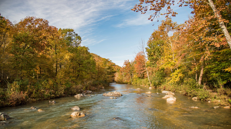
Tucked into the southern edge of Arkansas' Ouachita National Forest is a spectacular mountain escape that has largely flown under the radar. The Caney Creek Wilderness spans more than 14,000 acres and protects a rugged stretch of forest shaped by Caney Creek and the upper watershed of the Cossatot River, including peaks like Buckeye Mountain. If steep ridges, dramatic valleys, and gushing creeks are your thing, you'll fall in love with this spot.
Because it's so under the radar, you'll feel totally remote (if you like this, you might enjoy America's most remote retirement destination). There are no large resort towns here — in fact, the closest town is Mena, almost an hour away by car. The area is instead made up of big forests with trailheads that will truly make you feel like you're away from it all.
Reaching it takes some effort, which is part of why it's such a well-kept secret. You'll almost certainly need a car — this is deep forest, and there's no public transport directly to the trailheads. From Mena, head south and then east on Arkansas Highway 246 and north on Forest Road 38 to reach the eastern trailheads. Other trailheads are accessible via alternate forest roads off Highway 246. If you're arriving in the area by plane, the nearest airports with major commercial service are Fort Smith Regional Airport and Little Rock's Clinton National Airport. Both require a rental car and a drive of over two hours into the Ouachita region.
Trails and hikes in Caney Creek Wilderness
This is an untapped area in terms of hiking trails to explore, so you'll need to grab your backpack and your Costco wilderness-ready camping snacks and prepare for some seriously high step counts. One particularly hard trail, according to AllTrails, is one with a fair bit of elevation, over 1,500 feet throughout the 9.5 miles. You'll do a loop of Buckeye and Caney Creek, climbing through hardwood and coniferous trees, and passing wildlife like deer and black bears (camping nearby? Here are the best tips to keep bears out of your car). AllTrails recommends carrying a map with you due to areas where the path is not marked.
For something a bit different, try the East Caney Creek Trail. This one takes you through a rugged forest for around 8 miles. This is a moderate route with only 830 feet of elevation, and at the end, you'll be rewarded with a swimming hole to cool off. Along the way, you'll need to cross several creeks, with just one deep enough to wet your feet. One hiker calls this "one of the Ouchitas' loveliest trails" but notes that "fall overs are treacherous," so always practice caution when traversing rugged landscapes.
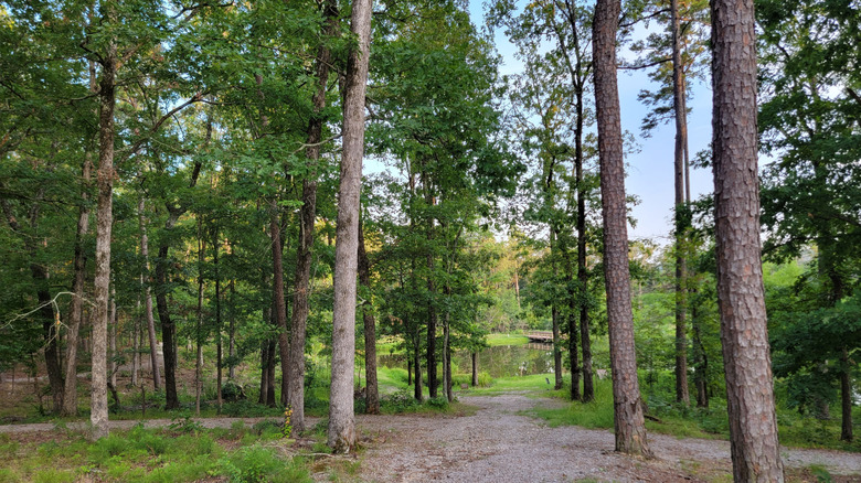
If you want a hike with a wide range of views, the trails at the Shady Lake Recreation Area are hard to beat. Shady Lake is a 25-acre remote lake situated in the southern part of the Ouachita National Forest. It climbs steadily toward Tall Peak, where a restored lookout tower gives you the full sweep of the Ouachitas. It's the perfect spot to stop and enjoy a picnic. By the time you reach the top, with the forest stretching out in every direction and the creeks far below, you'll realize just how remote it all is.