America's Longest Developed Rail-Trail Is A Scenic Missouri State Park Popular With Hikers And Bikers
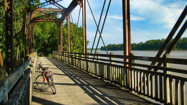
Missouri's railroad history began in the 1850s, with one of the major lines being the Missouri-Kansas-Texas Railroad. Also known as MKT or the Katy, this was the first of its kind to connect Texas to the national network, which drove cattle, agricultural, and freight commerce. While the trains are long gone, the MKT path remains — except this time, you can traverse it on foot or by bike. At 240 miles, Katy Trail State Park is America's longest developed rail-trail. With 26 trailheads, this route can be as long or short as you'd like. If you were to complete its entirety, you can opt to start in Clinton in western Missouri and end your journey in Machens (or vice versa).
Following the MKT's cessation of its Missouri route in 1986, the corridor was obtained through railroad donations, railbanking legislation, and a $2.2 million contribution from Ted and Pat Jones. The tracks were removed, and the railbed was covered with crushed limestone to create a flat surface suitable for hikers and bikers. Nowadays, you can ride through scenic river bluffs and farmland while discovering historic sites, small towns, and visiting wineries. Beyond its status as a premier rail-trail, the Katy Trail is a recognized Millennium Legacy Trail.
While rail-trails are already a top choice for being flat and traffic-safe, the Katy Trail stands out not only for its length but also its picturesque landscapes. Hikers and bikers have a lot to say about their experiences along the trail. One frequent visitor said they've been "riding the entire length of this trail yearly since '92," while another wrote that "it's a great way to take in America's heartland." What's more, the Katy Trail is consistently mentioned in rankings of the country's best treks, making it a bucket-list item for many outdoor enthusiasts.
You can tackle the Katy Trail in bite-sized chunks
The small Missouri city of Clinton marks the western beginning of the Katy Trail. From here, you can hike and bike toward Windsor. This section covers 17.2 miles, which would take hikers around six hours and cyclists around 1.5 hours to reach the city. You'll ride past wooded areas, open fields, and riverfront spots — there are a few benches if you need to rest your legs. If you're up for the challenge, continue toward Sedalia to bring the total distance to 35.3 miles.
You can access the Katy Trail from Boonville, too. From here, you can opt for a four-hour hike or an hour-long bike trip to Rocheport, a quaint city with riverside fun and outdoor attractions. The distance between the two measures 12.4 miles. As you're riding this section, you'll see that Boonville's railroad boom is very much alive thanks to the restored MKT Depot. Some cyclists like to attempt a multi-stop expedition from Boonville to Jefferson City, America's most beautiful small town. This extends the ride up to four hours without stopping — but you can take a load off at Hartsburg or McBaine before hitting the road again.
The Katy Trail also traverses Hermann, the country's "Little Germany," with vineyard wine tastings and old-world festivals. Tour the village and spend the night here, then hit the trail again to bike to Augusta. This portion is 34.4 miles, taking up to three hours to complete. Around this point, you're pretty close to the end of the trail. After a well-deserved break, pedal toward St. Charles for 2.5 hours. Rest for the last time to power through the hour-long ride to Machens, the eastern terminus.
Tips and tricks for hiking and biking the Katy Trail
A 240-mile hike or bike trip is no joke. Although the trail is mostly level, it's best to be prepared for the strenuous journey ahead. For starters, you should book lodging in advance due to the limited options in small towns. Map out how often, how long, and where you're going to stop along the way. Plan for additional resting points to fuel up with food — you might get hungry quicker than expected, so make sure to bring enough snacks.
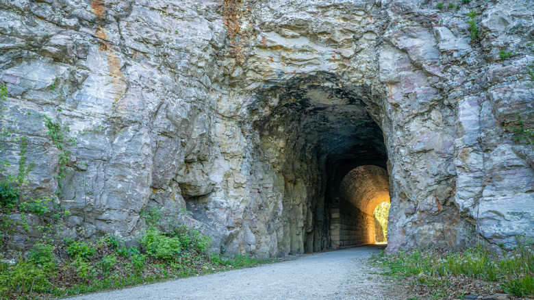
Pack light but bring the essentials — prioritize sun protection, bug spray, and enough water, as some sections are remote with limited services. The trail surface is generally hard-packed limestone but can become soft, muddy, or develop ruts after rain, particularly in areas prone to flooding. The best way to navigate the tracks is by using a gravel, hybrid, or mountain bike with tires at least 35 to 40 millimeters wide. Fenders are important, especially if rain is expected — this will prevent mud from coating you and your bike. Bring a spare tube, portable pump, and tools for flat repairs.
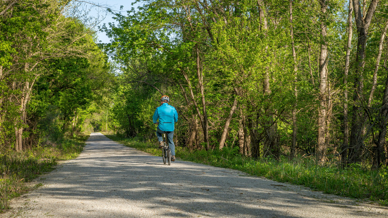
The best time to take the Katy Trail is September through October for pleasant weather and fall foliage — spring is popular, too. Avoid summer due to high heat, humidity, and mosquitoes. During the winter, snowy conditions can make the surface unstable. Feel free to customize your itinerary based on the season and your available time — since there are several trailheads, pick the one that suits your convenience. Along the way, you can include plenty of worthwhile stops, from the scenic A-Frame Winegarden at Les Bourgeois Vineyards to the 400-year-old Big Burr Oak near McBaine. These spots only scratch the surface of what your adventure can become.