Yosemite's Wildly Underrated Mountain Hike May Be The Best Viewpoint In The National Park
Yosemite is riddled to the brim with spectacular viewpoints. Some, such as the great introduction to the Yosemite Valley that is the Tunnel View, offer up jaw-dropping sights without even asking you to leave the comfort of your car. Others demand you hoof it on backcountry trails for mile upon mile before revealing their magical vistas. The path up Mount Hoffmann is most certainly among the latter group, but it flaunts what some say are the best panoramas in the whole national park — a big statement when it comes to Yosemite!
But it's not just anyone making such a bold claim. It comes straight from the pen of the legendary founder of modern conservationism, John Muir. Apparently, Mount Hoffmann was his happy place. In his 1912 book The Yosemite, he proclaims, "For a two-day trip I would go straight to Mount Hoffman[n] ... From the summit nearly all the Yosemite Park is displayed like a map: forests, lakes, meadows, and snowy peaks." True enough, Hoffmann rises close to the very geographical midriff of this iconic Californian reserve, with views that stretch north, south, east, and west across some of its most famous ridges, valleys, and lakes.
However, you will have to work for that reward. The trail to the top of Mount Hoffmann is rated hard on AllTrails, and it has some leg-burning metrics: 5.6 miles long, with almost 2,000 feet of elevation gain between the trailhead and the summit. The starting point is at the May Lake Trailhead, located just off the stunning scenic route of the Tioga Road, roughly an hour drive out of Curry Village in the heart of Yosemite Valley. Bear in mind that Tioga Road is seasonal, meaning the Hoffmann hike is typically only accessible between late May and November.
The underrated hike to the top of Mount Hoffmann
The hike to the top of Mount Hoffmann might offer views that could wow even Muir himself, but it seems the route remains largely underrated by Yosemite standards. You'll pass just a fraction of the people found on other, more popular, routes down in the Yosemite Valley. As one past hiker puts it in a glowing Tripadvisor review, "For the better part of an hour at the top, it was just us and the marmots. You'll see a fair amount of people on the first 1.2 miles of the hike, but most of them are only going to May Lake."
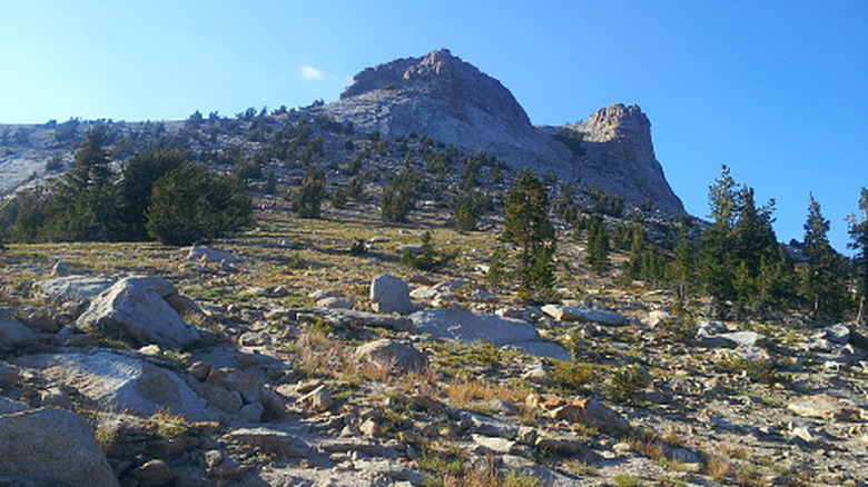
May Lake will be your first port of call after leaving the car. You reach it on a lightly ascending path that skips over quintessential Yosemite boulders and ducks through strands of evergreens. The route then fringes the south side of the water and emerges on a rocky mountain slope, where you begin a steeper ascent towards the top. A few false summits come and go as you get higher, before a final push to the very pinnacle — and the views!
It's worth knowing that the route to Mount Hoffmann is not an official National Park Service trail. The way up often splits into multiple unmarked routes, especially in the exposed boulder field after May Lake, before uniting once again before the summit. Be aware that this one involves some Class Two scrambles, not to mention a variety of terrains, from wildflower meadows to exposed granite slopes.
Mount Hoffmann is a viewpoint you'll remember
Congratulations! You did it. Standing at the top of Mount Hoffmann, views unfold 360 degrees around you. Echoing Muir, one Redditor sums up why it's quite so awesome here: "In terms of views, the great thing about Hoffman[n] is that it's an isolated peak that happens to be located in almost the exact geographic center of Yosemite National Park." To put it another way, there's something to see in all directions.
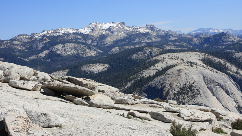
First, look south. There, some of California's most stand-out mountains string out like a tiara. There's the colossal granite massif of Cloud's Rest, and, of course, the Half Dome, one of the world's most iconic natural wonders. Behind them, the Clark Range forms a phalanx of stone on the horizon, offering a distant glimpse of a far-flung corner of the Sierra Nevada with no roads, only hiking paths.
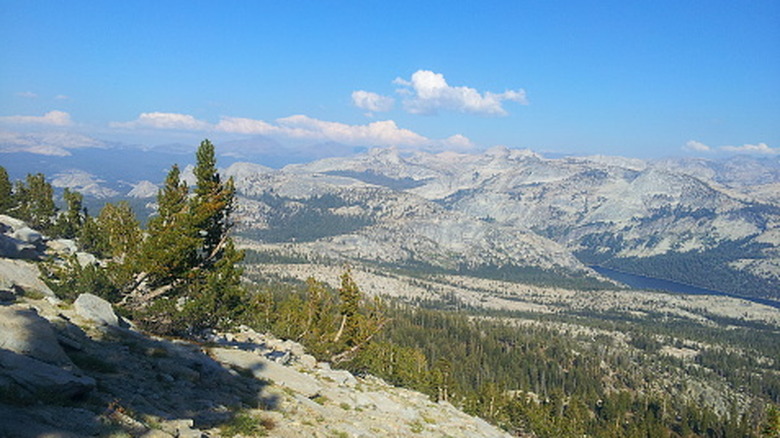
To the east, you'll spy out the glowing waters of Tenaya Lake, California's "Jewel of the High Country," huddled beneath the group of twisted-top mountains known as the Cathedral Range. In the opposite direction, you can look out toward the state's Central Valley, beyond where the sylvan low hills of the Sierra Nevada hide charming and scenic Gold Rush towns that are steeped in history.