Halfway Between Baltimore And DC Is Maryland's Scenic Watershed For An Idyllic Suburban Escape With Recreation
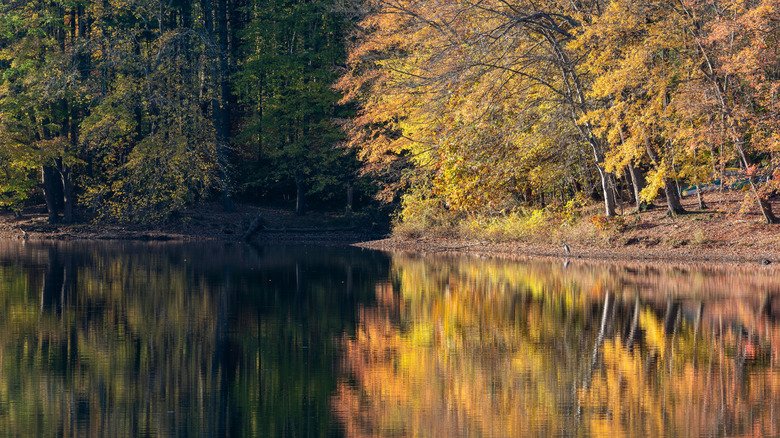
For drivers traveling along Maryland's Interstate 95 corridor, the concrete span of the T. Howard Duckett Dam is often just a blur outside the window. Yet for those who take the time to exit the highway and venture beyond the dam's imposing boundary, a surprising world awaits. Here, dense forests offer a lush, idyllic escape from the relentless sprawl of suburban Maryland, providing a peaceful contrast to the bustle just beyond its edges.
The T. Howard Duckett watershed sits in the heart of the Washington, D.C.-Baltimore metropolitan corridor, 26 miles north of Washington, D.C., and 23 miles south of Baltimore. Encompassing nearly 6,000 acres of protected forests across Prince George's, Montgomery, and Howard counties, the watershed was established in 1944 with the construction of Brighton Dam along the Patuxent River, the state's longest. The dam created Triadelphia Reservoir, and 10 years later, the T. Howard Duckett Dam was built, creating Rocky Gorge Reservoir. Little Seneca Dam was constructed afterward. Together, the dams and reservoirs help supply drinking water to the growing region. While the Washington Suburban Sanitary Commission (WSSC) is primarily dedicated to safeguarding the water quality within the watershed, it has also opened some of the land to the public for recreation.
Hiking the T. Howard Duckett Watershed
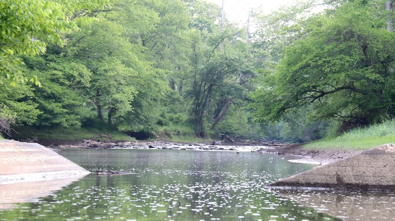
Much like Greenbrier State Park near Hagerstown, a secret white-sand beach park, the T. Howard Duckett Watershed is one of the state's hidden gems, offering nearly 28 miles of trails that wind through forests and along the riverbank. The longest of these is the Browns Bridge South Trail, which traces a path along the Patuxent River. Starting from the trailhead parking lot on Ednor Road, this 9-mile loop leads hikers beside the river's edge before looping back through dense woodlands to the trail's starting point. Completing the hike typically takes just over four hours, with changes in elevation offering a moderate challenge for most walkers.
West of Ednor Road lies the Browns Bridge and Rocky Gorge Reservoir Trail, a shorter but equally challenging route compared to its eastern counterpart. According to AllTrails, the main trail involves a steep climb up a hill, but for more leisurely hikers, gentler paths circle the hilltops. Both options offer excellent exercise and reward visitors with sweeping views of the watershed. Near Brighton Dam lies a trail that leads to the Azalea Garden, a 5-acre park created in 1959 as the brainchild of Raymond Bellamy, a former WSSC water commissioner. The park contains over 22,000 azaleas of different species, from the Indica Rosea, a pink and white hybrid species, to Hinodegiris, a heavy-blooming Kuruene azalea. All trails, including those within the Azalea Garden, are natural surfaces, which means they can become slippery and muddy after rainstorms.
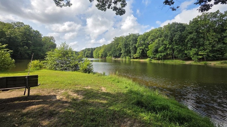
Fishing and paddling the watershed's reservoirs
Beyond hiking, the watershed is a popular destination for anglers, who are drawn to its waters from across the region. Both reservoirs within the watershed and the Patuxent River are known for species such as largemouth and smallmouth bass, northern pike, and walleye. Fishing from boats is allowed in the watershed, but only electric motors are permitted. Boat launches are available at any recreation area within the watershed (except for Brighton Dam). If you don't have a boat, shoreline fishing is permitted in designated areas only, and there's a pier located at Triadelphia Recreation Area. Fishing is not allowed near the reservoir dams, and you must have a fishing license.
Paddling is also allowed within the watershed. You can launch your canoe or kayak from the same boat ramps, with each offering a different experience. Launching from the Supplee Lane Recreation Area provides direct access to the lower portion of the reservoir, while the Browns Bridge Recreation Area ramp offers a more remote paddling experience. Paddling is restricted to canoes, kayaks, and rowboats, as stand-up paddleboards are not allowed. Since protecting water quality is the watershed's main goal, visitors must obtain a permit to access the area. A single-day permit is $5 and can be purchased online or at the Brighton Dam Visitor Center, which also provides maps of the watershed. Access is limited to designated areas only.
For those looking to explore more of Maryland's natural beauty, head west to Dans Mountain State Park, where you'll find fishing, hiking, and an Olympic-size pool. If you prefer the coast, travel east to Point Lookout State Park with fishing, trails, and a historic lighthouse for a scenic beach experience.