
Nestled Near The Arkansas-Oklahoma Border Is A Riverfront State Park With Rafting Adventures And Trails
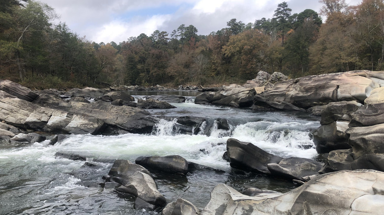
The scenic landscapes in Arkansas span mountains, river valleys, and lakes — from historic sites and museums to resort parks, there's a wealth of hidden gems to uncover. But there's something about riverfront destinations that makes for a great escape from the daily grind. The world-class, challenging whitewater rapids and the pristine, free-flowing Cossatot River at the namesake state park will have you pining for adventures. Comprising over 5,400 acres of hardwood forests and dramatic canyons, Cossatot River State Park – Natural Area is perfect for outdoor enthusiasts and adrenaline junkies. With some of the wildest whitewater in the South, the water conditions can be unforgiving for beginners. After all, its name "Cossatot" translates into "skull crusher," which says a lot about its sheer power.
Beginning at the boundary of the Ouachita National Forest, Cossatot River State Park was founded in 1988. While it's famous for its rapids, not all activities are water-related at this outdoor haven. The state park provides land-based and educational activities if you prefer to stay dry. Several trails make it easy to admire the striking rock formations dotting the area. The paths take you from ridgetop spots and hardwood forests to riverside sections. You can also check out the visitor center, which has displays on local wildlife, geology, and more.
For multi-day kayaking and rafting, spend a night at the state park campground. With only 15 primitive sites at the Cossatot Falls Area Campground and seven more tent spots at the Sandbar Area Campground, you're in for a rustic experience. The state park is located near the Arkansas-Oklahoma border — the drive from Little Rock takes two hours and 20 minutes, while Hot Springs is 1.5 hours away. Meanwhile, coming from Tulsa takes more than 3.5 hours, whereas McAlester is 2.5 hours away.
Hit the whitewater at Cossatot River State Park
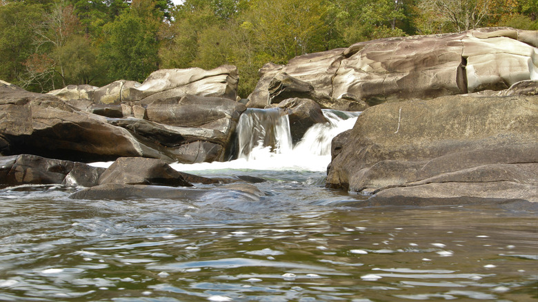
The Gauley and Arkansas Rivers are some of the best for whitewater rafting (other than Colorado) — but don't overlook the Cossatot River, especially if this isn't your first rodeo. The 12-mile corridor of the river provides excellent rafting best suited for pros. You'll encounter all five levels of rapids along the Cossatot. Thrill-seekers should be prepared to tackle Class III, IV, and V rapids, which are highly technical. The river is entirely rainfall-dependent, and levels change rapidly. Paddling is generally not recommended or even possible without sufficient rain. Ideal conditions for paddling are in the spring, winter, and late fall.
Set afloat on specific parts of the whitewater, depending on your abilities. The stretch from Highway 246 to Ed Banks is manageable whitewater — you'll be paddling through a 3.1-mile part of the state park. Another "easy" section and a good alternative to Cossatot's roughest areas is Ed Banks access to the Sandbar Bridge, a 2-mile stretch with Class III rapids. For experienced adrenaline junkies, there are really only two infamous sections you need to look out for: the Cossatot Falls stretch and Devil's Hollow Falls.
The Cossatot Falls stretch features six back-to-back drops over rock ledges that demand expert skills (these can range from Class II to V, depending on conditions). When you approach halfway through the run, the fourth rapid turns into a churning Class IV. This section isn't for newbies hoping to test their limits. Nicknamed the "washing machine," this part plummets 12 feet in 15 yards. You should practice just as much caution when attempting the Devil's Hollow Falls — the river drops over a river-wide six-foot ledge. For beginner-friendly runs, consider Indiana's East Race Waterway, which offers a great artificial whitewater course.
Dry off by meandering through Cossatot River State Park's trails
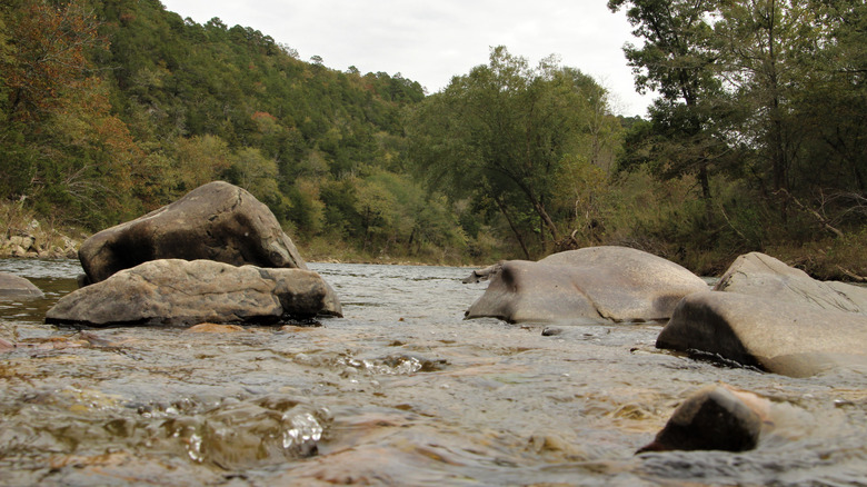
Where the whitewater is intense, the trails offer a tamer pace at Cossatot River State Park. If you want to see the Cossatot Falls but you're not ready to tackle technical rapids yet, take the footpath instead. A 0.9-mile out-and-back hike will bring you to the falls, which can be completed within 30 minutes. While it's rated easy on AllTrails, there are some rocky sections, so wear proper shoes. Another breezy stroll is the Waterleaf Interpretive Trail. Also covering 0.9 miles, this out-and-back path has interpretive signs with information about the park. Don't forget to keep your eyes peeled for the rare Browne's waterleaf plant if you're visiting in spring.
Take it up a notch by following the Harris Creek Trail. This moderate hike takes you on a 3.3-mile loop, all while exposing you to various landscapes within the park. You'll walk past forests, creeks, and colorful flowers before arriving at the Goat's Bluff vista point — take a break to enjoy the views before continuing the rest of the hike.
Those seeking a high-intensity adventure that matches the fierce energy of the rapids should brave the River Corridor Trail. Extending for 12.4 miles, this difficult point-to-point route is accessed from the Brushy Creek Area and is better suited for backpacking excursions. You don't have to complete it in one day, but make sure to register your hiking plan at the visitor center for an overnight trip. Panoramic views are abundant on this trail, but you have to earn them — with an elevation gain of 1,653 feet, expect strenuous climbs. If rough water isn't your style, there are other areas to discover. For instance, Arkansas' first state park, Petit Jean, has crashing waterfalls, stunning hiking trails, and epic summer swimming spots.