
Between Tampa And Miami Is Florida's Historic Highway Passing Through Scenic Parks And Jaw-Dropping Landscapes
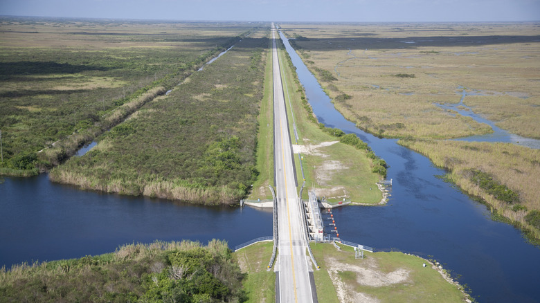
When travelers dream up a Florida road trip, the Gulf Coast, Atlantic beaches, or Orlando's theme parks tend to get top billing. But the 284-mile historic Tamiami Trail delivers a different kind of "Old Florida" escape, where around 750 species of wildlife – including alligators, crocodiles, turtles, herons, and countless other species — steal the show. Named as a mash-up of Tampa and Miami, the Tamiami Trail connects the two cities while mostly running parallel to Interstate 75, also known as Alligator Alley. While both roads take drivers through the heart of the Everglades, including the 1.5-million-acre, wildly underrated Everglades National Park, the Tamiami Trail takes travelers on a more exploratory journey through the biodiverse landscape.
Construction of the Tamiami Trail began in 1915 as part of a push to develop an automobile route across South Florida to bring more tourism to the region, where boat travel had previously been the primary mode of travel. Funding challenges delayed progress until entrepreneur Barron Collier financed a portion of the costs in exchange for naming rights to what is now Collier County, home to Naples and much of the region west of the Everglades. After 13 years of construction that required around 2.6 million sticks of dynamite to dig through the deep, swampy trenches, the Tamiami Trail opened in 1928, paving the way for road trippers to get up close with scenic parks, sweeping wetlands, and abundant wildlife.
On its eastern end, the Tamiami Trail begins near Miami's Brickell financial district, then rolls through Little Havana and past Florida International University, leaving city streets behind for wetlands. From there, the route crosses the Everglades region and its protected preserves before reaching Naples and turning north toward Tampa along U.S. 41.
What to expect on the eastern side of the Tamiami Trail
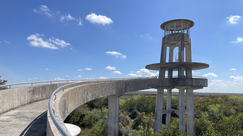
A popular stop along this historic highway is Shark Valley, one of three main entrances to Everglades National Park, along with Everglades City, the Gulf Coast gateway to the park further west, and Homestead, located south of Miami. Shark Valley is known for its 15-mile paved loop, which visitors can explore on foot, by bicycle (rentals are also available on-site) or aboard a guided tram. However you choose to explore, wildlife is the main attraction: There may be no sharks, but alligators bask right next to the pavement while turtles, herons, and other birds are common throughout the marshes.
The trail also leads to a 70-foot observation tower, where visitors can take in sweeping views up to 20 miles across the "River of Grass," a nickname popularized by environmental activist Marjorie Stoneman Douglas. One Google reviewer said completing the full loop took about four and a half hours while offering frequent sightings of birds and reptiles.
The Tamiami Trail also introduces travelers to the Indigenous communities that have lived in the Everglades for generations, including the Seminole Tribe of Florida and the Miccosukee Tribe of Indians of Florida. Visitors can learn about Miccosukee history and culture through exhibits at the Miccosukee Indian Village. While the highway has no shortage of airboat operators with giant kitschy billboard signs, including Coopertown Airboat Tours and Everglades Safari Park, the Miccosukee-operated airboat rides combine wildlife viewing with information about the tribe's connection to the Everglades, offering visitors a two-in-one experience. One Google reviewer raved, "The whole experience was informative and fun, especially due to the people who facilitated, they were great!"
What to expect on the western side of the Tamiami Trail
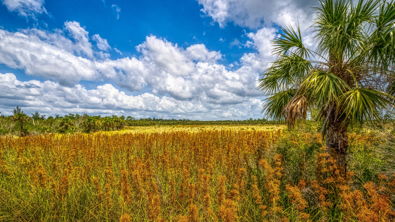
About 90 minutes west, the route reaches Fakahatchee Strand Preserve State Park, Florida's largest state park. Its 2,500-foot Big Cypress Bend Boardwalk carries sightseers above what is considered one of the world's largest royal palm swamps. As a Google reviewer put it: "As someone not from Florida, and wanting to see a darn alligator, this was the place," adding that they took two steps from the boardwalk and saw one right away.
The Marsh Trail at Ten Thousand Islands National Wildlife Refuge lies eight minutes west and provides another scenic stop. Florida Hikes describes the area as "where the Florida peninsula breaks apart into thousands and thousands of tiny pieces." The 2.2-mile out-and-back trail lets road-trippers experience the fragmented coastal landscape without booking a boat tour, but those with more time can still explore the winding labyrinth of islands by boat in search of manatees and birds such as black-whiskered vireos. Another seven minutes west, the 7,271-acre Collier-Seminole State Park preserves the historic Bay City Walking Dredge, the 1924 machine that helped create the Tamiami Trail.
Heading 45 minutes north brings the drive to Koreshan State Park in Estero, a Gulf Coast village full of outdoor fun. Here, remnants of a former 19th-century "visionary community" are juxtaposed beside Victorian gardens. About an hour and a half farther north, the laidback town of Osprey rounds out the route with shark-tooth beaches and Oscar Scherer State Park. This pocket of Florida wild contains 15 miles of trails, a lake popular for swimming and paddling, and a prominent scrub-jay habitat, offering one last taste of the scenery that the historic Tamiami Trail has to offer before it reaches Tampa Bay.