
Forget Big Sur, California's Alternative Road Trip Has Sweeping Mountain Views And Canyon Hikes
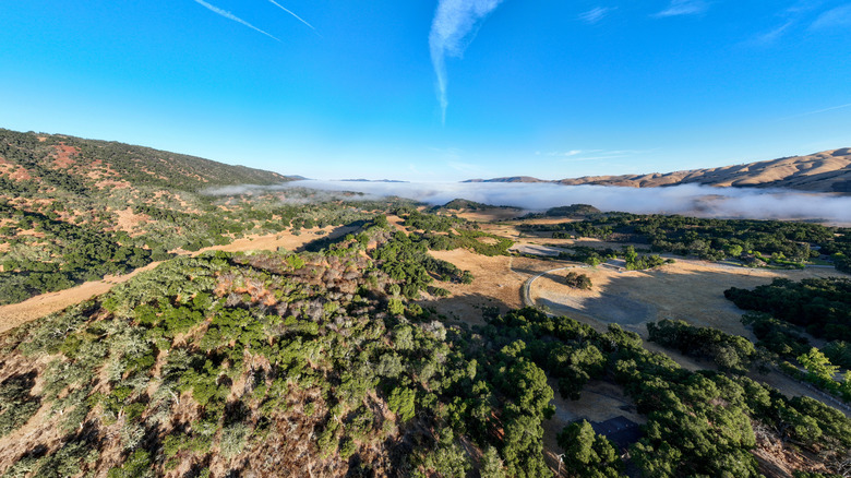
Ah, the Big Sur: Bend after bend of jaw-dropping coastal scenery where the California mountains crash into the Pacific Ocean. There are plenty of reasons why this 90-mile stretch of Highway 1 is hailed as one of the most epic road journeys you can do in America. But here's something you might not know: It's not the only way to traverse this corner of the Golden State from north to south, or vice versa. There is another route that connects Carmel-by-the-Sea with San Simeon, the official start and end points of the drive, offering to swap salt spray for sweeping mountain vistas, rugged canyons, and more.
Linking the whole of the scenic Carmel Valley Road with a bit of Highway 101 and sections of State Route 46, it whisks you away from the famous sights of the Bixby Bridge and Point Lobos, diving inland instead, through the forest-dashed reaches of the wild Santa Lucia Range, into the very heart of Paso Robles wine country, before finally reconnecting with the coast just south of the underrated, artsy city of Cambria.
I was forced to drive this back in 2025 when key sections of Highway 1 on the coast were closed to through traffic. I'll admit I wasn't happy when I learned I wouldn't be able to check that Big Sur-shaped line off my California bucket list, but frowns quickly turned to gasps as I began cruising through the rural landscapes of the Carmel Valley, watching as the peaks got higher with every turn, the oaks more twisted, the scenery more bucolic. Add in a canyon hike and river swim along the way, plus drop-in visits to local wineries, and this "alternative" fast became the main attraction.
How to drive the alternative Big Sur route through Carmel Valley
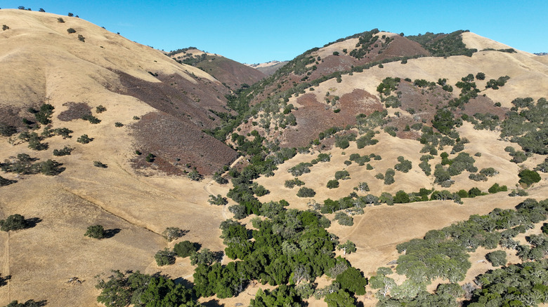
The northern end of this Big Sur stand-in is the very same as for the Big Sur itself. Begin in the beach-filled California town of Carmel-by-the-Sea, but don't be tempted to take the Cabrillo Highway south. Instead, divert off onto Route G16, a winding, weaving country road that might start off a little urban as you move through the fringes of Monterey, but quickly gets wild and wonderful — think sweeps of planted grape vines, dancing meadows of grasses, and the wild backcountry that opens up along the eastern edge of the vast Ventana Wilderness.
If you drove without stopping to take in the views (which I highly recommend you do not do on this gorgeous G16!), you'll notice the route branches east after roughly an hour. You'll now be on the Arroyo Seco road, an even more deserted country byway that soon descends into the flat, salad farms of the Salinas Valley. If you have a few extra hours to spare, it's possible to detour up to the underrated trails and caves of Pinnacles National Park at this point. If not, join the 101 and keep heading south.
Cattle ranches, rolling farms, and big, crumpled ranges of foothills provide the backdrop to this well-trodden highway as you enter the lesser-known wine region of Paso Robles. That's where you point the sat nav west again, taking California 46 all the way back to the Pacific. Prepare to be wowed by that run of asphalt. I recall visions of mist-cloaked mountains, forests of laurel and live oak, and — as you near the ocean — pull outs where you can see the whitecaps on the water far in the distance.
Hikes, swim spots, and viewpoints along the way
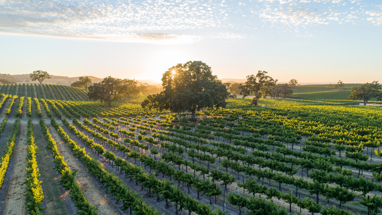
One of the great things about choosing the Carmel Valley-101-Paso Robles combo over the Big Sur is that there's stacks of stuff to get up to along the way. For starters, viewpoints abound. I couldn't count the number of times I drifted into a pull out, jaw low at the montage of peaks and valleys, vineyards, and woodlands spreading out before me. For me, a standout view came on the bends in the south Carmel Valley around Mascorini Place, where the road begins its long descent towards the 101, and the horizon gets flooded with the outline of the eastern Santa Lucia Range in the distance.
You'll also want to pack the hiking boots. A pitstop at beautiful Arroyo Seco will add under 20 minutes of driving overall. The reward? Park up and hit the Santa Lucia and Indians Road. It's actually a 17-plus-mile backpacking route into the Los Padres National Forest, but you can do shorter sections along a vertiginous canyon path where a river rushes below, and trademark Californian wildflower meadows bloom overhead. For something more chilled, stick to the day use area at the entrance to Arroyo Seco, where pebble beaches with BBQ grills line a cooling river.
And let's not forget the wineries. There are ample places to pick up a bottle. First, the Carmel Valley AVA offers up big, bold Burgundian reds. Then you get in excess of 200 separate tasting spots in the Paso Robles region, where fruity, high-acid Zinfandel grape creations are the name of the game.