
Boston's Underrated Rail Trail Is A Scenic Gem For River Views, Walking, And Biking
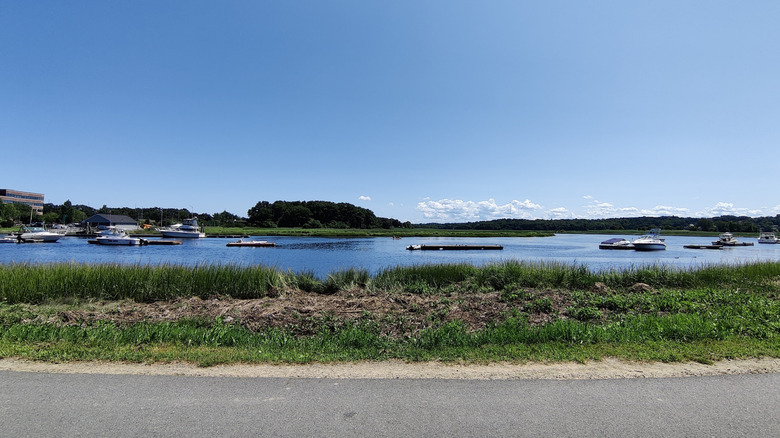
When you're visiting a city like Boston, Massachusetts, you may be focused on sightseeing at famous destinations like the Museum of Fine Arts, Faneuil Hall, or Fenway Park. However, if you're looking to explore Boston in a different way, there is a city rail trail that has scenic river views for walkers and cyclists that you may not know about. The Neponset River Greenway Trail is the perfect way to experience another side of the city, beyond the historic buildings and well-known landmarks.
Boston is one of the greenest cities in the world, full of parks and river walks just waiting to be explored. However, this 9.5-mile trail is an underrated city gem, with only three reviews on Yelp at the time of writing. Additionally, a poster on Reddit's r/bikeboston thread shared that they had only learned about the Neponset River Greenway Trail after 30 years of living in the city. While there are a number of reviews on AllTrails, they're only for a 3.3-mile section of the trail.
You won't find "Neponset River Greenway Trail" listed on Google Maps either. If you search for it, you'll see a five-mile section called the Lower Neponset River Trail. However, there are some resources that may help you plan if you want to do the full route. You can check out the RideWithGPS route or the TrailLink map (available for free with registration). They both provide clear indicators for parking, bike shares, and more. Note that the closest airport is Boston Logan International Airport, around 10 miles from the trail. There are shuttle buses from the airport to Airport Station, and the Blue Line subway goes from there into downtown Boston, so you won't need a car.
All about the Neponset River Greenway Trail in Boston
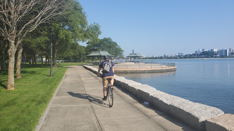
While you may see the Greenway trail listed as 10 miles long, I spoke with Andres Ripley at Neponset.org, who told me that it's actually 9.5, and runs from its northern extension (completed in July of 2025) between Tenean Beach and Morrissey Boulevard to Paul's Bridge in Milton. It's full of river views, including some on the northern portion of the trail that go along a section of the Boston Harborwalk, a 43-mile park along the waterfront, featuring some Boston Harbor vistas.
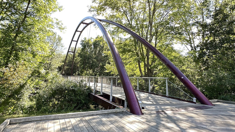
This trail also runs through areas like Dorchester, the largest neighborhood in Boston, Hyde Park, Mattapan, and Milton. It takes you to Carson Beach, Columbia Point, and Pope John Paul II Park, where you can find a playground, fishing spots, and free parking. Another river-viewing segment goes through the Neponset River Reservation and Ryan's Playground. One reviewer on Google Maps says of the Lower Neponset portion, "The trail is historic and very calming with the river running next to it." One charming area of note along the way is the Harvest River Bridge (pictured below) in the Mattapan neighborhood.
How to ride the Neponset River Greenway Trail and what's coming in the future
Portions of this trail run along a former rail line, and you'll find current Massachusetts Bay Transportation Authority (MBTA) bus, rail, trolley, and subway stops along the way. (In fact, Boston is known for having the most reliable public transportation system in America.) If you're visiting and don't have a ride, you can take advantage of Boston's bike share program, Bluebikes, with location information available on the mobile app. There are several Bluebikes stations along the route. If you do have a bike with you, note that they're permitted on Red Line trains outside of weekday rush hours, as well as on all buses.
If you happen to be riding in the heat of the summer, the southern side of the trail is noted as shady by TrailLink. However, make sure to wear sunscreen, no matter which side you choose.
Finally, Ripley revealed the future of the Neponset River Greenway Trail to me, explaining that the goal is to extend the trail even further. Feasibility plans from the Department of Conservation and Recreation (DCR) are still ongoing as of this writing.