
Forget The Grand Canyon, Visit Arizona's Lesser-Known Gem With Scenic Cliffs, Historic Ruins, And Hiking
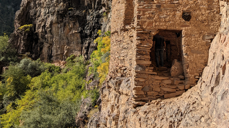
In the Sierra Ancha Wilderness, about 100 miles east of Phoenix, there's a challenging (but rewarding) hike along Devil's Chasm Trail that leads to remarkably well-preserved Native American ruins. Known as Devil's Chasm Ruin, the ancient cliff dwelling was built between 1280 and 1350 by the Salado people. While the surrounding wilderness is 32 square miles of extremely rugged terrain, the adventurous have found ways to reach it the site despite the challenges.
Timing matters: spring and fall are the best times to visit Devil's Chasm. Summers can be positively sweltering, and winters can be freezing. You'll want to utilize a high-clearance 4x4 vehicle to reach the trailhead. According to Wild Paths AZ (and just about every other resource you can find about the ruins), the road past Cherry Creek Campground is extremely rough. It would be exceedingly unwise to attempt the drive out during monsoon season or when rain is in the forecast at all. And flash flooding is not your only concern: while seeing other people out here isn't so common, seeing rattlesnakes can be, so stay alert.
Thankfully, the cost of admission is simply getting there. There are no fees and no passes required to experience one of the most intriguing lesser-known places in Arizona. If starting from Phoenix feels like too much, you can always spend the night and then start from Globe, a small hidden city near Phoenix with some amazing mountain views and nearby scenic drives.
A rugged hiking adventure
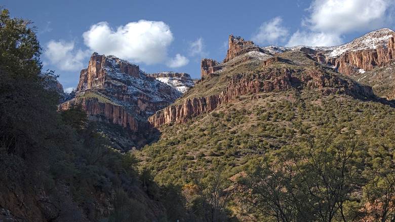
Devil's Chasm Trail begins at the creek, and it only gets harder from there. The hike (or climb, in some places) up the impressive cliff face to reach the ruins is short and strenuous; according to AllTrails, it's 3.3 miles out and back. You'll encounter an elevation gain of 2,070 feet along the way; the hike down and out is easier, thankfully, than the way up. It's mostly shaded, so the sun won't be beating the life out of you with every step. Despite the shade, you'll want to pack plenty of water and start the trek early; bring hiking poles to maintain your balance and footing in precarious places. This route involves scrambling, climbing, and some occasional route-finding, as it's not well-marked. At some times of year, a little bushwhacking might also be in order.
From the trailhead, you'll want to keep left until you reach a dry waterfall — or, at least you'd better hope it's dry. Should it be running, getting past it will be unpleasant, if not flat-out impossible. Finishing the rest of the hike relies entirely on your ability to climb up the waterfall and onto the ledge it occasionally cascades from.
The next "nope"-inducing part of the adventure is the suspiciously narrow ledge you need to get across to reach another waterfall (which, thankfully, you don't need to clamber through this time). Look to your right, on the cliff: the ruins will be right there, subtle at first, but more apparent the more you look. But don't forget to look outward, too: the views of Cherry Creek Valley below are jaw-dropping and make the whole journey worth it. If you're afraid of heights, though, this hike is probably not for you.
Historic ruins hidden within steep cliffs
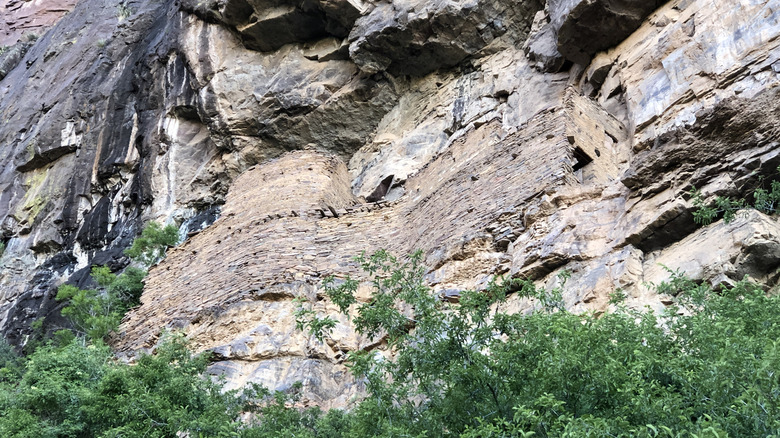
Once you've reached the ruins, congratulations: you've accomplished something amazing! Best of all, you're able to explore the ruins firsthand instead of being forced to admire them from afar. You'll enter the dwelling remains through the western end, and from there, you'll meander through each of the ground-floor rooms. The main structure has five modules of rooms, and it might have had up to three floors at some point. Pay attention to the small details: the dwelling's outer walls contour beautifully alongside the rigid lines of the cliff face it's built into (see photo above). There are still smoke stains on the wood and walls inside some of the rooms from fires burned indoors for light and warmth, and various signs of lives lived long ago in the form of old pottery scattered here and there. The view from some of the windows is nothing short of awesome.
Near the entrance, you'll find that you can scramble up the rock wall (never climb on the ruins — ever) and get an awesome bird's-eye view of the structure and the valley way down in the backdrop. The elevation at the ruins is about 5,700 feet above sea level; the elevation down in the valley you climbed up out of to reach the ruins is anywhere from 3,000 to 3,500 feet.
Linger as long as you'd like; it's not very likely you'll encounter others all the way out here, so it's a great place to enjoy a little well-earned peace and quiet. If you find yourself craving even more challenging hikes, check out Phoenix's own Camelback Mountain, one of Arizona's most perilous trails. Still want to walk (or hike, rather) on the wild side? Check out our picks for the most dangerous hiking trails in Arizona.