This Lively US City Out West Was Ranked The Best Urban Hiking Destination In The Country
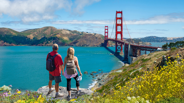
In May 2025, SportsShoes released the results of a study it conducted to determine which cities around the world were the best vacation spots for avid hikers. The study uncovered that Rio de Janeiro, where jungle trails meet iconic beaches, was the number one hiking destination worldwide, followed closely in second place by Mexico City. But the top city in the U.S. — ranking third on the list overall with a hiking score of 96/100 — was none other than San Francisco.
According to SportsShoes, San Francisco has 119 mapped trails within its city limits, which cover the rare combination of steep hills, ocean views, forest groves, and scenic overlooks. Top trails include easy access to natural landscapes like forests, bluffs, and shorelines, as well as city amenities, including toilets and running water. Not to mention, some of the routes include epic views of iconic sites like the Golden Gate Bridge.
The well-connected Bay Area Rapid Transit (BART) system gives visitors easy access to a variety of trails without needing to rent a car. Plus, the Bay Area is known for its mild coastal climate (albeit a notoriously foggy one), making outdoor exertion highly enjoyable. Lastly, San Francisco enjoys relatively easy access to a variety of ecosystems just beyond city limits — including redwoods, mountains, and protected seashores — making it an equally ideal destination for hikers looking to do casual walks or all-day trekking.
Where to find the San Francisco's best hikes
After the bridge itself, Golden Gate Park is one of the city's best-known attractions. This urban plot stretches from the hippie enclave of Haight-Ashbury to the ocean, encompassing 1,017 acres of gardens, groves, and lakes, with 13 easy-mapped trails and a hidden Japanese tea garden with tranquil landscapes nestled in its heart. For a greater challenge, head one mile north of the park's northwest entrance, where Fulton Street meets Ocean Beach. The Lands End Trail is a moderately challenging 3.4-mile loop that overlooks the rugged northwestern cliff of the San Francisco Peninsula, forested in dark cypress. This and the 1,491-acre Presidio park (just one more mile east) pair city Golden Gate Bridge views with greenery and hills — a must during any urban hiker's visit.
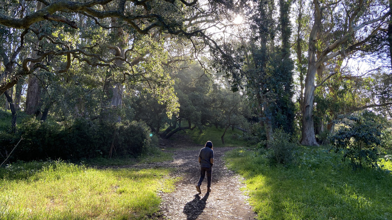
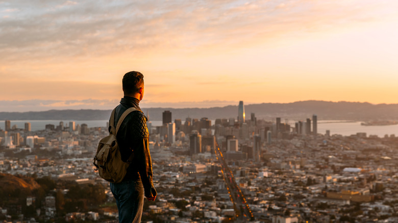
In the opposite direction, the Mount Sutro Reserve (one mile south of Golden Gate Park's southeast entrance at Stanyan and Frederick Streets) hides a misty bushland at the top of one of the city's highest peaks, just 92 feet short of an actual mountain. A 2.3-mile dirt trail loop allows hikers, mountain bikers, and runners to admire the almost mystical setting of a Tasmanian blue gum forest overrun with tart Himalayan blackberries and a blanket of English ivy. Another one-mile walk east will bring the avid hiker to Twin Peaks Trail, a two-mile out-and-back that features 180-degree panoramas of the city and bay below from the top of Noe and Eureka Peaks.
For those looking to do some serious urban trekking, check out the San Francisco Crosstown Trail or Double Cross Trail. Running 17 and 14.9 miles respectively, each takes hikers on an immersive all-day journey past some of the city's best-hidden trails, community gardens, steep stairs, and commercial streets.
Hiking the Bay Area beyond the city
Not only is San Francisco itself a treasure trove of trails, but it's also surrounded by an impressive array of diverse environments perfect for hiking as well. Just a one-hour drive north across the Golden Gate Bridge in Marin County, you can walk amongst the world's tallest tree species at the unforgettable ancient monument of Muir Woods, home to California coastal redwoods. Right next door, find more misty redwood trails, camping, and panoramic ocean vistas at Mount Tamalpais State Park, where the summit itself climbs an impressive 2,571 feet.
To the northwest and just a one-hour drive away from the city, Point Reyes National Seashore contains uncrowded beaches and lagoons across 656 miles of oceanfront that's perfect for hiking. The park contains a variety of coastal habitats, like sand dunes, estuaries, English Isle cliffs, and a bay made for oyster farming. To the south of San Francisco, you can access communities like Pacifica and Half Moon Bay — both full of coastal trails with lichen-covered bluffs and scrubland dotted by cypress trees. On the bay side of the Peninsula, San Bruno Mountain State & County Park is a gem hiding in plain sight, full of ridgeline trails with views of the city skyline.
To the east, Mount Diablo and Mission Peak each offer a climb up a green slope whose soft appearance belies its difficulty. The former is a 3,849-foot summit with views across the Bay to the west and the Sierra Nevadas to the east, and a blanket of California's celebrated wildflowers in spring. The latter is only 2,517 feet tall, but with its gratuitous views across the South Bay, it remains a popular summertime sunset escapade.