Hidden In Portland's Suburbs Is A Historic Parkway With Access To Old-Growth Oregon Forests And Sweeping City Views
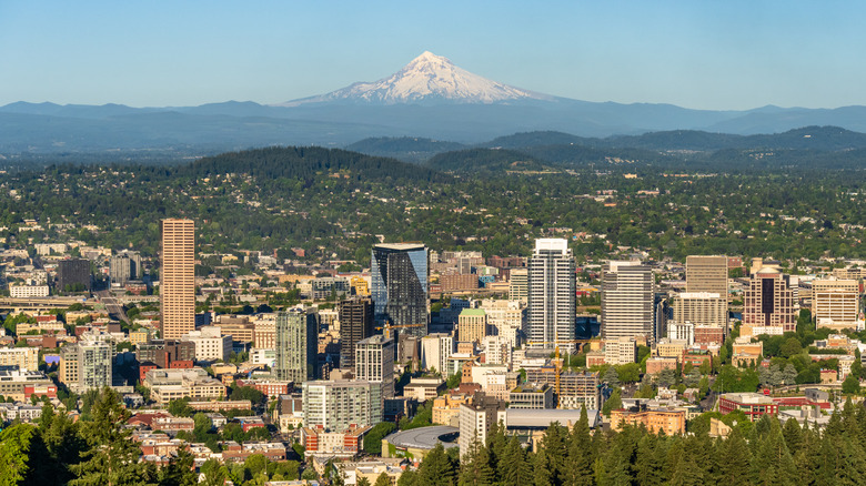
As Oregon's largest city, Portland – "the quietest city in America" – and its surrounding suburbs carry many travel gems and destinations around each corner for visitors to uncover. The Rose City has visitors tasting their way through endless food trucks and craft breweries, and exploring countless green spaces and parks on foot or by bicycle. You can find these in the underrated region of parks, charming neighborhoods, and small-town vibes of its fifth quadrant of North Portland and in the peace and beauty of Mount Tabor Park, a century-old quiet park with scenic views from a cinder cone volcano on its southeast side. Stretching out to the suburbs, the Terwilliger Parkway is a historic parkway through old-growth forests, offering city views and a true sense of Portland.
The Terwilliger Parkway, named for James Terwilliger, one of the first permanent residents of Portland, is a 2.5-mile stretch in the southwest corner of the city. After Portland established the City Beautiful Movement and enlisted landscape architects, The Olmsted Brothers, in 1903 to create the city's greenscapes, the parkway was created in 1912. The 102-acre parkway was added to the National Register of Historic Places in 2021. Its northernmost section commences in Duniway Park, named for Abigail Scott Duniway, an author and women's suffragist who campaigned for voting rights for Oregon, where a sign was placed in 2012. The southern portion intersects with SW Capitol Highway, ultimately connecting with Barbur Boulevard, with forestland, expansive parks, and hospitals along its route. The scenic roadway's design was intended for slow-speed travel to highlight the adjacent wooded areas and parks, along a hillside route for residents and visitors to fully take in and embrace its vistas, and provide options for outdoor recreation.
How to explore Portland's historic Terwilliger Parkway
When you're ready to explore the Terwilliger Parkway, you can do so by car to enjoy the curved roadways, but there is also a pedestrian pathway accessible for those wishing to stroll on foot, which also includes striped bicycle lanes. You'll want to stop at the scenic viewpoints along the way, featuring picturesque views of the city, Willamette River, Mount Hood, and Mt. St. Helens, and having a camera at the ready is also a must. Those viewpoints include the Eagle Point Nature Patch, which was added in 2023, a somewhat secret garden at Terwilliger Parkway and SW Lowell Lane. Just 300 feet away from Eagle Point is the Walpole Garden, which includes a labyrinth with scenic views, a tree-lined path, logs for seating, and many native plants. It sits above Bancroft Street, and the nonprofit Friends of Terwilliger Parkway is responsible for the care and upgrades in the garden, along with the Portland Department of Parks and Recreation.
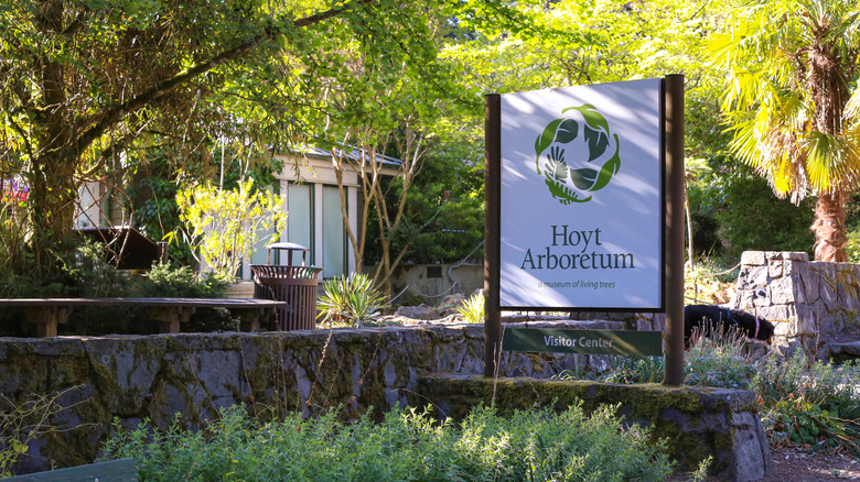
When the season is right, hundreds of rhododendrons are visible along an approximately 2-acre parcel of land formerly owned by long-tenured Portland residents Charles and Thelma Norris, who planted them there. Upon her 1992 passing, Thelma, an original member of the American Rhododendron Society, donated the land to the city. The parkway also serves as an ideal way to visit the Hoyt Arboretum, located inside the expansive 410-acre Washington Park, considered a jewel among the city of Portland's parks. The year-round arboretum features more than 6,000 trees from over 2,300 species, a visitor center, and a set of hiking trails that connect to those along the parkway, with no admission fee for visitors.
View the old-growth forests and city views on a trail along the Terwilliger Parkway
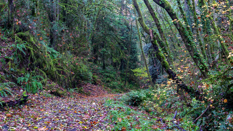
One of the parks you'll encounter on the Parkway's route, Marquam Nature Park is named for Philip Marquam, a former judge and state legislator, who was instrumental in shaping many parts of Portland. This 204-acre natural park is the third-largest park in Portland and offers seven miles of hiking trails on largely undeveloped land and intersects with the 40-mile loop trail system. The park is adjacent to the Oregon Health & Sciences University campus and open daily from 5 a.m. to midnight, with no use fees and picnic areas for public use. You can obtain a downloadable park and trail map from the Friends of Marquam Nature Park website to plan your excursion here. Be sure to check out the Marquam Mosaic, a collection of art designed to mirror the park's native flora and fauna, located at the shelter structure, right next to the 4T trailhead.
The most notable trail is the Marquam Trail, a 3.1-mile out-and-back moderately rated hike with a 672-foot elevation gain. You'll be able to view mossy-covered forests with a scenic view at the end after parking in the lot at the end of SW Marquam Street, according to AllTrails. It's also recommended to wear sturdy shoes since the trail features rocky portions and steep inclines. The Marquam Trail connects to the Council Crest Trail and Council Crest Park, which, at its location 1,073 feet above sea level, is one of the highest spots in Portland, with scenic views of Mount Hood and the city. If you're into forest-lined trails, you'll definitely want to head to Portland's Forest Park, the largest urban forest in the U.S., with some of Oregon's prettiest trails, about a 20-minute drive from the Terwilliger Parkway.