Arizona's 5 Best Long Trails Through Breathtaking Canyons
Arizona, for all of its unique topographical features, is very much a land of canyons. Many of the most drop-dead gorgeous canyons in the American West are located within Arizona's borders, with everything from vast, world-famous canyon formations to small, intimate slot canyons hidden in red rock countryside. Arizona's complex geology and unique desert conditions have combined to forge many of the world's most dramatic canyon systems, including several superb examples in Arizona's many acclaimed national and state parks. And, despite their treacherous terrain and even more treacherous Arizona weather, many of the state's spectacular canyons are also the sites of truly unforgettable hiking trails.
Arizona's one-of-a-kind desert environment and otherworldly geological foundation have already provided the state with many of America's most sought-after trails. The wonders of modern infrastructure have also put many of Arizona's most beautiful canyons well within reach of most travelers via short and sweet hikes along well-developed paths and accessible observation decks.
However, for more daring hikers, Arizona's rugged canyon landscapes are best experienced on long, epic, and challenging trails covering several miles of intricate canyon geography. While these longer and more challenging hikes are certainly not for everyone, they will forge lifelong memories among those who are up to the challenge. If you feel like you're among them, these five epic trails are some of the longest hikes through Arizona's canyons, with consistently high rankings on review sites like AllTrails.com, exceptional on-the-ground scenery, and second-to-none tours of some of Arizona's best outdoor destinations.
Boulder Canyon Trail, Superstition Wilderness
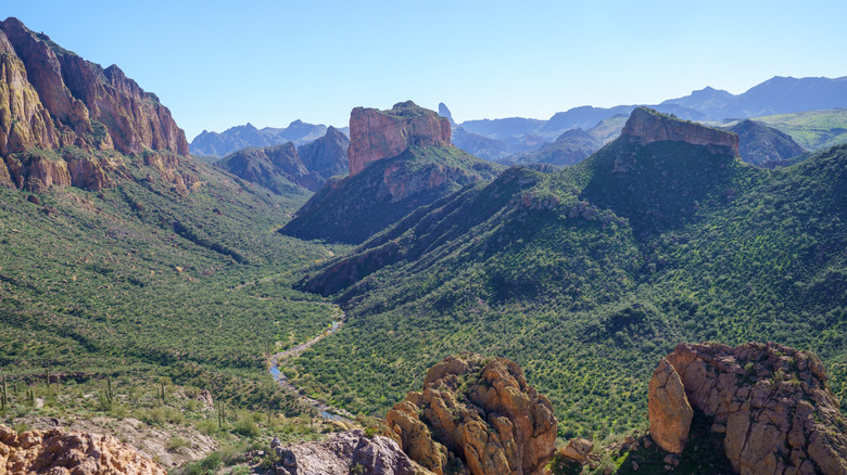
The Superstition Wilderness is a wild and rugged preserve of Arizona's unforgettable Superstition Mountains, a cosmic landscape of jagged red peaks that looked like something from another planet (even though they sit just 40 miles outside Phoenix). Within this challenging context, the Boulder Canyon Trail covers about 10.3 miles through a deep canyon wash nestled within the intimidating rocks of the Superstition Mountains.
Though arguably best known for Arizona's vibrant desert hiking and camping paradise of Lost Dutchman State Park, the Superstition Mountains also contain the much more isolated environment of the Superstition Wilderness. Located within the much larger Tonto National Forest, the Superstition Wilderness protects more than 160,000 acres of unadulterated Arizona beauty. The Superstitions are known for razor-edged peaks as high as 6,000 feet above the Sonoran Desert. They also feature some truly impressive canyon systems that cut deep pathways beneath the prominent red summits — most notably the extensive Boulder Canyon.
Suffice it to say, the Boulder Canyon Trail is not ideal for novice hikers. Alongside its formidable length and harsh terrain, the trail is also subject to the often-brutal temperatures of the Superstition Wilderness, which can exceed 110 degrees during the summer. However, if you come prepared for extreme heat and dangerous terrain, you'll be rewarded with spectacular views of towering red mountain skyscrapers presiding above you, all dressed in a surprisingly rich layer of greenery. Fortunately, the Boulder Canyon Trail isn't all remote desert wilderness. The trailhead starts at the Canyon Lake Reservoir, where hikers can relax and grab a bite to eat at the Canyon Lake Marina.
Pima Canyon Trail, Pusch Ridge Wilderness
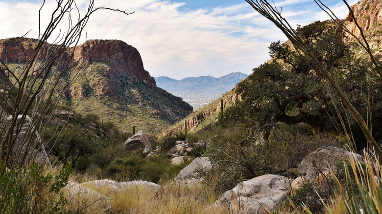
The Pusch Ridge Wilderness is one of the hidden gems of the Tucson area, a region largely defined by the much better-known Saguaro National Park. As part of southern Arizona's epic Coronado National Forest, the Pusch Ridge Wilderness displays the strange beauty of the Sonoran Desert framed by the stately peaks of the Santa Catalina Mountains. As with the Superstition Mountains further north, the Santa Catalina Mountains bear a series of deep canyon systems carved by Arizona's complex climate and geology. And like the Boulder Canyon Trail, Pusch Ridge Wilderness's Pima Canyon Trail is a lengthy and challenging adventure through a one-of-a-kind Sonoran Desert landscape.
Pima Canyon centers around a long desert stream that feeds a fertile riparian ecosystem along the trail, despite the harsh desert conditions around it. The trail itself covers about 10.6 miles along the natural Pima Spring stream. As the trail progresses, hikers will gradually ascend from the lower-elevation stream to the higher-elevation Santa Catalina uplands that bracket the canyon. Though this means a bit of work on your part, it also means epic panoramic shots of Pima Canyon below, plus the striking Santa Catalina peaks ascending as high as 8,000 feet across the horizon.
These vantage points provide clear views of the surprisingly diverse vegetation of the Pusch Ridge Wilderness, with cottonwood trees, pine trees, maples, and (of course) iconic saguaro cacti all visible from the trail's many scenic areas. The Pima Canyon Trail also provides excellent, close-up shots of some of the most prominent mountains around Tucson, including the 5,675-foot Bighorn Mountain and the wilderness' namesake, Pusch Peak.
Ford Canyon Loop Trail, White Tank Mountain Regional Park
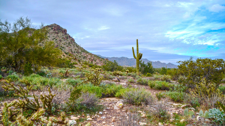
Looking at a photo, you'd likely assume that the spectacular desert scenery around the 11-mile Ford Canyon Loop Trail and its surrounding White Tank Mountains is part of an acclaimed national park. Remarkably, however, this extraordinary landscape actually sits within a mere regional park in the Phoenix metropolitan area. As the largest park in Phoenix's Maricopa County (and the country as a whole!), White Tank Mountain Regional Park is a one-of-a-kind preserve of epic desert landscapes, regardless of the presence of a major city just a few miles away. The park protects the relatively small but magnificent White Tank Mountains as they stretch across the skyline outside of Phoenix. Though the park has plenty of short and sweet day hikes, the challenging, the Ford Canyon Loop Trail is one of Arizona's most dramatic hiking treks.
The Ford Canyon Loop Trail follows a circular route around the central White Tank Mountains. Along the way, the trail's Ford Canyon passes through several smaller, more intimate canyon formations sitting at the base of the mountains, including Willow Canyon, Mesquite Canyon, and Dripping Springs Canyon. Though amenities are scarce along much of the trail, the route does pass an old dam around 4.5 miles in, which serves as a great place to stop and have a snack before continuing.
Much of the Ford Canyon Trail is lined with bright white granite rocks that shine out in the Arizona sun (making sunglasses something of a necessity). In addition to its staggering panoramic views of the White Tank Mountains and the Phoenix metro area, the Ford Canyon Trail is a great destination for seeing many of Arizona's most prized desert birds, including roadrunners, canyon wrens, and several species of hummingbird.
Wilson Mountain Trail, Coconino National Forest
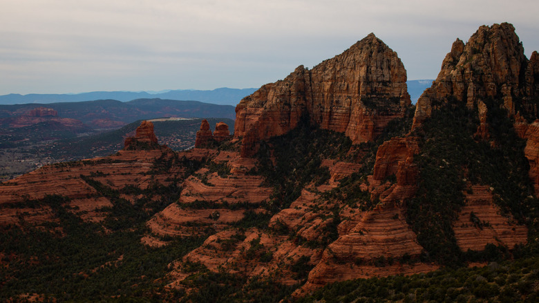
Arizona's marvelous Coconino National Forest surrounds the popular destination of Sedona with a veritable city of magnificent red sandstone mesas, buttes, mountains, and canyons. This incredible scenery (and possible spiritual vortexes) makes for some of Arizona's most beloved hiking trails. The Coconino National Forest has plenty of shorter and (relatively) manageable hikes for casual outdoor enthusiasts. However, if you're looking to really dive deep into this outstanding region, while also getting Instagram-worthy views of one of Arizona's most beautiful canyons, consider a trek along the monumental Wilson Mountain Trail.
The Wilson Mountain Trail covers 11.7 miles of hypnotic red landscapes around the 7,122-foot Wilson Mountain, a prominent flattop mesa and the highest point in Sedona. The mountain takes its name from one Richard Wilson, who was killed by a grizzly bear in 1885. Though you're unlikely to encounter a grizzly today, this foreboding name origin does convey the Wilson Mountain Trail's challenges.
The trail's 11.7 miles feature almost 3,000 feet of elevation gain and several sections bordered by precarious cliffs. In short, this trail is not for the faint of heart! If you can manage its challenges, however, the Wilson Mountain Trail also provides some of the best views in the Sedona area. For canyon lovers, the trail's highlight will undoubtedly be its soul-stirring views of Oak Creek Canyon. Straddling the complex borderland between Sedona's red sandstone geology and Flagstaff's green pine forests, Oak Creek Canyon is a magical synthesis of reds and greens in one canyon setting. The Wilson Mountain Trail passes along several excellent Oak Creek Canyon observation points, including the popular Midgely Bridge Observation Site. From the trail's final overlook, you can even see the Oak Creek waterhole and thrilling natural waterslide in Arizona's Slide Rock State Park.
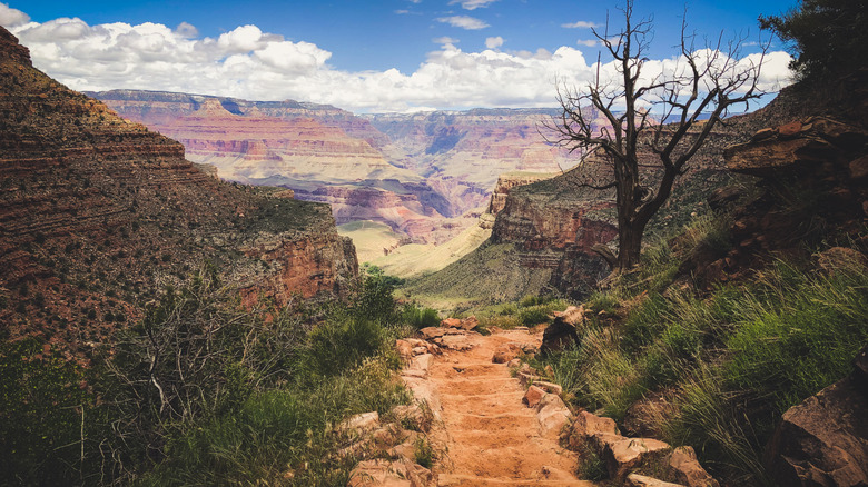
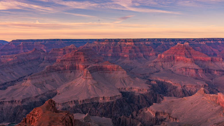
Bright Angel Trail, Grand Canyon National Park
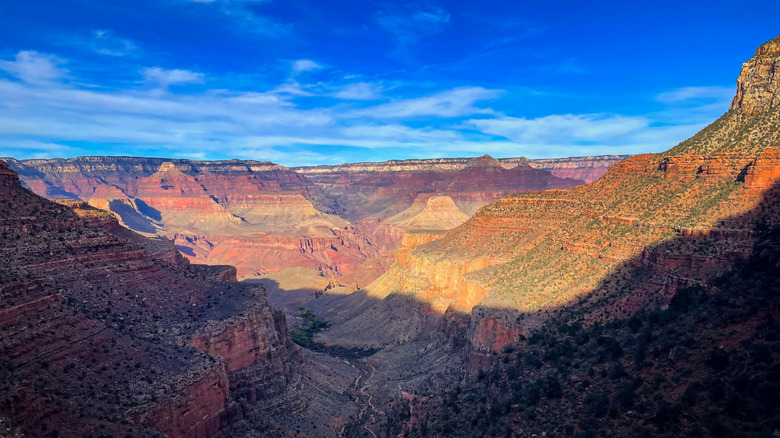
As impressive as all of these canyons are, any ranking of "top Arizona canyon hikes" would be incomplete without a stop at the world-renowned Grand Canyon. The Grand Canyon and its celebrated national park need little introduction for even casual travelers. And despite the Grand Canyon's heart-dropping depths and less-than-accommodating terrain, Grand Canyon National Park's visitor-friendly infrastructure does provide great short and easy trails and scenic viewing areas. However, if you're looking for a long and epic journey into this iconic world wonder, you'll find no better challenge than Grand Canyon National Park's daunting Bright Angel Trail.
The Bright Angel Trail's incredible views are only matched by its intimidating challenges. The full trail covers about 16.4 miles, much of it passing perilous cliff drops and steep climbs up rocky promontories. Fortunately, there are also several rest houses, water stations, and break points along the way, allowing hikers to complete the trail in a multi-day backpacking trip rather than trying to fit the full 16.4 miles in one day.
If you're up for the challenge, the Bright Angel Trail does hit many of Grand Canyon National Park's best attractions, both natural and human-made. The trail begins from the South Rim's comfy Grand Canyon Village, where you can stock up on food and supplies before heading out. Further out into the canyon's depths, the Bright Angel Trail also passes through the enchanting Havasupai Gardens, a gorgeous oasis of cottonwood trees and flowing water (and a terrific campground). If you make it through the trail's full passage into the canyon, you'll be rewarded with a stop at Pipe Creek Beach and its supreme views of the Colorado River.
Methodology
Compiling a list of the best "long" trails in any state is not quite as simple as just looking at the various official lengths of all relevant trails and ranking them from shortest to longest. For one, different sources have somewhat different "official" lengths for relevant trails. Additionally, not all trails are as "official" as others. While park administrators do maintain a few specific trail networks, other trails listed on websites like AllTrails.com are more information routes forged by the hiking community itself, or combinations of other, smaller routes into one comprehensive scenic hike.
To keep things simple, we kept our focus on AllTrails.com's algorithmic ranking of the best "long" trails in Arizona. This wasn't perfect for our purposes, as AllTrails.com's definition of "long" tends to go beyond mere mileage and also includes characteristics like steepness, challenging terrain, and other factors that can increase hiking time. Similarly, the official list grouped the long trails based on overall reviews, not length.
Still, this ranking was sufficient for identifying particular Arizona canyon trails of notable length. Each of the five trails on this list is within the top five longest Arizona trails that center around a particular canyon feature. While the state may have other, even longer trails that pass one or more canyons, the five trails that made our list are largely centered around a particular canyon or system of canyons, rather than simply passing by one on a much longer route. In addition to length and sufficient canyon terrain, each of these trails also stands out for exceptional views and biodiversity, providing a comprehensive tour of unique Arizona environments as they highlight a particular national or state park.