5 Easy, Accessible Nature Trails In Phoenix, Arizona
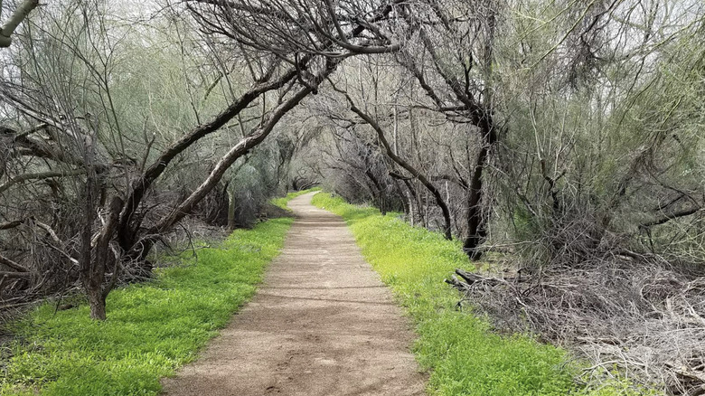
Although it's one of the largest cities in the United States, Phoenix's location in the middle of the Arizona desert makes it a top destination for one-of-a-kind hiking experiences. Within the Phoenix metropolitan area, avid hikers can find worthwhile challenges like the epic Maricopa Trail looping through Phoenix's Sonoran Desert landscape, or the high-elevation Dobbins Lookout trail past ancient petroglyphs and Phoenix sunset views. Not every Phoenix-area hike is quite so challenging, however. Despite the fearsome reputation of Arizona's Sonoran Desert, many Phoenix trails are rated as "easy," with several featuring well-maintained accessible infrastructure that opens up Phoenix's unique natural beauty to all hikers.
Hikers who use wheelchairs or other mobility devices can find several well-reviewed ADA-accessible trails across the Phoenix area. Rather than simply offering walking tours of Phoenix's urban infrastructure, many accessible trails in Phoenix exemplify the distinctive flora and fauna of the Sonoran Desert. As a result, Phoenix's natural beauty is available to all visitors, no matter their hiking experience or accessibility requirements. This list highlights five Phoenix-area trails rated "easy" by hiking platforms like AllTrails, designated as wheelchair-accessible by the city of Phoenix, and known for stunning desert scenery for every hiker to enjoy.
Penny Howe Trail, North Mountain Park
The Penny Howe Barrier Free Trail lives up to its aspirational title with one of the most accessible, barrier-free hiking experiences in Phoenix. With a mere half-mile of flat, looping trail with minimal elevation gain and convenient parking lot access, the Penny Howe Trail is the easiest hiking tour of Phoenix's North Mountain Park. Despite the mountainous nature of the "mountain" park, the Penny Howe Trail largely consists of well-paved, flat, and level paths that are perfect for wheelchairs, mobility devices, and strollers. The trailhead begins at a parking area off the nearby North 7th Street, which includes two accessible parking spots right next to the trail itself.
While accessibility is essential, the Penny Howe Trail is much more than its flat, even surface. The trail is an accessible nature tour of the idiosyncratic flora and fauna of Phoenix's Sonoran Desert beauty. Much of the trail loops around cultivated free-growing botanical "exhibits" of desert plants. Hikers will find plenty of well-placed educational signs with information about the trail's many botanical residents, giving a much broader context to the Sonoran Desert ecosystem, without forcing guests to brave harsh desert terrain.
As if an educational nature hike wasn't enough, the Penny Howe Trail also circles past many of North Mountain Park's family-friendly picnic ramadas, including the accessible Havasupai and Yavapai ramadas that feature large tables and ramps to restrooms. Though it's flat and accessible, the Penny Howe Trail provides exceptional views of North Mountain Park's picturesque desert mountains, like the 2,104-foot North Mountain and the 2,149-foot Shaw Butte.
Judith Tunell Accessible Trail, South Mountain Park and Preserve
On the opposite cardinal direction from North Mountain Park's Penny Howe Trail is the equally easy Judith Tunell Accessible Trail in South Mountain Park and Preserve. The Judith Tunell Trail consists of two half-mile loops over a flat, paved surface that's ideal for wheelchairs and other mobility devices. With a minimal slope, the Judith Tunell Trail has few challenges and uphill sections. The trail also includes several benches, water fountains, and picnic ramadas that hikers can take advantage of in the hot Phoenix conditions.
Similar to the Penny Howe Trail, the Judith Tunell Trail is an interpretive trail, with well-placed signs and displays (in both visible text and in Braille) on the desert flora and fauna of South Mountain Park and Preserve. Alongside the trail's prominent desert scenery are several well-preserved examples of ancient petroglyphs etched on nearby rocks, protecting the legacy of the Indigenous peoples who inhabited the region before European settlement. Even more conveniently, the Judith Tunell Trailhead is right next to a large parking area and the South Mountain Park Visitor Center, where hikers can find more informative exhibits on the Sonoran Desert's ecosystem and wheelchair-friendly infrastructure.
Scenery-wise, the Judith Tunell Trail offers an accessible sightseeing tour of the remarkable scenery in South Mountain Park and Preserve. The park's 16,000 acres sit at the convergence of the Gila, Guadalupe, and Ma Ha Tauk mountain ranges. And though the Judith Tunell Trail certainly doesn't make any challenging ascents up mountain slopes, it does provide hikers with excellent viewpoints of these stunning peaks from the comfort of an even, paved path, or an accessible picnic nook.
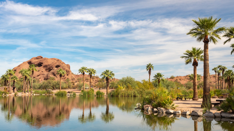
Elliot Ramada Loop, Papago Park
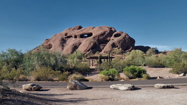
The Elliott Ramada Loop may be the best way to experience the rugged magic of Arizona's Sonoran Desert without having to venture away from Phoenix's urban amenities and accessible infrastructure. The trail covers around 2.7 miles through Phoenix's Papago Park, with the northern section of the trail consisting of paved, even surface that can accommodate wheelchairs, strollers, and mobility devices. The entire loop is largely flat, with 118 feet of total elevation gain throughout the hike.
The Elliot Ramada Loop begins at a parking area off North Galvin Parkway, where visitors can find several accessible spaces for vans. From the parking lot, hikers should begin the Elliott Ramada Loop in a counterclockwise direction to stick to the trail's paved, accessible segments. After about a mile of paved surface, the trail does become less accessible as it transitions to dirt and gravel through several desert washes. However, the paved, accessible portion of the trail is more than scenic enough. The trail also includes several benches and a picnic ramada for anyone who wants to stop and enjoy the scenery.
Even if you stick to the paved, out-and-back route, the Elliott Ramada Loop is a great introduction to Papago Park. With both a stunning collection of desert plants and rock formations and no admission fee, Papago Park has long been one of Arizona's best free tourist attractions. The Elliott Ramada Loop offers views of Papago Park's striking red sandstone buttes, tall palm trees, and the many classic Arizona cacti that decorate the Phoenix landscape. Though it works perfectly as an accessible nature trail, the Elliott Ramada Loop also provides great vistas of downtown Phoenix.
Barrier Free Nature Trail, Reach 11 Recreation Area
Though it does not traverse a park as well-known as North Mountain Park or South Mountain Park and Preserve, the Barrier Free Nature Trail in Phoenix's Reach 11 Recreation Area is a lovely way to explore a rare stretch of Sonoran Desert greenery on an accessible path. The trail covers a 1.8-mile loop over very flat and level terrain (with only 16 feet of elevation gain total). Most of the trail covers paved concrete or asphalt that's at least 6 feet wide. The Barrier Free Trail is part of the longer Reach 11 Recreation Loop, itself an easy 2.9-mile loop with minimal elevation gain or challenges, albeit with some less accessible terrain than the barrier-free portion. Both loops start from a trailhead parking lot with van-accessible spaces and convenient access aisles for wheelchairs and mobility devices.
The Barrier Free Nature Trail also lives up to its title of "nature trail" with mesquite trees, colorful wildflowers, and other remarkable desert plants. The Reach 11 Recreation Area is a 1,500-acre public park and green space in northern Phoenix, which runs alongside the Central Arizona Project canal. Nature lovers can enjoy the Barrier Free trail's interpretive signs with supplemental information on Reach 11's plants and wildlife residents. At some points during the hike, Reach 11's tree cover becomes thick enough to provide a much-needed degree of shade under the Arizona sun. The trail's proximity to a water-rich canal also creates more wetland sights and sounds than the average Arizona park, including a pond with frogs, ducks, and other wildlife.
Paseo Pathway, Sonoran Preserve
The Paseo Pathway in the Sonoran Preserve is one of the longest trails in Phoenix that is both easy and accessible throughout. At 9.9 miles long, the full Paseo Pathway generally takes more than three hours to complete. However, that 9.9 miles is largely an unchallenging, paved route with accommodating width (up to 10 feet in places) and a gentle gradient of less than 5%. The trail also has several accessible hiker-friendly subsections. For example, Paseo Pathway's east and west "Skip Rimsza" trails (named for a former Phoenix mayor) are easy and accessible routes that are much shorter than the entire Paseo trail.
The West Skip Rimsza Paseo Trail covers 3.1 miles with only 15 feet of elevation change and a mild gradient, while the East Skip Rimsza Paseo Trail covers only 1.9 miles with 37 feet of total elevation change. Both trail segments have a smooth concrete surface that's ideal for wheelchairs, mobility devices, and families with young children. The full Paseo Pathway runs parallel to Phoenix's Dove Valley Road and Sonoran Desert Drive (though the trailhead's parking area off of Dove Valley Road may not be as accommodating to vans and mobility equipment).
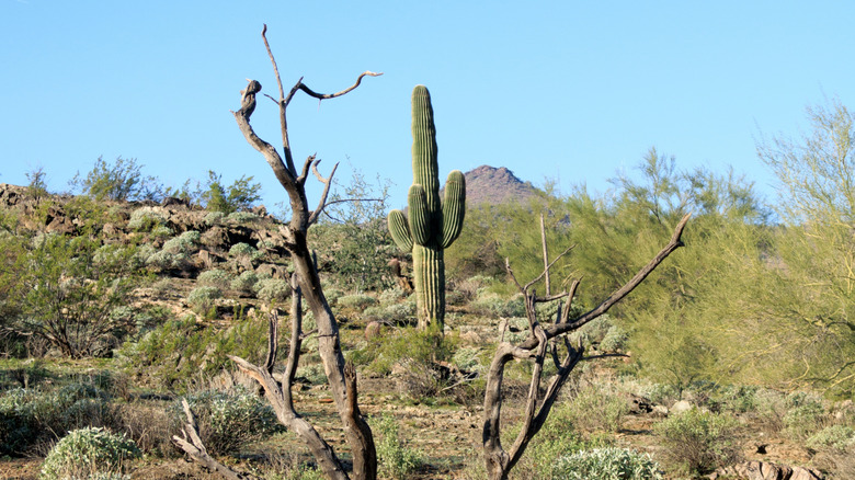
The Paseo Pathway (particularly the Skip Rimsza sections) offers what may be the most hiker-friendly immersion into some of the least-developed desert environments around Phoenix. The Phoenix Sonoran Preserve covers around 9,600 acres of desert wilderness, including ample photo opportunities of the iconic saguaro cactus.
Methodology
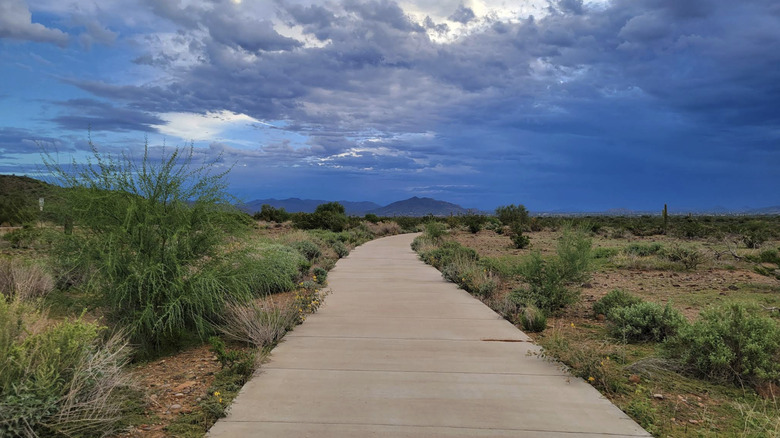
Our methodology for this list was based on three key factors: the "easy" rating of a particular trail, the trail's accessibility features, and the natural scenery hikers can see there. For the first point, we utilized the difficulty ratings primarily from AllTrails, supplemented with other hiking websites like Trailforks, Traillink, and GJHikes. AllTrails, our main source for trail information, defines "easy" trails as those that are "typically short, with clearly marked paths and fairly level terrain." Although difficulty ratings are always at least partially subjective, AllTrails employs an equation-based grading system and also takes into account factors such as obstructions, uneven terrain, or navigational challenges. Trails graded as "easy" by AllTrails or equivalent sites will therefore be quite simple to navigate and lack any difficult sections that require physical exertion.
While all five trails on this list meet that criteria, we also wanted to highlight hikes with specific accessibility features for visitors who use wheelchairs or mobility aids. The five trails on this list are not merely rated as "easy" by hiking sites like AllTrails, but are also designated as "wheelchair accessible trails" by the Phoenix municipal government, due to their accessible infrastructure, paved surfaces, minimal elevation changes, and lack of obstacles. Finally, each of these trails is located in a Phoenix-area park that offers abundant natural scenery and sightseeing, particularly for the unique flora and fauna of Arizona's Sonoran Desert. Thus, each trail is a true nature trail, rather than a simple, flat-surfaced route in Phoenix's urban areas.