
The Best Oʻahu Ridge Hikes That Offer Incredible Views Without The Crowds
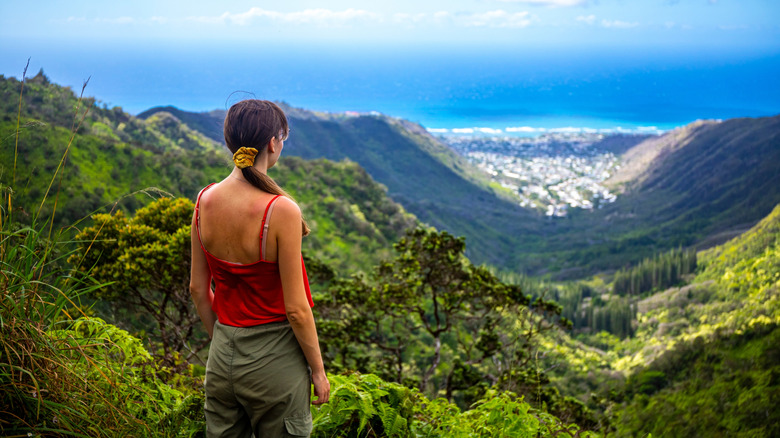
With two volcanic mountain ranges, the Ko'olau to the east and the Wai'anae to the west, O'ahu is easily one of the world's best hiking destinations. If you visit, you'll likely hear about the Diamond Head Crater Summit Trail and the Lanikai Pillbox Trail, the latter of which particularly offers some of the most picture-perfect views in all of Hawaii. However, both of these trails are also very busy. Luckily, O'ahu is also threaded with ridge trails with some of the finest views of the island, and some of them even allow you to escape the crowds at the same time.
Before attempting any of them, you need to consider why these ridge hikes are uncrowded. Some require permits or escorts, while others demand scrambling and rope skills. Most require a strong head for heights, while the muddy conditions on others are a primary concern. These trails are considered unsuitable for children and inexperienced hikers. You should also start early, because the midday sun can be fierce, and clouds can build through the afternoon — obscuring the very views that you set out for. In fact, all of the views described in this article are subject to weather conditions. Bring plenty of water and snacks, and wear long pants to protect your skin from the sun and thick overgrowth.
Each trail here has been cross-referenced with hiking blogs and local websites, including Noah Lang Photography and Journey Era, alongside hiking platforms like AllTrails and mountain identification sites like PeakVisor. Additionally, we made sure to only include legal trails since some iconic Hawaii hikes are now illegal for scary reasons. Here are some of the best ridge hikes in O'ahu that offer those famous views — but without too much company.
Poamoho Trail
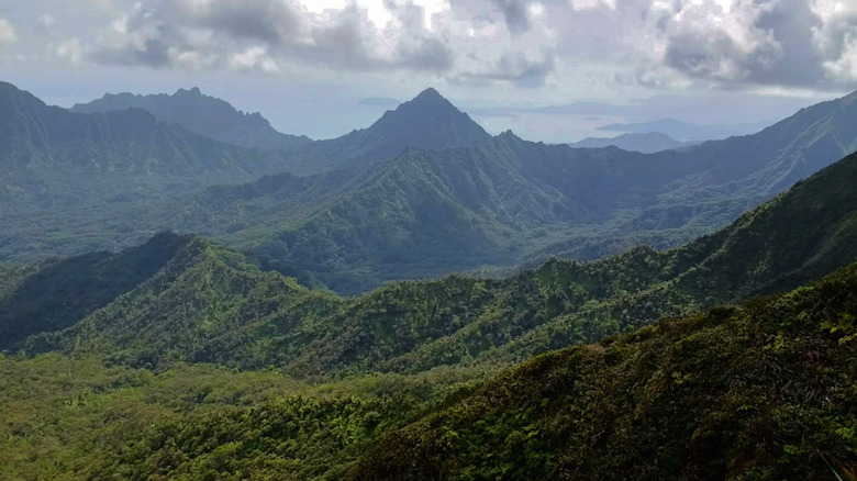
Deeply ridged and densely forested mountains roll toward the coast in every direction at the top of the Poamoho Ridge Trail. Beyond, the ocean shimmers, while the Kahana and Punalu'u valleys open up below. You can see peaks like Pu'u 'Ōhulehule and Pu'u Manamana rising against the sky, but you won't see any road, rooftop, or any other sign of civilization anywhere. If you're lucky enough to stand at the top on a clear day, and they can be a bit of a rarity here, you'll be treated to some of the best summit views in O'ahu.
The Poamoho Trail follows the Poamoho Ridge deep into one of O'ahu's most protected native forests. It gently climbs 800 feet across 3.5 miles, repeatedly crossing from one side of the ridge to the other, hugging its sides rather than only running along the top. And it's well maintained for at least some of the hike. Other parts are rougher and more overgrown, and you'll need to put in a bit more effort. Expect a lot of mud, no matter the season — in fact, expect it ankle-deep in some sections, according to hikers on AllTrails.
You'll need a 4x4 vehicle with high clearance for the access road. On top of that, you'll also need a permit — and only 20 are issued per day. The trail is also only open from Friday to Monday, adding in another factor that keeps things quiet. It'll take around four to five hours to complete the trail, but take note that an April 2026 landslide means it is closed at the time of this writing. Check with the Division of Forestry and Wildlife for updates before visiting.
Puʻu Kōnāhuanui (K1)
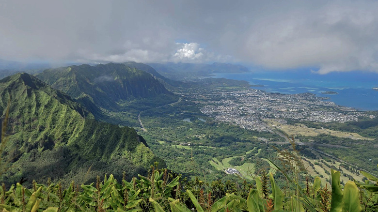
Pu'u Kōnāhuanui — or K1 — is the highest point in the Ko'olau Range. Standing at 3,150 feet, you'll witness the range stretching away in two directions, its sharp spine seemingly dividing the island in two. Look west on a clear day, and you can see Honolulu sprawling out below with the Waiʻanae Mountains as a backdrop. Look east and you might see Hawaii's secret coastal town, Kailua, with Mount Olomana rising before it from the green valley below.
But you'll need to earn this view. It's just over 8 miles of tough hiking, going up a total of 3,215 feet of cumulative elevation gain across six to seven hours. It might begin easily enough, just winding through lush, shaded forest. However, after the Nu'uanu Lookout, it changes character entirely. The groomed path soon gives way to a rough, muddy, vegetation-choked climb. You'll pass through K2 first, the lower of the two peaks on this trail, and there are fixed ropes here to assist with the steep push — experience with rope sections is essential, and gloves are recommended.
The ridge intensely narrows in some places, and the path shrinks to little more than a precarious ledge. Only some hikers make it this far and many tend to turn back at the lower sections, but the open ground between K2 and K1 often delivers better views than the K1 summit. The ridge is exposed and dramatic on both sides, and because K1 is frequently clouded in, you may also want to turn back at this point. If you're determined, start early before those thick clouds appear.
Mt. Kaʻala Trail
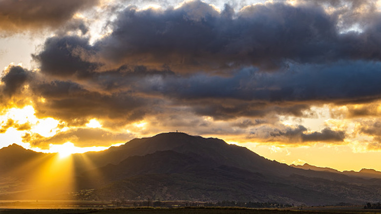
The first mile and a half or so of this climb to Mount Ka'ala is on a paved road, but it's also a gradual (and possibly challenging) uphill climb. Things don't get any easier after that once you hit the unpaved trail. An elevation gain of 3,500 feet passes you through increasingly steep, muddy terrain with fixed ropes lining the most difficult spots. There's even a ladder to assist with one of the more challenging boulder sections. The ridge tightens as you near the summit, with the ground falling away steeply on both sides — this difficulty alone keeps the crowds away.
However, there is a reward for your endeavors. At the top, you'll be standing at the highest point on O'ahu. From up there, you'll see the Leeward Coast, the North Shore, and the Wai'anae Range — that is, provided you started early enough. Cloud cover rolls in through the afternoon, and the summit is regularly lost in fog. Make it an early rise and allow five to seven hours for the climb.
The trail ends at a semicircular, mile-wide summit bog, which sits within one of the most pristine native forests in Hawaii. It's marked by a large dome, which is actually an FAA tracking station. The installation is secured by the U.S. Army, so stay within marked areas. One other vital piece of information hikers need to know is that there have been reported break-ins in the parking lot, so leave nothing of value in your car. This could be another reason why visitor numbers are kept down to a minimum here.
Mānana Ridge Trail
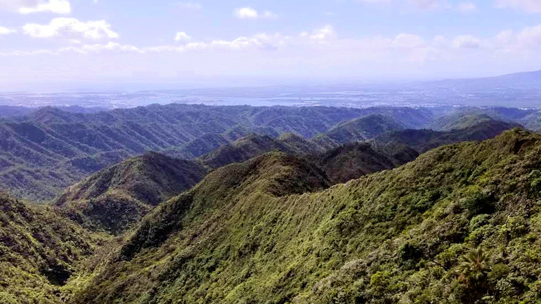
Many hikers who set off on the Mānana Ridge Trail don't reach the summit. Some split off to the more-popular Waimano Falls Trail at the Waimano Falls Junction. Others turn back at Mānana Shelter. Beyond that point, the trail turns wilder and gets muddier, narrower, and even harder than before. Heartbreak Hill can claim more who have run out of steam. Beyond that point, those who push on find themselves deep in the Koʻolau Range far from anywhere — and they might even have the place to themselves.
Getting to the trail's summit can take all day. It's over 10 miles of relentless ups and downs, with the trail rolling along the ridgeline like a rollercoaster. You'll climb 2,834 feet of cumulative elevation gain — and you should be very mindful as you go. Some ropes higher up on the trail are said to be in poor condition by some hikers on AllTrails. Try them carefully first. And with little shade on the trail, it pays to start early if the sun is blazing overhead. As you near the summit, the trail rises above the surrounding vegetation onto an exposed crest. The ridge then narrows, and the wind blows hard on both sides as the clouds drift past below.
On a clear day, you can see both sides of the island stretching in either direction. Lush Ko'olau peaks rise from deep green valleys, while the coastline curves far below against the extraordinary turquoise ocean. You might even see Pearl Harbor to the west. But this is some of the wettest terrain on O'ahu, and views are never guaranteed. Those who time it right, however, may well find something close to perfect solitude.
Mauʻumae Ridge Trail
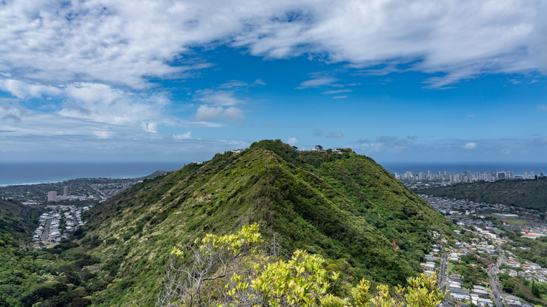
The Mauʻumae Ridge Trail, also known as the Lanipo Trail, is just a short drive from the iconic coastal destination of Waikiki, but it feels like you're in a completely different world soon after starting the hike. Diamond Head is visible from the ridge early on. As you climb, Ka'au Crater appears below — a vast, flat-floored green bowl surrounded by dense forest — and both Honolulu and the Pacific glitter beyond. The open, exposed ridge treats you to views like these throughout the climb, but to complete it, you'll need at least five to six hours to cover the 6.5 miles across 2,660 feet of elevation gain. The opening mile or two is manageable, but beyond that, the trail turns increasingly overgrown. According to some hikers on AllTrails, the brush in the upper section can grow head-high in some parts, so long pants are practically non-negotiable.
Rope sections are there to assist on the steeper climbs, but the trail can still be genuinely dangerous when the weather brings rain or strong winds. It's essential to check the forecast before attempting this trail. However, on a clear day, you'll get confirmation that O'ahu is one of the best destinations for breathtaking views and flawless beaches. There are the sharp twin peaks of K1 and K2, the turquoise waters of Kailua Bay, and the Honolulu skyline stretching along the coast. Like the end of many other ridge trails in O'ahu, the summit is often lost in clouds. But even without a clear summit, the ridge views make the hike worthwhile — and for a trail so close to Waikiki, it is remarkably quiet.
Kahekili Ridge Trail
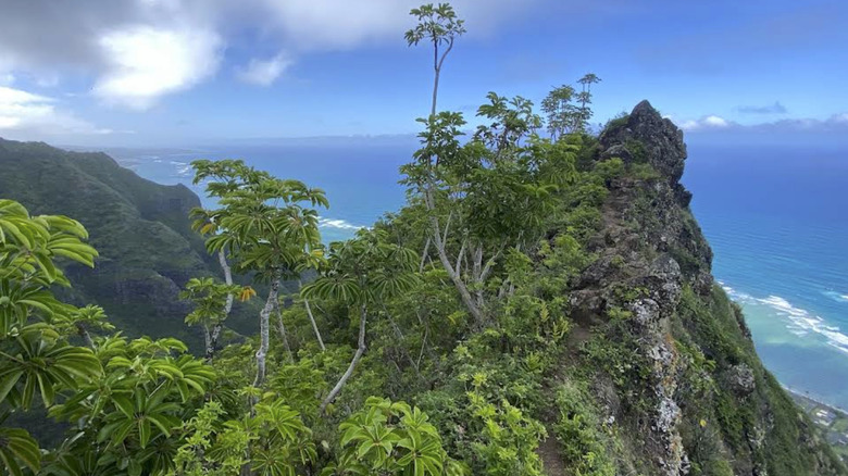
Unless someone tells you it's there, you probably won't find the Kahekili Ridge Trail. That's because the trailhead starts at the end of a quiet cul-de-sac. You need to look for a small sign pointing the way, and within what feels like no time, you're on a narrow, exposed ridge looking straight down on the extraordinarily blue waters of Kahana Bay.
The trail is comparatively short at 3 miles. It climbs 1,771 feet, and you'll need two or three hours to complete it. It winds through verdant forest before climbing out onto a razor-thin ridge where the ground falls away steeply on both sides. This is where the rock scrambling and rope sections begin. Do not attempt this trail in wet conditions; the slopes are treacherous, and you should reconsider the hike if you have no scrambling experience.
However, the trail is well signed, with tape markers leading the way throughout. But reaching the summit offers little. It's just a small plateau ringed by tall bushes hemming in the views. The real payoff is the halfway point, where you can see expansive views of the ocean and surrounding greenery.
Wiliwilinui Ridge Trail
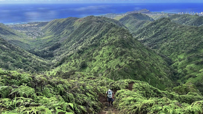
To hike the Wiliwilinui Ridge Trail, you must first find your way past its gatekeeper. As the trail sits inside a gated community, that gatekeeper is the guard who sits in the guard station issuing parking passes to visitors. The lot has limited parking spaces, so you'll be turned away if you arrive too late.
Those who make it through are rewarded with morning views of Diamond Head and Honolulu. They open up more as you climb the nearly 5-mile trail. The elevation gain of 1,597 feet is gentle enough for the most part (aside from a few challenging sections), but the last stretch throws everything at you. It's a punishing, heavily eroded ascent with steep stairs and ropes. It's also largely exposed to the sun, so protect yourself accordingly.
When the skies are clear, you can see the razor-sharp spine of Mount Olomana thrusting itself up from the forest floor like a dinosaur's back. Ironically, you can also see the beautiful Hawaiian nature reserve, Kualoa Ranch, a vast, flat green valley was a filming location for the 1993 film, "Jurassic Park." In addition, you can possibly see Mokoli'i Island sitting in the midst of turquoise waters as well. However, there's a chance none of it will be very visible since the summit is frequently covered in clouds. If that's the case, you can take your chances and wait to see if they clear away. That said, if it's the sunset you're chasing, don't arrive too late. You'll be refused entry if you haven't allowed for enough time to get back safely.
Kolekole Trail to Puʻu Hapapa
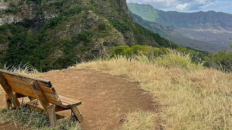
The entrance to the Kolekole Trail to Puʻu Hapapa sits inside Schofield Barracks, an active military base in central O'ahu. Getting on the ridge trail requires a military ID, or you can obtain a visitor pass at the Lyman Gate. The trail is only open on select weekends, and there are usually just two in any given month. You can usually find the updated schedule on the U.S. Army Garrison Hawaii Facebook page. But all this means that most people on the island, locals included, have never actually hiked it. Those who do hike it get a rewarding day out, possibly all to themselves.
It's a 2.7-mile out-and-back trail that'll take at least four to hours to complete. The elevation climbs to 2,900 feet but begins easily enough on a gentle trail leading to a bench with excellent views over Lualualei Valley. Beyond there, however, it turns into one of the most technically demanding hikes on the island. The trail involves a scramble up two exposed notches where the ground falls away steeply on both sides. Between them, the ridge opens up to panoramic views of the Waiʻanae Range before heading back into dense brush. Take care here; some of the rock is loose, according to some past hikers on AllTrails. Use the handholds where available and reconsider going this far if you are a beginner.
At the summit, you'll see the sharp ridges of the Wai'anae Range leading down steeply to the coast. Considering it gives you such a rewarding view, you'll be surprised at the solitude here.