
America's 9 Waterfalls That Are The Best-Kept Secrets From Tourists
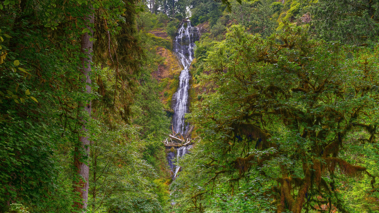
Some waterfalls in the United States are so beautiful and iconic that they attract millions of visitors every year. Niagara Falls, Yosemite Falls, Multnomah Falls — these are all special places,ut they can also be incredibly crowded. If you've visited them in the past, you probably stood in line for ages before having to elbow your way to the railings for a good view, only to have a bunch of strangers crowd your shots. But not every waterfall in the U.S. has been photographed to death. From coast-to-coast, there are waterfalls so secret that you may only have heard their name in whisper — if you have heard of them at all.
Some have no marked trail. Others have no signage or parking. Some require you to get your feet wet or descend steep slopes, and some are hidden in plain sight and yet somehow manage to remain largely undiscovered. They might not have the scale of America's biggest falls, but these hidden gems have drama. Visit any, and you'll likely enjoy an intimate experience with nature, beautiful trail scenery, and a sense of genuine discovery. No crowds, no queues, no jostling — and nobody photobombing your shots. We've consulted travel blogs like Anne's Travels and My Life's a Movie, as well as specialist waterfall websites like World of Waterfalls, to find these secret cascades. Most are known to locals, but all are off the tourist trail. Here are 9 of America's best-kept waterfall secrets patiently awaiting your discovery.
Iron Creek Falls, Gifford Pinchot National Forest, Washington
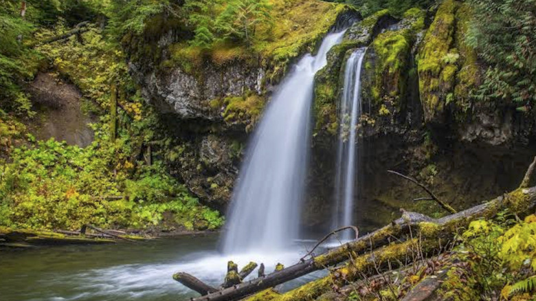
About 20 miles of Randle, Washington, tucked into the Gifford Pinchot National Forest, is Iron Creek Falls. It's only two hours from Portland, Oregon and three-and-a-half from Seattle, so it could be a welcome detour on a longer road trip in the Pacific Northwest. The water drops in a solid sheet over a dark, moss-capped ledge into a deep teal pool. That moss is thick on the rock above, and dense vegetation press in from every side to give the area an almost untouched atmosphere.
The falls are not completely unknown, though. They have built a quiet following among locals, but the wider tourist trail completely bypasses them. To get there, head south from Randle on Highway 131, then take Forest Road 25 for about 16 miles to the signed trailhead. There is a parking area there, where you'll find a 500-foot trail leading to the falls.
It's suitable for all ages to walk, so it's a good way to spend a Saturday afternoon in the area, and the recommended window is April through October. This is especially true for the summer months when the pool makes a fantastic swimming spot. If you have time, you can also check out Walupt Creek Falls, another secret and very unique waterfall just about a two hour drive east.
Royal Terrace Falls, McDowell Creek County Park, Oregon
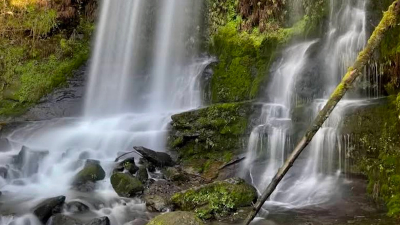
The McDowell Creek Falls Trail is possibly the most overlooked waterfall hike in Oregon. Crowds naturally tend to pile into nearby Silver Falls State Park, which is Oregon's largest, mind you. McDowell Creek County Park, however, is where you'll find a trail that sees way less foot traffic in comparison. It sits about two hours away from Portland and follows the McDowell Creek, passing four waterfalls along the way. The 119-foot Royal Terrace Falls is the biggest and most impressive.
The water cascades down a broad, tiered rock face in silky curtains, pausing for a millisecond before fanning wide at each ledge before dropping to the next. A viewing platform puts you close enough to feel part of it, and the geology is a unique part of the visuals. Where Silver Falls tumbles vertically down its basaltic lava, the smooth, curved, ribbon-like tiers of Royal Terrace Falls are the result of its softer volcanic breccia and sandstone.
The trail passes through a forest of fir, maple, and alder, where the trees are so thickly coated in moss that they feel as if they haven't changed in centuries. It's a 1.6-mile loop with a steady 291-foot elevation gain — which is pretty easy for most. You can bring your dogs as long as they are on a leash, and no pass or permit is required. Bridges and platforms deliver you up close to the falls — close enough to feel the spray on your face. Along the loop, you'll also see the smaller Crystal, Majestic, and Lower McDowell Creek Falls. Peak flow runs from late fall through spring, but summer is the best time for swimming. Stairs on the trail can ice over in winter, though, so check conditions before visiting.
Tillicum Creek Falls & Little Niagara Falls, Gifford Pinchot National Forest, Washington
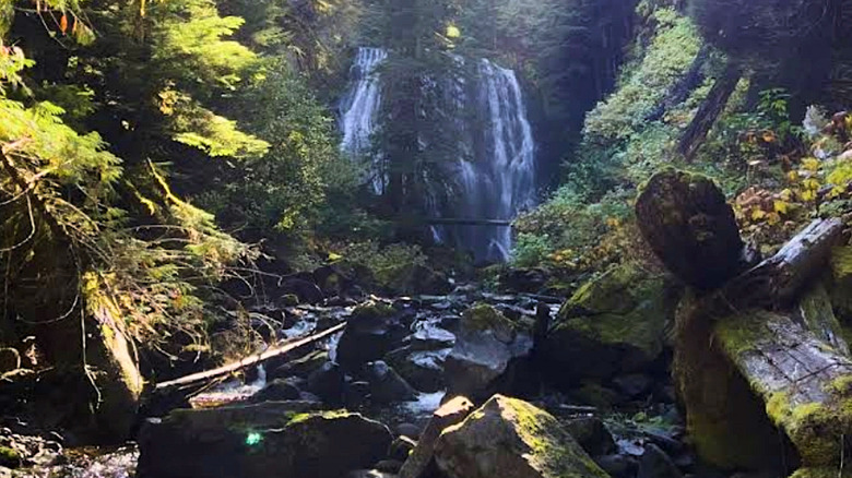
Tillicum Creek cuts through a steep, narrow canyon in the Gifford Pinchot National Forest in Skamania County, Washington. The vegetation is so thick and the terrain so enclosed that few people are aware that a couple of stunning waterfalls, Tillicum Creek Falls and Little Niagara Falls, even exist. Neither has a marked trail, a signpost, or any official route to follow. The nearby Tillicum Trail attracts some hikers, but if you're coming to the area, you should note that this trail is only open from June 15 to November 1, most likely due to winter conditions. Visiting these falls outside of that window will likely be difficult, too.
Little Niagara sits just 800 feet from the nearest road yet feels completely cut off from the world. This highly photogenic cascade tears down the rock face in a full, thundering flow of white water from 74 feet above and spreads across a horseshoe rim 90 feet at its widest. Tillicum Creek Falls sits downstream from its sibling and is a smaller, tighter cascade squeezed into a dark, dripping rock canyon. Technically, it's not even officially called Tillicum Creek Falls, but most people know it as such.
There is a faint boot path leading down into the canyon. Follow it all the way for Tillicum Creek Falls. If you want to see Little Niagara Falls first, you'll need to leave the boot path and make a steep off-trail push through rough canyon terrain, which is not recommended without experience. Otherwise, you can make the walk upstream from Tillicum Creek Falls.
Roaring Fork Falls, Pisgah National Forest, North Carolina
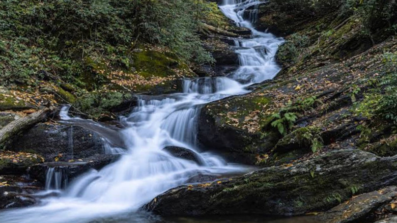
Roaring Fork Falls is a 100-foot cascade deep in Pisgah National Forest. It's one of those American national forests with uniquely beautiful trees, but nobody really talks about the falls. But when you consider what these falls deliver, the lack of chatter about them can be a good thing for solitude-seekers. In fact, you might have the entire scene to yourself. Parking can only be described as small dirt patch with room for a few vehicles at most. And even in the peak leaf-peeper season, you'll only find a couple of cars there.
The falls snake down over layer after layer of rock. It's a long, tiered, and constantly changing waterfall. At each tier, the water fans wide before tumbling on to the next. At the base, large granite boulders hide pools worth lingering in, and the trees close in tight overhead. In the fall, the rock face runs vivid with orange and rust-colored growth, which make for very photogenic scenes against the white water. Space is limited, though. There's just enough for a small group. But this does help maintain its aura of secrecy.
Getting there is relatively straightforward. It's a 1.3-mile walk along a flat, old roadbed. It's easy enough for most people, and it can be a great family afternoon out. The drive there is about an hour and a half from Boone and about an hour from Asheville. The falls are a natural stop between the two, but Catawba Falls make for a good second stop if you don't mind an extra drive. They add to the family day out, but you'll find considerably more people there.
Lower Pine Creek Falls, Zion National Park, Utah
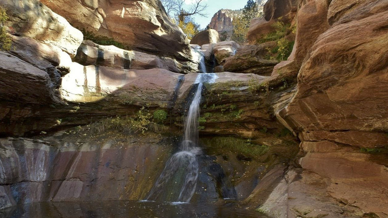
There is no trail on any map to Lower Pine Creek Falls. No sign at the trailhead, either. Just an unmarked pullout in Zion National Park that you could drive past a dozen times. The park simply doesn't advertise this waterfall. The trail to get there might be a round trip of just 0.7 miles, but it is rated as moderate. It's an easy dirt path at first, but the canyon soon takes over. You'll need to hop a few boulders as the trail gets harder to follow. Keep a lookout for the stacked rocks that will keep you on track, and be aware that the canyon sits in a flash-flood zone. Give it a miss if inclement weather is brewing. In winter, ice adds to the difficult navigation, so spring through fall is the better window.
Just before you reach Lower Pine Creek Falls, the creek opens out into a series of pools perfect for a refreshing dip. You'll see the water dropping down ahead. It's a moderate size at 15 feet, but the stunning Zion scenery that you might even have to yourself is what makes this trip so worth it. Lower Pine Creek Falls spill down in two steps over Zion's signature pink and red sandstone into a wide, swirling pool at the bottom. At its base is a small sandy beach, a welcoming spot from where you can admire the surroundings. The canyon walls close in on both sides, narrowing to a strip of sky overhead, with red rock towers rising above. For a place hidden in one of America's most-visited national parks, it really feels remarkably untouched.
North Fork Casa Falls, Carson National Forest, New Mexico
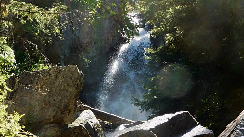
It's said that only six waterfalls appear on any map of New Mexico, and the North Fork Casa Falls isn't one of them. It sits in the Sangre de Cristo Mountains, deep in Carson National Forest, in a canyon that runs at high altitudes. Nothing points you there. No highway sign, no markers. Even the country road signage that once existed disappeared long ago. Therefore, getting there is no easy task. It doesn't even appear on Google Maps. If you're determined, head north on the NM-518 to Cleveland, then turn west to Walker Flats. You'll see the canyon about a mile further on.
The Río de la Casa flows through the canyon, dropping through a series of cascades with dense conifer forest pressing in. Ferns and moss coat the rock faces, and the whole place feels alive, a world apart from the desert landscape outside. The lower two falls are accessible by four-wheel-drive only. At the end of the road, the route turns into an off-trail scramble through steep, trackless terrain. It's demanding and should certainly not be underestimated.
If you'd rather avoid the road and the tough scramble, you can hike Forest Trail 269 from Trailhead 22 above the canyon. The descent is still a steep drop, but it's more manageable than below. The main fall on the fork, a 50-foot cataract, eventually reveals itself, dropping and spreading over the sheer granite. There's more than a mile of falling water through the canyon, tumbling through plunges, slides, and cataracts cut into the solid rock. New Mexico is said to have hundreds more like it — and the best part is that most of them are well-kept secrets, too.
Chimney Top Falls, Red River Gorge, Kentucky
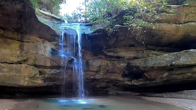
Most people come to Red River Gorge for its impressive natural arches, but most people are unaware of the hidden valley holding three secret waterfalls. You'll find Chimney Top Falls (separated as Upper, Middle, and Lower) along the right fork of Chimney Top Creek, deep in the Daniel Boone National Forest. Here, the sandstone cliffs to rise up to 300 feet. It's another well-kept secret, thanks again to the lack of a marked trail on any official map.
The 3.5-mile round-trip begins at Koomer Ridge Campground. From there, a 1-mile-long trail leads to Hidden Arch, where another path below splits downhill to Lower Falls. It's a 30-foot double drop where the creek divides around an eroded hump of rock, and each channel falls separately into a cove that's ringed by towering cliffs. The other continues through rhododendron tunnels to the Middle and Upper Falls — but this hike isn't for everyone. Venomous snakes, black bears, boggy terrain, and a steep descent that calls for trekking poles are all part of the deal. The unmarked terrain, exposed cliff edges, and the need to wade through a creek at one point also contribute to needing to take extra care on this one.
You'll find Middle Falls at the end of a 50-yard wade beneath one of those rhododendron tunnels. The Upper Falls comes last and hits the hardest. It plunges 30 feet into a pool with a sandy beach set inside a cavernous rock shelter from where you can admire it. The turquoise pool contrasts beautifully against the amber walls, but you might catch it running with gold and terracotta patches glowing through the water. Spring brings the best flow, though it is best to avoid the hike after heavy rain.
Munson Creek Falls, Oregon Coast Range, Oregon
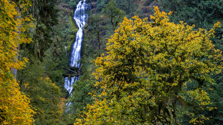
Most people just drive on by on US-101, oblivious to the existence of a hidden waterfall surrounded by lush emerald forest. At 319 feet, Munson Creek Falls dwarfs the Statue of Liberty. It's the tallest waterfall in the Oregon Coast Range, and it sits quietly (or noisily) in old-growth forest just south of Tillamook. It's barely promoted and never crowded — and yet, it's not difficult to visit either. The trail is an easy 0.6-mile round trip that's accessible to all.
It makes an excellent weekend day trip for all the family, and the path that leads to the falls passes through some incredible forest. Sitka spruce and western red cedar tower above; one of the Sitkas even reaches 260 feet, while a fallen cedar forms a natural tunnel about halfway along the trail. Big-leaf maple and red alder trees fill in the understory, with those maples turning out vivid yellows and ambers in fall, while summer brings trillium and violet blooms.
From the Munson Creek Falls official viewpoint, you can only see the middle and upper tiers, but it's still mightily impressive. It drops from high above in a single white ribbon of water that threads its way down through an almost impossible green wall of vegetation. The mist keeps the forest cool and dripping, especially from late fall through spring when the water is at its fullest. Once upon a time, you could see all three tiers drop from the upper trail. Unfortunately, it was closed in 1996 due to a destructive flood and never reopened.
Upper Sols Creek Falls, Nantahala National Forest, North Carolina
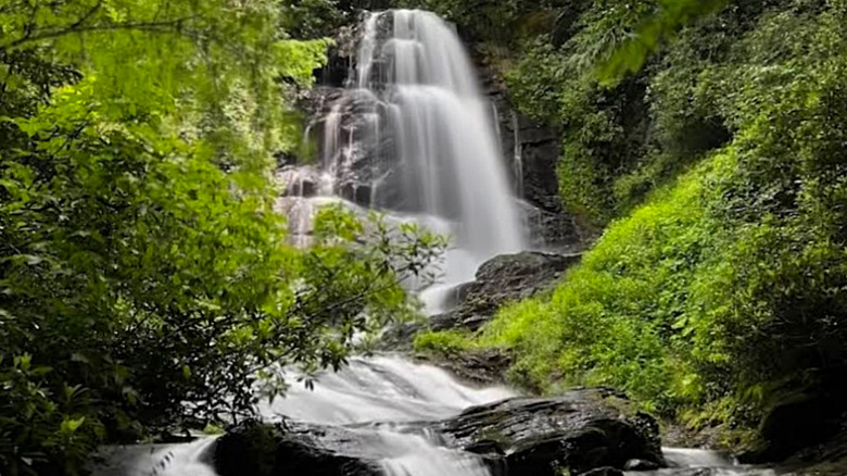
When you head off looking for Upper Sols Creek Falls in the Nantahala National Forest, don't expect any signs or very much in the way of parking. What you can expect is a steep descent into a hidden valley and a 60-foot waterfall, which the rest of North Carolina has forgotten about. The trail is marked by colored ribbons to help you find the way, and the steeper sections have fixed ropes, which can be worn in some places. It can also get overgrown and muddy, so it's best to wear long pants and maybe even cancel the hike if the weather has been wet.
To get there from Cullowhee to the northwest, head south on NC-281 for about 9 miles to the culvert at Sols Creek. Park on the grass shoulder and hop the guardrail to the east side. About halfway along the trail, the creek starts spilling over a series of small cascades. Round the corner, and you'll get your first sight of the Upper Sols Creek Falls.
The rock face is broad and layered, and the water fans across multiple ledges. Forest presses in on all sides, and a natural grotto formed by tall cliffs hides on the west side. When the water runs high, it stretches across the entire rock face. At the base, a secondary 15-foot cascade acts as the viewing area, adding another tier, which pushes the total height to 75 feet. But the best part is, you'll likely have the entire place to yourself on any given day, and you may even consider Upper Sols Creek Falls to be among the world's most ethereal waterfalls.