
9 Tips From Park Rangers For Enjoying Redwood National And State Parks
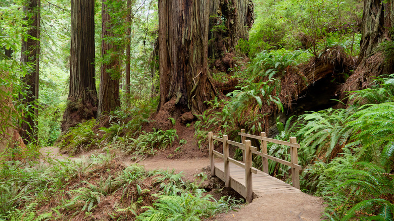
Hugging the Pacific Coast between the bohemian coastal college town of Arcata and Crescent City, Redwood National and State Parks (RNSP) cut a unique profile in Northern California. The distinctive setup consists of Redwood National Park, operated in partnership with three state parks — Prairie Creek Redwoods, Del Norte Coast Redwoods, and Jedediah Smith Redwoods — that were established decades before the national park. If you've ever driven along U.S. Highway 101 through this region, you'll have passed right through the southern heart of the parks, but if you didn't explore further, you'll have only seen a hint of what they offer.
Overall, Redwood National and State Parks cover shy of 132,000 acres, just a little more than half of which is federal and the rest state-managed. All but 4% of California's old-growth coast redwoods have been logged over the past couple of centuries, and the parks preserve 45% of what remains. That means nearly 39,000 acres of trees, many of which are several hundred years old. Whether you visit for a day or camp overnight, there are diverse landscapes, trails, and ecosystems to explore. Rangers also have some of the best tips for how to experience the park fully and what to watch for.
Below, discover 10 tips from RNSP rangers to help you safely enjoy the park, plus factors that depend on the time of year you visit. We consulted ranger tips and videos published on NPS.gov, plus interviews from news sources, blogs, and podcasts. We also mostly relied on NPS.gov for practical information about the parks and how to visit, with the addition of park foundation, conservancy, and interagency resources.
If you're looking for the drive-thru tree, you won't find it
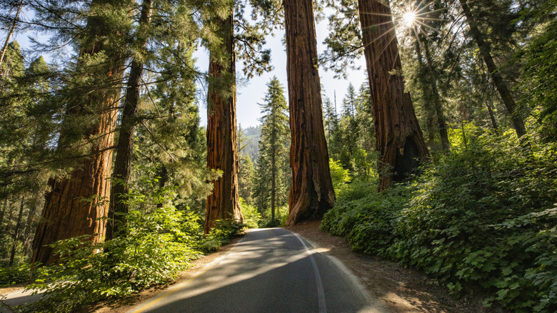
Northern California's redwoods region is rich in tourist attractions, from the odd and charming World Famous Tree House in Piercy to Trees of Mystery in Klamath, where visitors can walk along an elevated trail through the canopy. Redwood National and State Parks focus more on the natural side than on kitschy tourist attractions, so you won't find suspension bridges or gift shops carved out of tree trunks here. Although Northern California is home to trees so big that cars can drive right through living redwoods, you won't find one in RNSP. You might also be thinking of a different park. "If you recall a historic black-and-white image of a car driving through a tree, that was likely the Wawona Tree, a giant sequoia in Yosemite National Park, which fell in 1969," NPS says.
There's also much more to see than redwoods at Redwood National and State Parks. Ranger Susanna Ausema tells Finlay Holiday Productions, "There are some trails where you can hike through an old-growth redwood forest and you really feel the history of what these 2,000-year-old trees represent. But then, as you hike along, you can hike down to the ocean." There are also oak woodlands and grasslands. These complementary ecosystems create a diverse experience that can lead to wildlife sightings and shed light on the complex history of how humans have lived and worked in the region over the centuries. Do yourself a favor and take advantage of everything the parks have to offer.
Permits and fees vary depending on which areas you visit
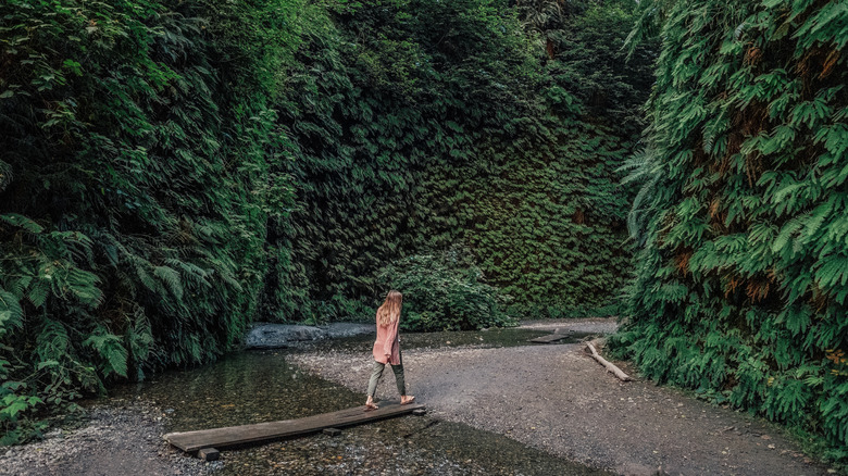
Every national park has its popular "must-see" spots, like Zion's crowded and deadly Angels Landing and Grand Prismatic Spring in Yellowstone National Park. In part, this is because of how much more we know about these parks thanks to social media influencers and bloggers, but that also can lead to overcrowding, damage, riskier situations, and sometimes, less fun. Overcrowding is one reason RNSP has implemented a permit program for some places, such as Fern Canyon with its fern-covered walls. Between May 15 and September 15, visitors driving to the Gold Bluffs Beach Day-use Area, including the Fern Canyon Trailhead, need a free permit.
Take a hike instead of a drive for a different type of adventure: "You can hike the 11-mile round trip hike to Fern Canyon from the Prairie Creek Visitor Center without a permit all year!" says a ranger tip. Additional areas also require reservations in advance to help monitor the impact of visitation on ecologically sensitive sites. If you hike to Tall Trees Grove, you'll need a free permit, which can be reserved up to 24 hours in advance. If you plan to camp in designated backcountry sites, apply for a permit — also free — at least 48 hours before you arrive.
Planning to hang out at Gold Bluffs Beach in Prairie Creek Redwoods State Park? There's a day-use fee, which is $12 as of this writing. It's waived if you have an America the Beautiful pass or you're camping at Gold Bluffs Beach or Elk Prairie campground. Vehicle day-use fees for Del Norte Coast Redwoods and Jedediah Smith Redwoods state parks are also $8 each, but they are similarly waived if you have an America the Beautiful pass.
Hyperion is off-limits
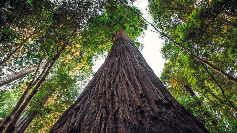
Named after one of Saturn's moons, the tallest tree in Redwood National and State Parks is named Hyperion. But as tempting as it might be to try to find it, the tree is off-limits to visitors for its protection. According to SFGate, the park implemented the rule because too many visitors damaged the area, partly because there is no formal trail and people trampled vegetation along the way. Now, it's illegal to visit the area, and visitors face up to a $5,000 fine and six months in jail if found in violation.
"It is in a particularly challenging area to get to," ranger Patrick Taylor shares on the Safe Travels Podcast. He adds, "Do we build a new trail every time there's a new tallest tree regardless of what that means we destroy to get there? The decision was made a while ago that, no we won't." He adds that it's not even a very photogenic tree, even if you do get there. The park instead emphasizes exploring nearby areas and appreciating the many other impressive tall trees that exist along established routes.
There are more than 200 miles of trails to explore in RNSP, and rather than viewing the parks as a checklist of the "best trails" where you can see the biggest or most impressive trees, think of them as an entire experience. RNSP visual information specialist Greg Litten suggests on Find Your Park that Trillium Falls Trail is a good place to start. "It's got big old-growth redwood trees, a small waterfall, gentle climbs, and the chance of seeing some large wildlife like elk or bears. It's an hour of walking joy."
The park is laid out in an unusual way, so go with a plan
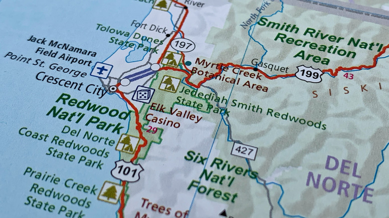
As we've mentioned, Redwood National and State Parks is, well, all in the name — which can cause a little bit of head-scratching for first-time visitors. "Feel a little bit confused about how to navigate the park? Don't worry, you're not alone," ranger Steve says in a Facebook reel. "Our park is long and skinny. The park lies along the 101. You'll also notice that we're a partnership; we have three state parks inside the national park." He suggests that the best course of action is to stop at a visitor center first. You'll be able to find maps and ask rangers for advice or directions, and they can tell you whether any alerts or closures might affect your visit. Five visitor centers are open throughout summer — most are also open at least a few days per week during winter — so it's easy to get oriented.
When it comes to campgrounds, as with most popular national parks, sites fill up quickly. "Sorry, but finding a place to sleep in the park at the last minute won't likely happen," the park says. There are four developed campgrounds in the state parks — Prairie Creek has two and the others have one apiece — and reservations are strongly recommended for all. Remember that backcountry camping is also an option, but the park reminds visitors that a permit is required and you must "be 100% ready to hike out and camp in the woods."
Not all smoke is a wildfire
Wildfires are a common occurrence in dry climates, including those at higher elevations. We often hear about the increasing threat of megafires, which are being documented more frequently as the global climate warms. It's good to be cautious and aware of where fires are actively burning if you're planning to visit during summer. Keeping an eye on the news is a good start, but you can also check live maps from the National Interagency Fire Center — even Google Maps has a wildfire layer that shows the latest data visually. That said, not all smoke means wildfire, and Northern California is also carefully managed by fire ecologists and technicians through prescribed burn programs. Typically, the parks will put signs or warnings out ahead of time so visitors know they're entering an area where a prescribed burn is taking place, partly so they don't panic and report a wildfire when there isn't one.
RNSP fire ecologist Emma McClure works on prairie and woodland restoration projects, meaning the parks proactively burn areas to restore native ecology while also reducing overgrowth and invasive species. In a park video about a prescribed burn at Coyote Creek, she says, "We tend to burn every five years, if we can, in these kinds of systems, in the grasslands and the oak woodlands." The prairies are found up in the hills, especially along the Bald Hills Road, a dirt route that ascends steeply, so it's a likely place to see smoke or encounter a road closure during operations.
Be ocean-smart and watch out for rogue waves
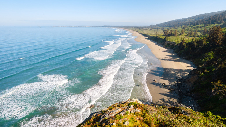
Although it may be named for its remarkable trees, Redwood National and State Parks also boast 37 miles of Pacific coastline. There are a few things to keep in mind about these rugged, wild stretches of beach. One phenomenon to be aware of, ranger Steve says in a Facebook reel, is sneaker waves, also known as rogue waves, which occur when waves traveling at different frequencies or from different directions meet and form one extra-large wave. "If one of those sneaker waves makes it to shore, some of them can actually travel up the beach over 100 feet," he says. If the sea looks like it suddenly goes out much farther than normal, get off the beach — it means a big wave is on its way in.
You can't outrun a rogue wave, and you will want to be extra aware of what the water is doing if you're walking below the wave slope. This is where the ocean has created a tall wall of sand through repeated motion and erosion, and it can be high and difficult to climb. "If a sneaker wave pins you against that slope, it can then pull you out to sea," Steve adds. Northern California beaches can be treacherous, with driftwood and debris, so watch your step. Also, the water is cold. "Our waters can induce hypothermia in less than 20 minutes, but cold water shock can cause cardiac arrest and drowning within just two minutes," Steve says. "When you go the ocean, observe it before you get too close to the water."
Winter weather can be surprisingly dangerous but also beautiful
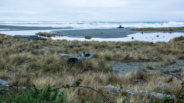
Winter weather in Northern California can be moody and atmospheric, which makes for a distinct experience. But the season can also bring strong winds, heavy rain, and occasional frost. In January, the average high is around 54 degrees Fahrenheit, and the low averages around 40 degrees, but dampness and wind can make it feel colder. "We get winter weather, but it may not be the weather you expect," says a ranger in a Facebook reel. Variable conditions can mean treacherous beaches and falling limbs in the forest, sometimes referred to in forestry circles as "widowmakers." The ranger adds, "With those wintry conditions, such as frost warnings, strong winds, or even a lot of rain, these woods become very dangerous, and the trees, they fall over — a lot." Roads will sometimes close when the weather becomes dangerous or when limbs or debris make them unsafe.
It's also worth touching on sneaker waves one more time, because although they're not limited to winter, some of the biggest often occur during that time. "You'll also want to be aware of our king tides," ranger Steve says. "These are our highest tides of the year, usually occurring in winter. When a sneaker wave meets one of our king tides, that produces much larger waves." Stick to high ground or, at the very least, keep a close eye on the water and the weather.
Get off Highway 101, but don't rely on GPS
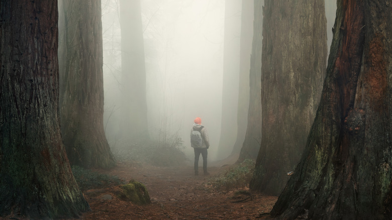
Stretching along U.S. Highway 101, often referred to simply as "the 101," Redwood National and State Parks is a must-see along an expansive coastal road trip route. But to see what the parks are known for, you'll want to get off the main drag. There aren't any entrance stations — entry is free to the national park — but scenic drives and hiking trails are well worth detouring for.
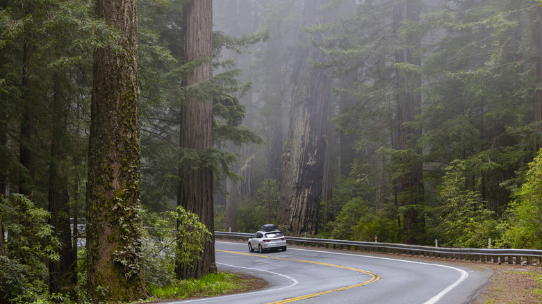
The 10-mile Newton B. Drury Scenic Parkway is a good place to start, especially if you're looking for old-growth redwoods and a straightforward detour that links back up to U.S. 101. Howland Hill Road is another option in the northern region, stretching 10 miles through old-growth forest in Jedediah Smith Redwoods State Park from Crescent City to U.S. 199. The parks also publish recommended hikes based on how much time you have. If you have about an hour, head to Lady Bird Johnson Grove. With a couple of hours, take the Stout Memorial Grove Trail, which includes a crossing over the beautiful Smith River.
If you're heading farther into the parks, don't rely on GPS alone. "Don't use 'Bald Hills Road', or 'Tall Trees Grove' as destinations when you are driving to Redwood National and State Parks," says a ranger tip. These areas are either long or expansive, and the directions GPS provides may lead you to restricted areas or unpaved roads your vehicle may not be equipped to handle. The parks advise using a printed or offline map, which you can pick up at a visitor center or download from the NPS app.
Avoid certain areas with the big rig
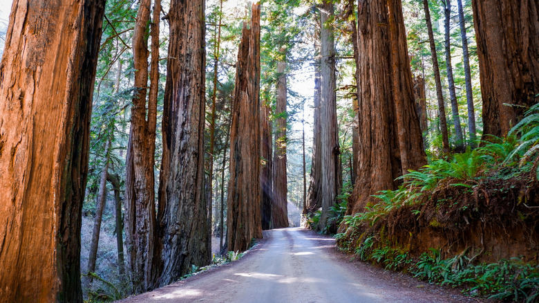
Redwood National and State Parks are full of scenic drives, but the accessibility of those routes varies substantially. To start, Newton B. Drury Scenic Parkway is an unforgettable drive through California's redwoods that's easy to traverse in just about any size vehicle, but beyond that, it depends. Howland Hill Road, for example, is narrow and unpaved, so bigger rigs won't fit. Enderts Beach Road is paved, but larger vehicles are not recommended past the picnic area at Crescent Beach. That's also the case with Requa Road, which leads to a Klamath River overlook and where larger RVs and trailers are advised to avoid. On Cal-Barrel Road, motorhomes, RVs, and trailers are prohibited.
While there are several places where larger vehicles aren't permitted, they're certainly not off-limits altogether. Trailers and larger rigs are not permitted at Gold Bluffs Beach Campground, but they're welcome at the other three developed campgrounds. Do your research on the parks' website before plotting a route if you have a motorhome or trailer in tow. "There is good RV parking at the Yurok Loop Trail, along the Newton B. Drury Scenic Parkway, at the Big Tree Wayside, and at the Trillium Falls Trail," says a ranger tip.