15 Active Volcanoes To Visit In America For An Unforgettable Experience
We may receive a commission on purchases made from links.
The planet that we call home is filled with eye-opening, jaw-dropping sights. Among the most inspiring natural phenomena are volcanoes, those mammoths of geological and thermal activity. Volcanoes are exciting to see because they are physical representations of all that cooking and pressure happening under the surface, a reminder that the Earth is a living, breathing, evolving organism. Gazing at a volcano, especially one like Europe's tallest active volcano, is both unnerving and riveting.
When you talk about mountains of fire, historic volcanoes like Italy's Mount Vesuvius might first come to mind, but there are dozens of active volcanoes in the United States that you probably never knew about. Indeed, travelers will find a huge number of active volcanoes in the U.S., more than 160 according to the United States Geological Survey (USGS). While many of them have a low risk of erupting, 18 are identified as being a very high threat. A couple can even be visited as part of an excursion with Viator. We've gone through USGS data and pulled out the active volcanoes that are easy to see in person, an experience you are likely to never forget.
Crater Lake, Oregon
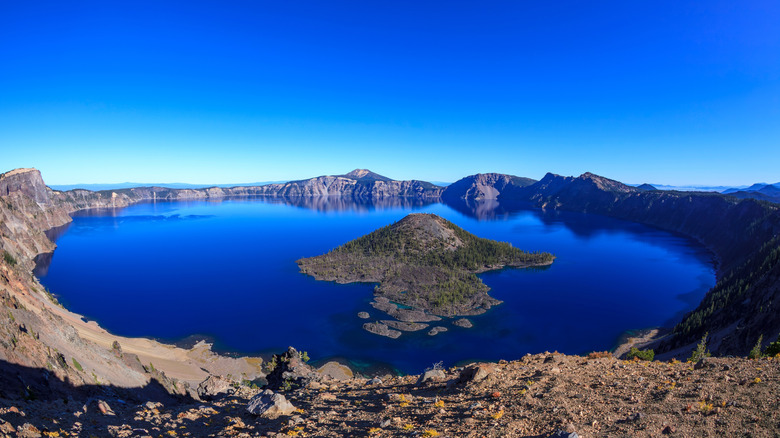
This lake sits within Crater Lake National Park, a destination that promises one of the most breathtaking scenic drives in a national park. The lake formed about 8,000 years ago, and was created by the eruption of Mount Mazama. Through the sheer force of the explosion, and the magma produced, the top of the volcano imploded and eventually a caldera formed. That caldera, filled with water from rain and melted snow, became Crater Lake, a huge body of water that is five miles across, and more than one mile deep.
The USGS believes that an eruption is likely to happen again in the future in this is a place of immense beauty, where the deepest lake in the country has hypnotic blue water. Thanks to its location within a national park, the lake is easy to access. Visitors taking the 33-mile Rim Drive, which is only open seasonally, can stop at any one of the 30 viewpoints. They can also learn about the history of the lake and its formation at information boards displayed at some of the overlooks.
Glacier Peak, Washington
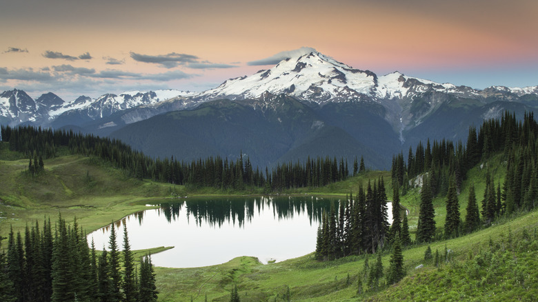
Glacier Peak is an extremely volatile volcano in Washington state, with large-scale eruptions taking place in the last 15 millennia. For many years, residents near Glacier Peak assumed that it was just an ordinary mountain. It was only when Native Americans described it as emitting smoke in the past that the reality sank in.
Of the active volcanoes in the state, this one is the most hard to get to. It sits quite some distance northeast of Seattle, in an area barely served by roads, so seeing it in person requires some effort. But if you have some hiking experience and camping know-how, you can plan a visit to the volcano, which gets its name from the large number of glaciers that blanket its slopes. What you'll see if you commit to making the excursion is cool, ice-blue glaciers even in the middle of summer, and sharp mountain ridges that stretch until the horizon.
Kilauea, Hawaii
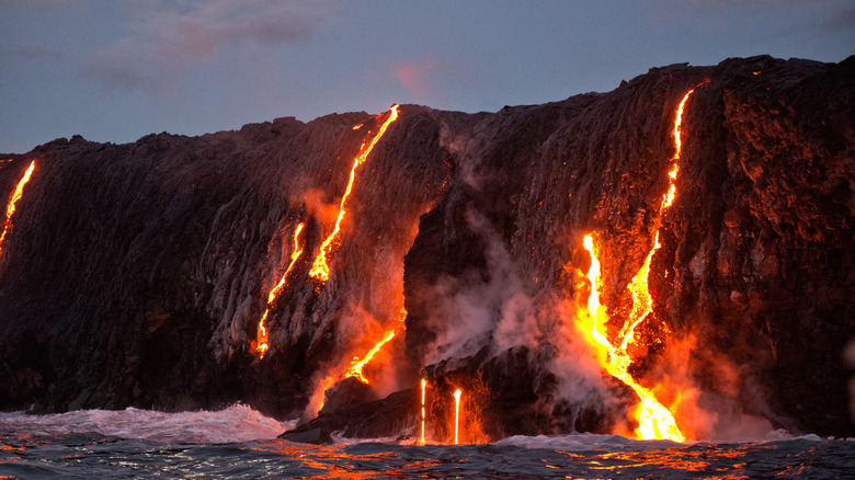
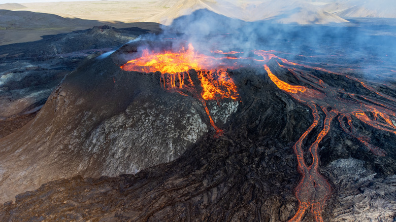
Looking for an active volcano that's letting off some steam? Then this volcano on the Big Island is just the place. Kilauea is extremely busy erupting, with recent activity in September 2024 producing lava flows that covered hundreds of acres of its slopes. In fact, the peak has erupted many times in the last century, with plenty of steam and a lava pond visible in the period from 2008-2018.
Kilauea almost appears as an extension of the mammoth Mauna Loa, but it is a separate volcanic structure with a discrete network that creates magma, a system that is more than 30 miles deep. The volcano plays a role in Hawaiian legend with the caldera of Kilauea believed to be where the force that gave life resides. Travelers can even see the crater of this huge volcano on a Viator helicopter tour that takes in Hawaii Volcanoes National Park. The full-day excursion also includes a visit to a macadamia-nut factory, and a black-sand beach.
Lassen Volcanic National Park, California
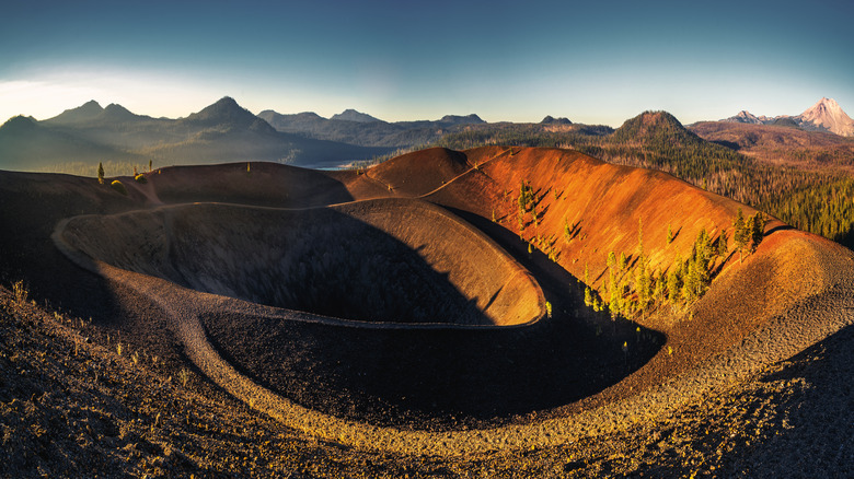
Visitors will notice plenty of thermal activity at this peak that is located in a national park. This active area is located in the north of California, about a three-hour drive from Sacramento. It's also an attractive place, where visitors will see fields of wildflowers blooming in the spring, and cool, placid alpine lakes. There are also a number of volcanoes within the park, and for visitors, the sight of steam billowing out from fumaroles is a regular occurrence.
For geologists, Lassen is an important totem in the evolution of the USGS. It was where, about 100 years ago, the organization installed its first observatory to track developments in volcanic activity. Travelers can get a good handle on the terrain in the park along the 150 miles of hiking trails there, routes that take in the meadows, mountain tops, and frisky thermal areas. Hiking is best done from May through October, a time when the trails are generally clear of snow. During the colder months, this park can get more than 30 feet of snow dumped on its slopes, valleys, and plains
Long Valley Caldera, California
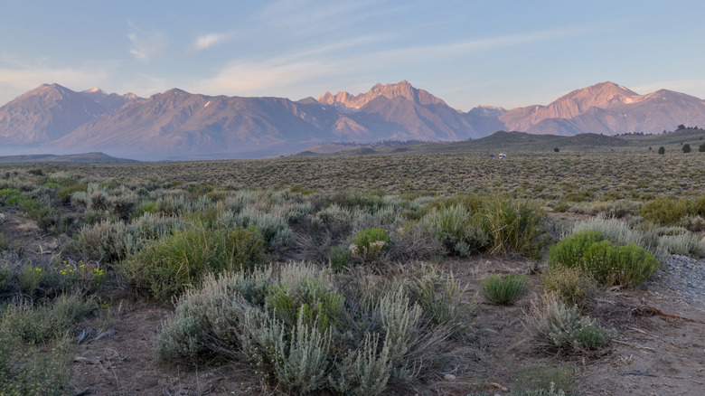
Expect to see some cool rocks on the hikes around this large caldera in Central California, just east of Yosemite National Park, which is known for its dangerous hikes. Long Valley is dangerous in another way. More than 700,000 years ago, a mammoth eruption of magma exploded from underground, forming a caldera that measures 10 miles in width, and 20 miles in length. Long Valley sits within that vast expanse. At Long Valley, ash from the eruption fell and cooled to create Bishop Tuff, a sizable area of rock whose facade looks almost like it's been textured by a giant paintbrush.
Eruptions in the last millennia are responsible for the creation of domes, and there are craters and lakes in the caldera also. Seismic activity continues in more recent times, with a number of powerful shocks in the caldera in 1980, and scientists have uncovered evidence that the core of the caldera is actually on the rise. Spend time at Long Valley Caldera, and you might see the hexagon-shaped lava columns of Devils Postpile, the multi-colored rocks of Glass Creek Dome, and haunting limestone towers in Mono Lake
Mauna Loa, Hawaii
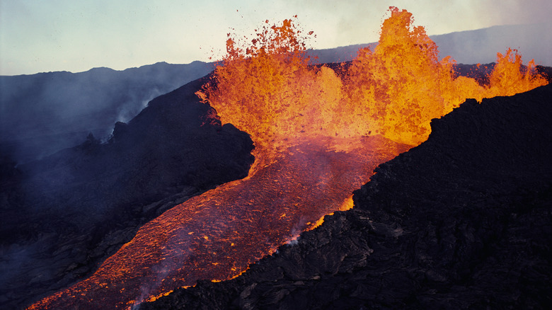
The largest active volcano in the world is part of Hawaii National Volcanoes Park, which can be visited on a Viator excursion that explores endless lava fields, the Big Island's seismic hot-spots, and one of the state's most beloved waterfalls. The name Mauna Loa translates to the English "long mountain," and once you lock eyes on its huge form, you'll see why. The shield volcano, a type of geological structure characterized by low, gradually descending slopes that give the peak the shape of a broad pyramid, spreads out far and wide.
The volcano comprises more than half of the land of the Big Island, and it rises from than 13,500 feet above sea level. There is even more of that volcano under the water, and if measured from the sea floor, Mauna Loa is actually taller than Mount Everest. Most of the dried lava that covers Mauna Loa, which is part of Hawaii National Volcanoes Park, is from flows in the past four millennia. Most recently, it erupted continuously for almost two weeks in 2022, with molten lava dancing and bubbling out of a fissure like it was a choreographed fountain.
Mount Baker, Washington
If you want to take a beautiful drive in Washington state, consider taking the road up to see this towering volcano. Also known as State Route 542, Mount Baker Highway links the town of Bellingham to fine overlooks onto the volcano. It first debuted in the 19th century, built by the loggers as a way to ensure access to the forested riches in this section of the country. Trees are still part of the experience on the route up, with maples and evergreens flanking the roadway, and glimpses of the Nooksack River appearing alongside.
The end of the road, at least in the warmer summer months, is a parking area near Artist Point, where views of the volcano are Instagram worthy. In the winter, the drive ends a few miles early, terminating at Mount Baker Ski Area, one of the earliest places in the country to go snowboarding. While the volcano, which tops out at 10,781 feet above sea level, hasn't erupted for almost 200 years, a new eruption could produce rivers of lava and sections of collapse in a region that getting increasingly populated by locals drawn by the area's stunning natural beauty.
Mount Hood, Oregon
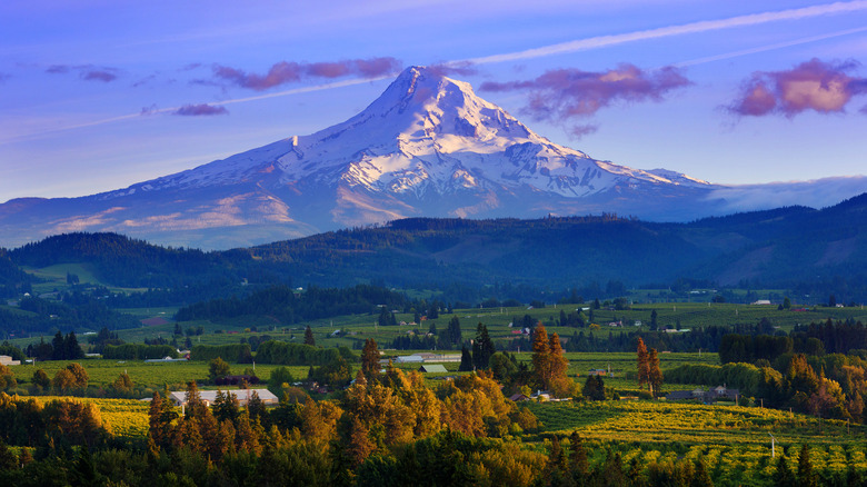
The highest peak in the state is a little over an hour by car from Portland. It's a huge draw for tourists looking to escape from urban life, or ski its slopes, and it also plays a key role in local water management. The volcano rises to 11,240 feet above sea level, and for thousands of years, eruptions were a regular part of its life cycle. In the past two millennia, Mount Hood has only experienced two substantial eruptions, which both altered the form and shape of the volcano to add domes on certain slopes.
Visiting Mount Hood at any time of the year is an appealing prospect. Travelers will find ski areas blanketed in fresh powder throughout the ski season, as well as biking trails designed for beginners and skilled riders. Lakes in the area open their waters to kayakers, and hiking trails ensure that active types can enjoy views of the snow-capped mountains, and wildflowers in the warmer months.
Mount Rainier, Washington
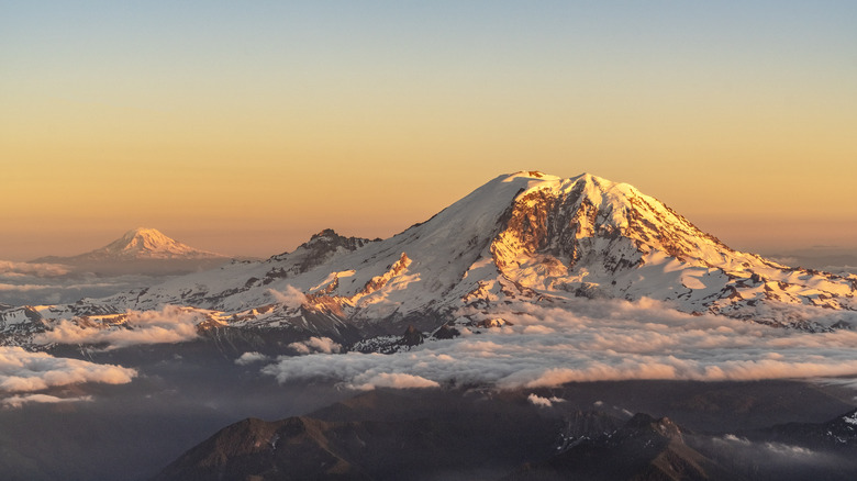
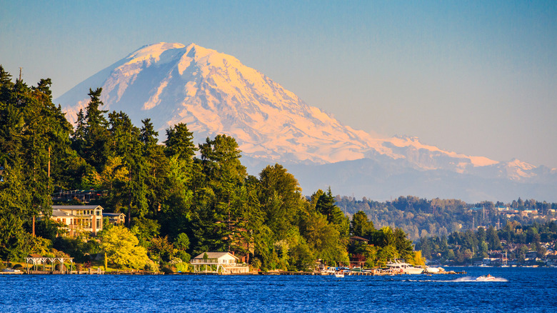
A peak that is an emblem of this western state that's also home to one of the largest rainforests in the U.S., Mount Rainier rises to 14,410 feet, and is known as much for its finely rugged form as its vast number of glaciers. The volcano in Mount Rainier National Park has 25 large glaciers around its terrain, and is a land of packed ice and deep snow. It is, in fact, the mountain in the Lower 48 with the most glaciers, and the source for five rivers. While it hasn't erupted in any major way for the past five centuries, it has the potential to produce an explosion due to a number of factors.
Rainier is extremely tall, the highest peak in the state, and sits in a region prone to earthquakes. If there was a serious eruption, the lava flows would melt glaciers around the volcano and cause devastating landslides and rivers of mud and debris. But all is not doom and gloom, and Rainier is home to flowering meadows and old forests on lower elevations. You can get great views of this volcano on the Sunrise Road, a beautifully scenic road trip. Cross-country skiers will also relish the route along Paradise Valley Road, where the trails look out onto pretty, open, mountainous terrain.
Mount Saint Helens, Washington
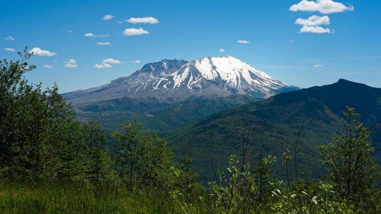
People of a certain age might remember the shock and panic felt around the country when this volcano erupted in May 1980. Though the eruption lasted for less than half a day, the effects were profound. More than 500 million tons of ash entered the atmosphere, and some of it floated as far east as the center of the country. The eruption even reduced the height of the volcano, as part of its cone was destroyed by the sheer force of the explosion.
Looking back at the history of Mount Saint Helens, it should come as little surprise that it erupted in the recent past. From 40,000 years ago, the volcano had a tendency to erupt one and off for millennia, and even the local Native American groups referred to it as "one from whom smoke comes." Leisure travelers can explore the volatile peak with a hike to the crater rim, and see where the lava, all those decades ago, spewed forth. They can also wander along lava tubes that formed under the surface, or take to alpine lakes on a kayak. In the winter, cross-country skiing and snowmobiling draw sports enthusiasts.
Mount Shasta, California
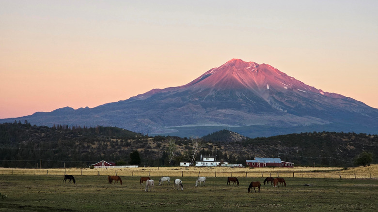
A steep mountain that climbs to 14,163 feet, Mount Shasta sits in Northern California, and looms large over the nearby communities of McCloud, Mount Shasta city, and Weed. Shasta can trace its origins back more than 300,000 years, and its most recent eruption occurred 3,200 years ago. More recently, slippages of ash and lava rock caused by rain and glacial melt have resulted in mudslides of varying power. According to patterns of seismic activity, it's believed that Shasta erupts every 700 years or so.
The top of the volcano is often covered in snow and ice, making it a pretty sight to see from a distance. Native Americans lived around the volcano for millennia before trappers descended in the 1800s, followed by gold miners, and the timber industry. These days, active types are drawn to the possibilities around this volcano, where lodging can range from simple camping in the wilds, to plush resorts that make the most of the natural setting.
Mount Spurr, Alaska
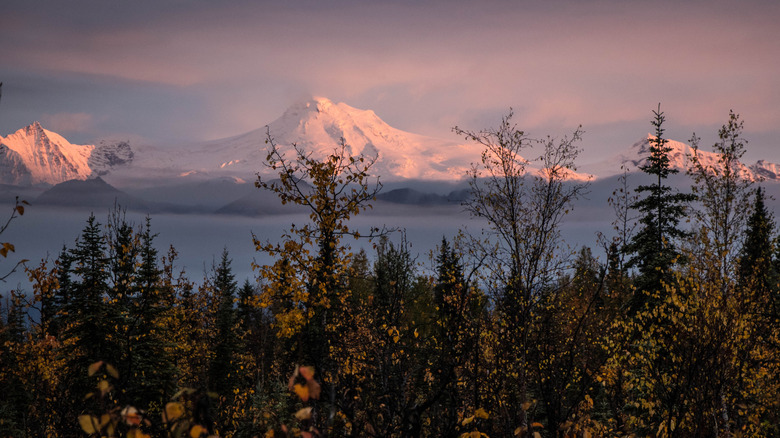
Direct access to this craggy volcano isn't easy, which might not be surprising in a state that is best seen on a cruise. But it can be spotted from many places around it. Even from Anchorage, which is 80 miles east of Spurr, the band of white ice and snow that is the volcano can be spotted in the far distance. Elderberry Park, in Alaska's most populous city, is a good spot to see it on a clear, cloudless day. For an even better vista, try the Glen Alps Overlook in Chugach State Park, or stops along the Seward Highway.
Mount Spurr tops out at 11,070 feet above sea level, and last erupted in 1992. It might not have made global headlines, but it did dump ash all over Anchorage, and disrupted life in the city for a number of days. Since then, the volcano has repeatedly rumbled, and even as recently as early November 2024, small earthquakes bubble under the surface of the volcano.
Newberry National Volcanic Monument, Oregon
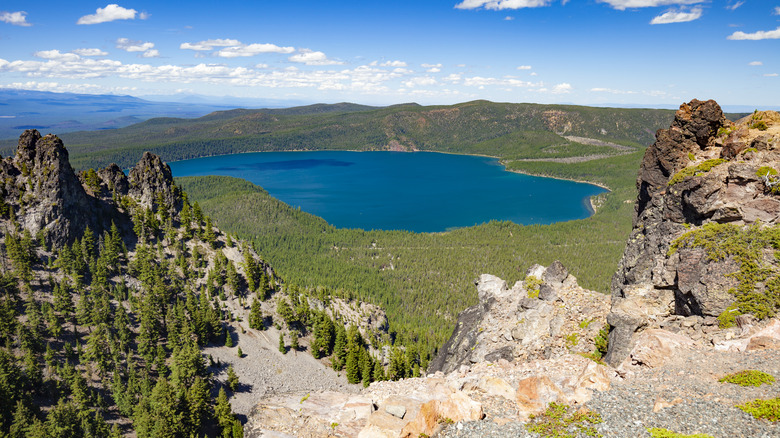
This destination is a relative newcomer to wild American spaces, debuting in 1990 within the Deschutes National Forest. It spreads across more than 50,000 acres, and features lava flows, fascinating rock formations, and lakes, with a high point of Paulina Peak, almost 8,000 feet above sea level. Sometimes known at Newberry Crater, the main caldera of the volcano is a huge structure, 17 square miles in total, created by a collapsed dome.
The volcano itself is substantially larger, about 1,200 square miles (making it as large as Rhode Island), and is very active since it's believed by scientists that the magma is only a few miles below the surface of the caldera. Travelers can come to the park and witness the release of pressure from this behemoth through the vents around the national monument, see cinder cones covered in trees, and find lava tubes forming a cave network.
Redoubt Volcano, Alaska
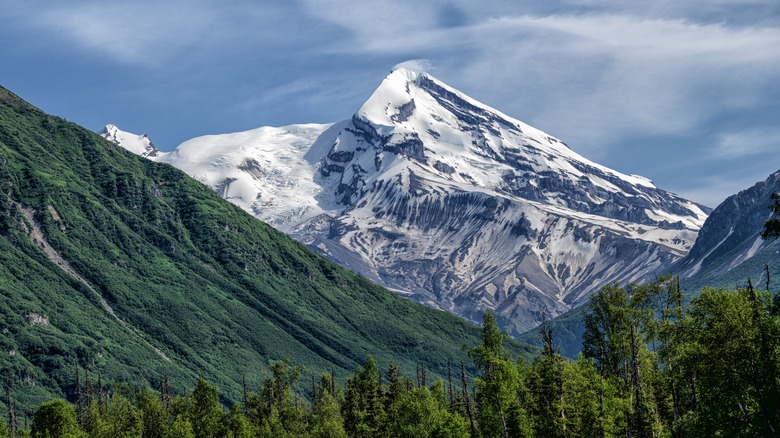
Sitting at the Chigmit Mountains in Lake Clark National Park & Preserve, Redoubt soars 10,000 feet up. Since it resides close to Cook Inlet, it can appear to almost rise up from the seawater, a view that only adds to the sense of majesty. Eruptions at the volcano are regular, with many in the 1900s, and one in 2009. One eruption, in 1989, produced an ash cloud that visibly affected flights — one plane that had flown in from Amsterdam suffered from engine failure when it flew through the ash cloud, but it was able to safely land in Anchorage.
Spanning a few miles across, Redoubt's slopes ascend sharply, and the volcano has a one mile-wide crater near the top permanently filled with ice. Access to the volcano isn't easy, and for travelers that want to get a close look as it will need to be flush with cash. The simplest way to set eyes on this grand wonder is part of a flight tour, though travelers might need to charter the whole aircraft, if flying with an outfitter like Smokey Bay Air.
Three Sisters, Oregon
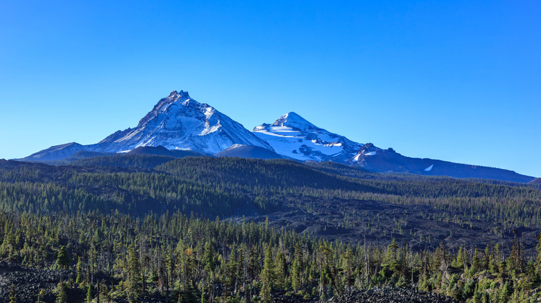
A little northwest of Mount Bachelor, and close to the town of Bend, the trio of volcanoes are the main attraction, but there is much else to admire. Known as South, Middle, and North Sister, the peaks each top 10,000 feet, and often have summits covered in snow. They are within the Cascade Range and are visible from many points around Central Oregon.
In the heart of Bend, Pilot Butte offers clear vistas of the soaring siblings, while Three Sisters Viewpoint, set on Highway 20 that links Bend to the quiet, artsy town of Sisters, is another fine option. There are in fact about 460 volcanoes in the Three Sisters region, ensuring there is plenty to see for visitors. To get an even closer look to the mountains, summers are a good time for some exploration. Mountain biking trails wind near the peaks, while hiking in the Three Sisters Wilderness area, the region around the volcanoes, promises adventurers more than 250 miles of trails.
Methodology
To put together this list of active volcanoes to visit in the U.S., we consulted with the experts in the field, the USGS. Using research data it published, we focused primarily on the 18 volcanoes that it perceived as being the most active. These were listed in its "2018 Update to the U.S. Geological Survey National Volcanic Threat Assessment" as having a very high threat of volcanic activity in the future. We discounted ones that were at sea or excessively remote, and so nigh impossible to access, and focused on the rest. We also added in a trip on Viator that would bring travelers close to a couple of them.
