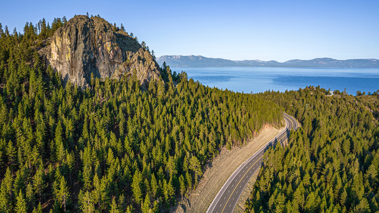
15 Of The Most Dangerous Roads In California, According To Statistics
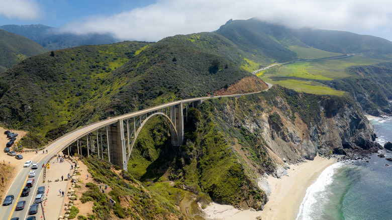
California's highways are legendary. From US-101, which plots some of the most breathtaking road trips along the West Coast, to underrated freeways dotted with hot springs, and even a monumental route that links every single national park in the state, the Golden State's road network is as iconic as it is essential. But beneath the sunshine and scenery lies a darker truth: some of these roads are among the deadliest in America. Using the latest crash records from the National Highway Traffic Safety Administration's Fatality Analysis Reporting System (FARS), this ranking reveals where fatal crashes are most concentrated — measured by fatalities per mile.
The results might surprise you, in that short urban spurs turn out to be far riskier mile for mile than longer cross-state giants. Each entry here pairs the data with context — where the road runs, what it connects, and the conditions that make it perilous. Some stretch through mountain passes where the weather turns treacherous, while others are daily battlegrounds of congestion, distraction, and aggressive driving. Together, they map a sobering picture of California's driving landscape, where beauty, density, and danger share the same lanes.
Interstate 805
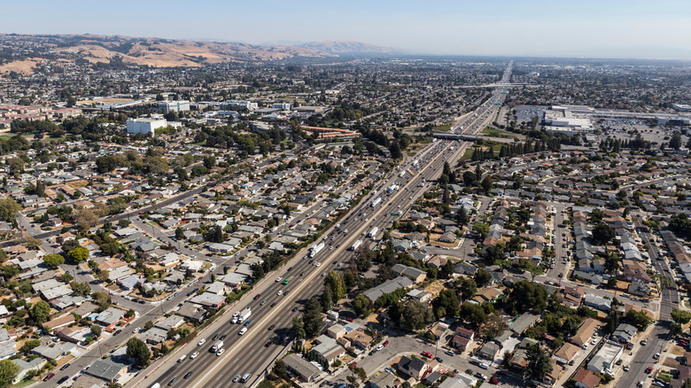
Interstate 805 may be just 29 miles long, but it claims the top spot as California's most dangerous road. According to FARS data, in 2023, a total of 13 people died here, translating to about 0.45 fatalities per mile, the highest density in the state. Approved as an interstate in 1958 and completed in 1975, I-805 was built as a north–south alternative to I-5, giving drivers a way to bypass downtown congestion. Beginning near the Mexican border in San Ysidro, it pushes through Chula Vista and National City, then cuts into central San Diego before reconnecting with I-5 in the Sorrento Valley. Along the way, it funnels traffic directly into major job hubs like Kearny Mesa and University City.
The result is a freeway that never rests. FARS data shows that nearly all of I-805's fatal crashes occur in dense urban segments, and the majority involve multiple vehicles, a hallmark of congested freeways. Unlike rural highways where fatigue and single-vehicle run-offs dominate, the 805's profile is distinctly urban. The freeway is short, yes, but it threads directly through San Diego's residential and commercial districts, and in this compressed environment, the risks are magnified mile for mile, helping to explain why I-805 is one of the most dangerous roads.
State Route 91
At just under 58 miles long, State Route 91 is one of Southern California's busiest freeways, cutting east–west through Los Angeles, Orange, and Riverside counties. According to FARS data, the route saw 23 fatalities in 2023, which works out to about 0.39 deaths per mile — the second-highest risk rate of any major California road. As for the reason behind these high numbers, the crash patterns reveal a split personality.
In the urbanized areas of Los Angeles and Orange counties, most recorded fatalities involved multiple vehicles, reflecting the congestion of a freeway that links with other busy routes, including the I-5, I-605, SR-57, and SR-55. Further east in Riverside County, however, where the road narrows through the Santa Ana Canyon, alcohol and nighttime crashes become more prominent, as lighter traffic allows speeds to climb. Together, these dynamics show how SR-91 combines the worst of both worlds: Pile-ups in the west and high-speed run-offs in the east, making it one of the most unforgiving freeways in California, mile for mile.
Interstate 605
Nicknamed the San Gabriel River Freeway, I-605 might only stretch 28 miles through Los Angeles County, but it punches far above its weight in danger. In 2023, nine people were killed in crashes here, giving it a rate of 0.32 fatalities per mile, according to FARS data. The 605 runs north–south, skirting the eastern edge of LA's suburbs from Seal Beach up toward Duarte, and the latest FARS records show that fatalities on I-605 cluster around its busiest interchanges, where traffic from other major freeways like I-5, I-10, and I-210 merges into already heavy flows.
The vast majority of these crashes are multi-vehicle collisions, consistent with an urban corridor defined by congestion. The 605's risks come from its commuter grind: Crowded lanes, short ramps, and constant pressure to weave and squeeze through gaps. The numbers reveal this as one of L.A.'s most unforgiving corridors, and provide a good excuse to plan a day of car-free sightseeing across L.A., using this secret bus route.
Interstate 880
Running 46 miles through the East Bay, Interstate 880 connects San Jose in Santa Clara County to Oakland in Alameda County, where it meets I-80 near the Bay Bridge toll plaza. In 2023, it logged 14 fatalities — a rate of 0.3 per mile — ranking it as the fourth most dangerous road in California. I-880 is a freeway of pure urban intensity. Locals know it as the Nimitz Freeway, and it passes through some of the Bay Area's busiest and most densely built-up corridors, including Fremont, Hayward, San Leandro, and Oakland. The route hugs the shoreline alongside the Union Pacific rail line, threading past industrial zones, port facilities, and tightly packed neighborhoods.
According to FARS data, most fatal crashes here involve multiple vehicles, a clear reflection of the heavy congestion and relentless merging from short on- and off-ramps. I-880's risks come from its setting: crowded lanes, constant pressure, and limited escape space. It's proof that danger doesn't require mountain passes or long desert stretches, just the relentless crush of traffic — and it's a place to know this safety technique from UPS drivers.
Interstate 110
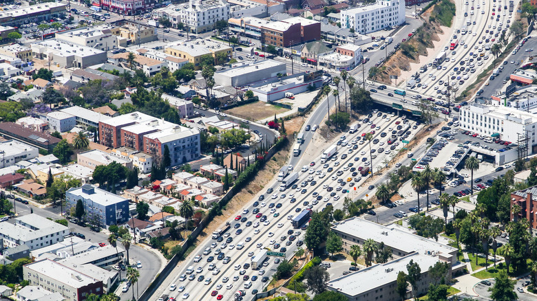
Few freeways are as embedded in Los Angeles life as the 110. Running just 20 miles from downtown LA to San Pedro, it recorded five deaths in 2023, making it the fifth most dangerous road in the state, despite its short length. I-110 begins in the heart of downtown, threading past LA Live and the University of Southern California before heading south through South Central and into the industrial port district of San Pedro. FARS data paints a clear picture: nearly all fatalities involved more than one vehicle, underscoring how constant congestion and tight merges shape its risks.
Rear-end collisions also make up a large share, a pattern consistent with LA's stop-and-go driving. Alcohol is flagged in a notable share of cases, especially south of downtown. The freeway's role as the primary link between the city center and the Port of Los Angeles adds another layer, with commercial trucks often mixing in with daily commuters. It's not fatigue on empty roads that drives the numbers here, but the relentless pressure of urban traffic — a reminder that even in just a few miles, this freeway can be one of California's most punishing drives.
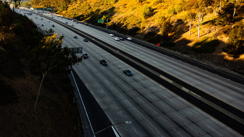
Interstate 80
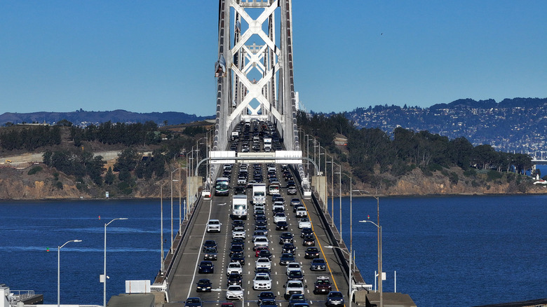
California's section of I-80 packs everything from urban gridlock to alpine extremes into just over 200 miles. Beginning at the Bay Bridge in San Francisco, it cuts through Oakland, Sacramento, and then climbs into the Sierra Nevada before crossing into Reno, Nevada. In 2023, 45 people were killed along this corridor, giving I-80 the sixth highest crash density in the state. The dangers shift as the road changes character. In the Bay Area, congestion and distraction drive multi-vehicle pile-ups. East of Sacramento, freight trucks mix with tourist traffic headed to Tahoe, creating heavy, impatient flows.
The Sierra Nevada brings yet another layer of danger. FARS data shows a larger share of weather-related fatalities here than on most California highways, with snow, ice, and sudden fog featuring in the records. The result is a corridor where each section carries its own hazards: urban pile-ups in the west, truck-tourist conflicts in the foothills, and treacherous winter driving in the mountains. I-80 is a vital artery linking the Bay to Nevada, but the numbers make clear it's also one of the state's most consistently unforgiving roads.
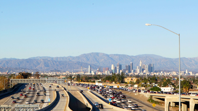
Interstate 405
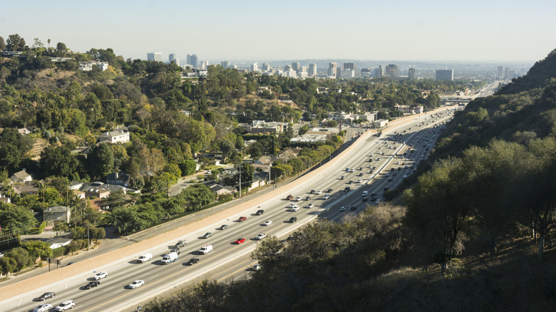
Few roads are as infamous as the 405. Stretching just under 75 miles through Los Angeles and Orange County, it's been called the busiest highway in America – and in 2023 it also proved one of the most dangerous, with 16 deaths, or 0.21 per mile. The 405 is practically a character in LA's story: it threads past LAX, UCLA, and some of the city's wealthiest enclaves, yet it's better known for bumper-to-bumper traffic. FARS data shows its fatalities are overwhelmingly multi-vehicle crashes, a profile that mirrors the constant congestion drivers face.
When the rush-hour gridlock eases, the dangers of the 405 don't disappear, they simply change shape. FARS data shows a notable share of crashes happen at night, particularly near entertainment districts, often involving multiple vehicles. In contrast to highways that wind through mountains or rural expanses, where fatigue and isolation play a bigger role, the 405's risks are magnified by the sheer volume of traffic. For Los Angeles drivers, the 405 is part of daily life, but mile for mile, it remains one of California's most hazardous freeways.
Interstate 15

Interstate 15 is the gateway from Southern California to Las Vegas, a 287-mile run through San Bernardino County and the Mojave Desert before reaching the Nevada state line. In 2023, FARS data records 61 fatalities along the California stretch. The majority of these crashes were single-vehicle run-offs, often at night and on the long, dark desert segments where speeding and fatigue loom large. With limited lighting and vast distances between services, small mistakes can quickly turn catastrophic. It also features the kind of isolated stretches that makes reading up on the best things to do when your phone suddenly loses service on a road trip essential.
But the crash profile isn't uniform. Near San Bernardino, where commuter traffic joins freight, fatalities more often involve multi-vehicle collisions, a pattern tied to congestion and heavy merging. FARS also shows alcohol cropping up more frequently in weekend crashes — unsurprising given the steady flow of leisure traffic headed to and from Las Vegas. The contrast is stark: emptiness that punishes lapses in concentration, and crowded urban approaches where split-second errors ripple into pile-ups.
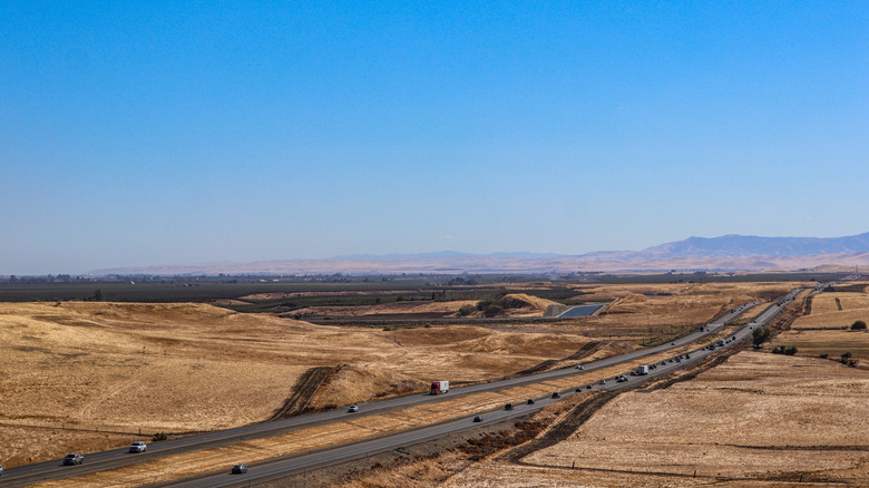
State Route 99
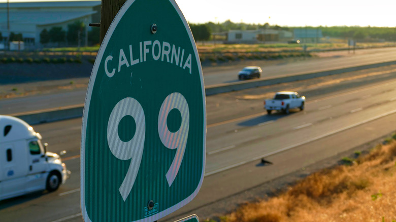
At 424 miles, SR-99 cuts right through the Central Valley, passing Bakersfield, Fresno, and ending in Sacramento. In 2023, it recorded 90 fatalities, putting it firmly within the ranking of the state's deadliest roads. An older highway that predates I-5, the crash profile underscores the risks built into this aging route. Unlike I-5, which was built to modern interstate standards, much of SR-99 passes directly through cities and towns, where fast-moving through traffic intersects with local drivers and cross-streets.
FARS records show a large share of deaths are single-vehicle run-offs, often tied to speeding or fatigue on the long, straight Valley stretches. Alcohol involvement also emerges repeatedly, especially in weekend crashes. Heavy freight traffic, tied to the region's farming economy, adds another layer of exposure, while the Central Valley's notorious tule fog can make visibility vanish in seconds, turning ordinary conditions into deadly ones. SR-99 doesn't have the coastal views or national profile of California's other highways, but the data is clear: mile for mile, it remains one of the state's most unforgiving roads.
Interstate 10
Stretching 240 miles across Southern California, I-10 is one of the busiest east-west corridors in the country. In 2023, it logged 48 deaths in the state's section of the route, placing it firmly in California's danger zone. The freeway begins at the Pacific Ocean in Santa Monica and runs through downtown LA before continuing east across the desert to the Arizona line. Like many of the longer roads in this ranking, its dangers are split: FARS data shows that in Los Angeles County and the Inland Empire, the vast majority of fatal crashes involve multiple vehicles, consistent with the stop-and-go congestion and constant merging pressure of dense urban interchanges. East of Palm Springs, however, single-vehicle run-offs dominate — particularly at night. Alcohol involvement shows up frequently too, most notably in weekend crashes, amplifying the risks along both urban and rural sections.
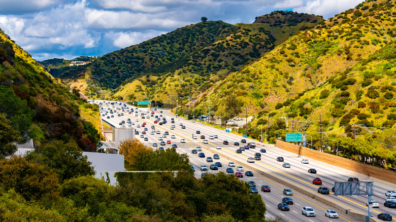
Interstate 680
Interstate 680 stretches 70 miles, winding around the inland edge of the Bay Area, skirting east of Oakland and Richmond while threading through cities like Pleasanton, Walnut Creek, and Concord before reaching I-80 at Fairfield. To the south, it connects directly to San Jose, making it a vital commuter route for the East and South Bay.
In 2023, the route recorded 12 fatalities. In Contra Costa County, interchanges funnel drivers into narrow lanes, where the FARS data confirms that multi-vehicle collisions are common. South of Pleasanton, the freeway rises over the Sunol Grade, a steep, winding section notorious for congestion and vehicle slowdowns. Farther south, toward San Jose, the hazards tilt back toward urban patterns: rear-end collisions often fueled by distraction. Unlike California's rural highways, I-680's risks stem less from isolation and more from intensity. For a suburban freeway, it carries a crash profile every bit as complex as the state's larger interstates.
Interstate 580
At 76 miles long, Interstate 580 is one of Northern California's busiest connectors, stretching from San Rafael through the Livermore Valley and over the Altamont Pass before joining I-5 near Tracy. According to FARS, 13 people were killed on this stretch 2023 — a rate of roughly 0.17 fatalities per mile — placing it among the state's riskiest freeways relative to its size.
The danger shifts dramatically depending on where you drive. In the East Bay, fatalities are tied largely to heavy traffic, with multi-car collisions often sparked by distracted driving in crowded lanes. Crossing the Altamont, the profile changes: steep grades and dense freight traffic create conditions where pile-ups are frequent and recovery space is limited. East of the pass, FARS data points to a different hazard altogether: single-vehicle run-offs and fatigue-related crashes, many of them linked to speed on long, rural straightaways.
U.S. Route 50
US-50 passes through a total of 12 states, and California's 108-mile stretch of the route isn't just a scenic climb into the Sierra Nevada, it's also one of the state's deadliest highways. In 2023, FARS records show 18 people were killed here. The route starts in West Sacramento, winds through Placerville, and climbs sharply toward Echo Summit before crossing over into Nevada just past South Lake Tahoe. It's a corridor packed with recreation traffic year-round, from ski season to summer hikes, which keeps it busy in all conditions.
The crash profile is clear in the FARS data. Most fatalities were single-vehicle run-offs, a pattern typical of winding mountain highways where drivers misjudge a curve or lose control on steep grades. Weather is also a recurring factor: snow and fog show up in a larger share of fatal crashes here than on most California routes, underlining how fast conditions can change at elevation. It's a highway that delivers striking views and direct access to Tahoe's resorts — but the very features that make it a favorite road trip route also drive its deadly statistics.
Interstate 5
Interstate 5 is California's backbone, running nearly 800 miles from the border crossing at San Ysidro, through Sacramento, and then all the way to the forests of the Oregon line. In 2023, FARS data logged 105 deaths along its length: a stark figure for a road that millions rely on every year. The risks shift with the landscape. In the south, through San Diego and Los Angeles, it's congestion that clearly dominates, with multi-vehicle crashes common in this area. North of there, the Central Valley brings a different problem — long, monotonous stretches where fatigue, high speeds, and inattention feed single-vehicle run-offs. Beyond Sacramento, weather begins to shape the numbers, with rain and fog in the northern counties showing up in a notable share of fatalities. I-5 is indispensable thanks to the way it ties together ports, farms, and cities across nearly the entire state. But FARS records underline that this essential artery can also be unforgiving.
Interstate 105
Also known as the Century Freeway, I-105 is one of the shortest interstates in California at just 18 miles, running from Norwalk west to LAX. Based on the 2023 FARS accident data, just two fatal crashes were recorded on this route, and both tell a different story of risk on this short but vital corridor. One occurred in the spring, during clear weather in Los Angeles County, with conditions marked as daylight and dry pavement. It was a multi-vehicle collision, involving several cars during a busy commute window, the kind of pile-up that comes when traffic is dense.
The other fatality came later in the year and under very different circumstances: a night-time, alcohol-related single-vehicle run-off in South Los Angeles, where visibility was low and speed played a role. Together, the two crashes illustrate the twin hazards the FARS data consistently shows on urban freeways: congestion-driven multi-car wrecks in the day, and impaired or fatigued driving at night. For I-105, even just 18 miles long, the 2023 record is a reminder that short stretches of freeway are not immune to California's broader road safety challenges.
Methodology
To uncover California's most dangerous roads, this ranking draws directly on the 2023 Fatality Analysis Reporting System (FARS), the most recent crash dataset available from the National Highway Traffic Safety Administration. Every fatal crash in the state is logged here, including when and where it occurred, how many vehicles were involved, and contributing factors such as alcohol, speeding, distraction, and weather. We filtered the records to California highways and matched each route with its official mileage from the Federal Highway Administration. To compare routes fairly, we calculated a fatalities-per-mile rate for each corridor. This was done by dividing the total number of deaths recorded on a highway in 2023 by its official mileage. This approach avoids bias toward longer roads with more overall exposure, instead highlighting where fatal crashes are most densely concentrated.