'Public Transit Deserts' In These Major Cities Make Visiting Without A Car A Challenge
Perhaps the best way to explore America is by car, as seen on these stunning and storied routes for the perfect U.S. road trip. There is something deeply thrilling and romantic about hitting the open road, and given the excellent and extensive driving infrastructure in the U.S., you can easily reach any corner of the country. This includes Key West — the southernmost point of the continental U.S. — as well as this short and sweet tribal scenic byway that leads to Cape Flattery, the northernmost point in the Lower 48.
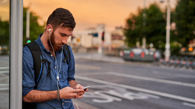
But to experience all of this, you'll need a vehicle. However, when visiting some U.S. cities, you may want to leave the car at home. Wall-to-wall traffic and scarce or expensive parking can make driving far more of a hassle than it's worth, and sitting in a car often means missing out on things best appreciated on foot. While rideshares and taxis are convenient options, the cost of using them can quickly add up, making public transportation an attractive option.
While some American cities — like this thriving East Coast town with the country's most reliable subway — boast decent public transit, not all are created equal. In fact, compared with most of the developed world, U.S. urban centers are dominated by large areas where demand for public transit far outstrips supply. These are sometimes referred to as "public transit deserts," and can make exploring cities a hassle. Here are five U.S. cities with large areas where it may be difficult (or outright impossible) to catch a bus, tram, subway, or train, according to urban planning organizations that study car dependence and residents who know the reality on the ground.
San Antonio, Texas
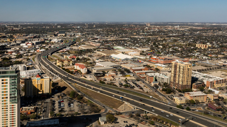
While the Alamo City may be famous for its historic Spanish missions and beautiful River Walk, it's not known to be a pedestrian-friendly town. The platform Walk Score, which rates walkability in cities across the U.S., gives the city a score of 42 out of 100. When it comes to rating its public transit, that figure drops to 35, driving home the fact that the Lone Star State's second largest city is a tough place to visit without a pair of wheels.
"San Antonio residents know from experience that large portions of their city are not very walkable, especially outside of the historic core," University of Texas at San Antonio associate professor Ian Caine underscored while speaking with the San Antonio Express-News. "Many characteristics associated with sprawl, like scattered development patterns, widespread single-use zoning and low-density neighborhoods can make cities less walkable."
Given this reality, it should come as no surprise that San Antonio is also home to several transportation deserts. According to data from the Urban Information Lab (UIL) at the University of Texas, 8.5% of San Antonio's residents live in areas where demand for public transit exceeds supply, though this number may underestimate the problem. "There are some unincorporated areas with San Antonio addresses that do not have bus stops," observed one local on Reddit, while another weighed in: "It takes 2 hours minimum for the bus to take you anywhere. I wouldn't wish that on someone. Also, it stops running at night."
The good news is that central San Antonio — home to most of the tourist attractions — is considered a "transit oasis," according to UIL, meaning supply outstrips demand. It's also home to some very walkable districts, like King William, an artsy neighborhood with Victorian vibes and great eats.
Sacramento, California
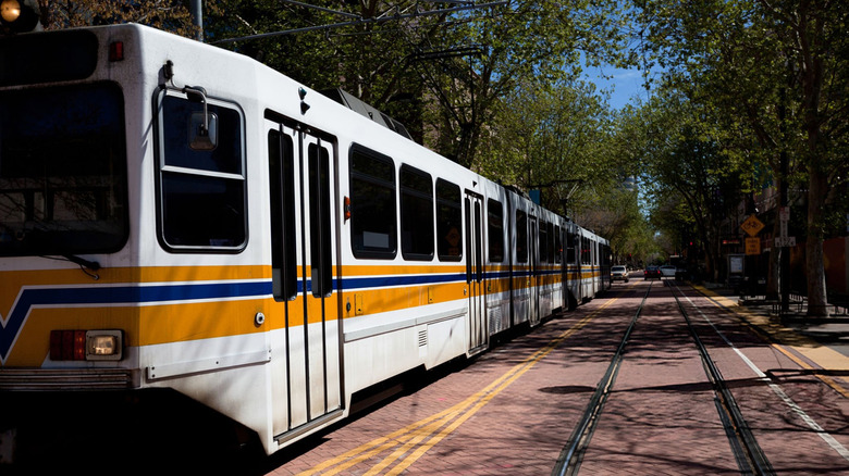
California's underrated city may be known as "America's farm-to-fork capital," but if you don't drive to the restaurant, you may have to walk off your meal. The UIL found that 12.82% of Sacramento residents live in transit deserts, one of the highest percentages on its list. Just one glance at the lab's research map for Sacramento reveals a patchwork of bright-orange transit desert zones.
Despite this, the "City of Trees" is served by a bus system that operates 80 routes reaching into the suburbs and surrounding community, as well as a light rail system running on 43 miles of track. There is also a rideshare system called SacRT Flex, a curb-to-curb rideshare service for qualified riders (including seniors, low-income individuals, and those with disabilities) within the Sacramento Regional Transit District (SacRT) system. All of this earned SacRT the 2021 National Award for Outstanding Public Transportation System of the Year for a midsized city from the American Public Transportation Association.
That said, not all of Sacramento's light-rail riders are convinced, with some taking to Tripadvisor to air their grievances. "Completely unreliable. Get a car. Pathetic for a capital city to have such a subpar transit system," lamented one reviewer, while another noted, "Light rail is a failed system." Such comments reflect a widely acknowledged trend: Even when U.S. cities try to improve public transit, the results are often mixed at best. As it stands, Walk Score gives Sacramento an underwhelming Walk Score of 49 and an even more abysmal Transit Score of 34, meaning most errands in the city require a car.
Orlando, Florida
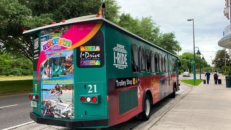
Despite having a few pedestrian-friendly neighborhoods, like South Eola, a thriving treasure stuffed with shops and good bites, Florida's theme park capital scores dismally low on the walkability meter, with Walk Score giving it a 41 and a Transit Score of just 33. This makes it an absolutely car-dependent city, so it should come as no surprise that Orlando is also home to plenty of transit deserts.
The researchers at UIL estimated that 12.17% of Orlando residents were underserved by public transportation, another high ranking on the list. These mainly occur at the edges of town, which should come as no surprise in a city notorious for its suburban sprawl. Even the Orange County government recognizes the shortfall in public transport, stating on a page on their website titled Transportation Fast Facts: "Current public transit is inadequate. LYNX bus routes do not meet the current demand, and SunRail, the regional commuter rail system, does not run often enough."
However, things aren't all bad for non-drivers in Orlando. Walk Score rates the Central Business District at 85, and the city is taking steps to improve safety and walkability through its Quick Build infrastructure program, which aims to construct new crosswalks, raised sidewalks, and signalized crossings to reduce pedestrian injuries and fatalities by 2040. Also, like other towns on this list, much of the city's core is considered a transit oasis by UIL, which makes it easy to catch a bus, as long as you're not going too far out.
Colorado Springs, Colorado
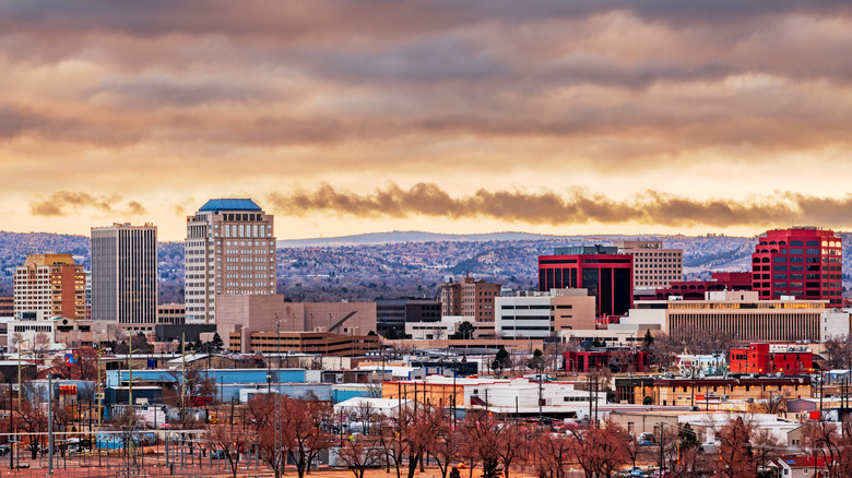
It may surprise some to learn that Colorado Springs made this list. After all, Colorado is known for its outdoorsy, active spirit and relatively progressive politics, so you would think that public transportation would be a priority in the state's second-largest city. However, according to the UIL, 10.1% of Colorado Springs residents need more public transportation than they're getting. Large swaths of this spread-out town are considered transit deserts, especially in the north-central and south-central zones.
To make things worse, according to Walk Score, Colorado Springs' Transit Score is rated an abysmal 19. What makes it so subpar? According to one resident on Reddit, "It's a combination of endless sprawl, zoning restrictions, and underfunding," while another observed, "Public transportation is more feasible when the population density is higher. Colorado Springs tends to build outwards, rather than upwards, resulting in lower population density."
Despite the lack of public transit, Colorado Springs is considered a relatively bike-friendly city. The town has been named a Silver Bicycle Friendly Community by the League of American Bicyclists, a designation it has held since 2017. The city boasts more than 100 miles of off-street trails and has a respectable network of on-street bike lanes, so perhaps the best way for visitors to explore Colorado Springs is on two human-powered wheels.
Arlington, Texas
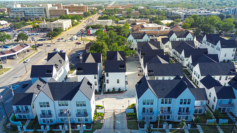
Situated between Dallas and Fort Worth, Arlington is home to some 400,000 people. Despite being a large, thriving American metropolis, it received an astounding Transit Score of 0 and a Walk Score of just 38 on Walk Score. Not only does Arlington lack a subway or light rail, but it also has no bus routes. This makes it the largest city in the country without mass transit service, and it goes without saying that this results in plenty of transit deserts.
Some residents have pushed for a public transit system over the years, but each time the proposal has made it to the ballot, it's been rejected. In her book "Lost in the Transit Desert," University of Texas at Arlington Professor Diane Jones Allen argues that more people would vote for public transit if a proper case for its existence were made. "If leadership can get people to make the connection between mass transit, employment and growth, higher density and creation of a live-work-play community life will eventually follow," she writes. "Arlington has a great deal of positivity and can have just as much development with better transit design and without auto and commuting reliance."
Even though Arlington lacks a conventional public transport system, it has made up for it with some innovative projects to get people around. The city experimented with a driverless rideshare program in the central core, which ended in 2025, and in 2017, Via was launched. This on-demand rideshare program features a fleet of vans that take passengers all over the city at affordable rates and may be the best bet for visitors who leave their cars at home.