5 Wildly Scenic Midwest Drives Brimming With Small-Town Charm And Natural Beauty
Hands on the wheel, the open road ahead, and the radio playing softly while beautiful scenery drifts by, a scenic road trip is as American as it gets. Car culture has been so woven into the fabric of the U.S. that roads like Route 66 or the Pacific Coast Highway are so famous that they become destinations in their own right. Naturally, each state has its share of dreamy drives through natural wonders and charming rural towns, and those in the Midwest are often overlooked compared to their coastal cousins. It's easy to forget that the Midwest is a massive region that encompasses several states, so it has drive-worthy routes to spare. It's also where Route 66 begins.
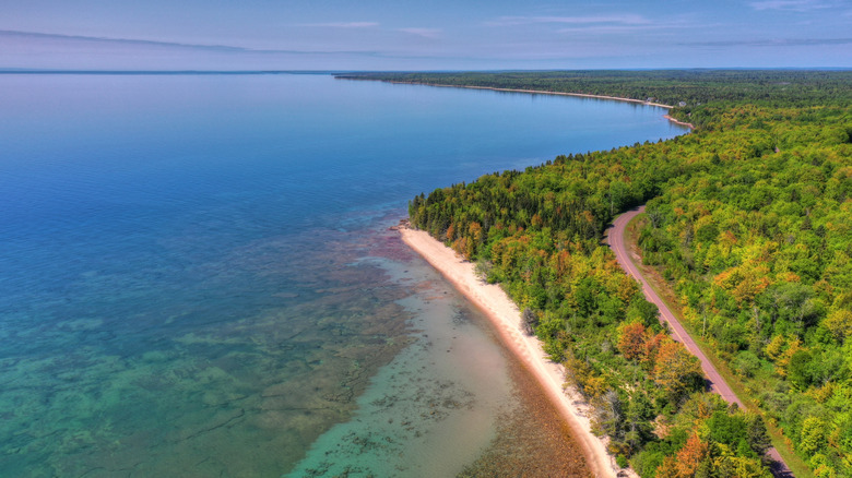
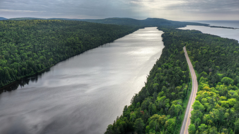
In the spirit of the great Midwestern road trip, we've put together a list of some of the Midwest's most scenic drives. These trips vary in length from a few dozen miles, which can be done over a slow afternoon, to multi-hundred-mile jaunts that require at least a night or two to explore fully, like the divine Lake Superior shore of Michigan's Upper Peninsula (pictured above). Add a piece of one of these scenic byways to a wider Midwest itinerary, or go deep and make an entire Midwest bucket-list road trip out of it.
If you're doing a proper road trip, don't forget the 3-3-3 Rule: Don't go more than 300 miles in a day, take a break every 3 hours, and, importantly, spend at least 3 nights at each destination. And while every road trip is different, consider similar guidelines for any of the routes below, regardless of distance. Take your time. Each stop deserves exploration, and the only mistake would be rushing it.
Highway 61 on Minnesota's North Shore
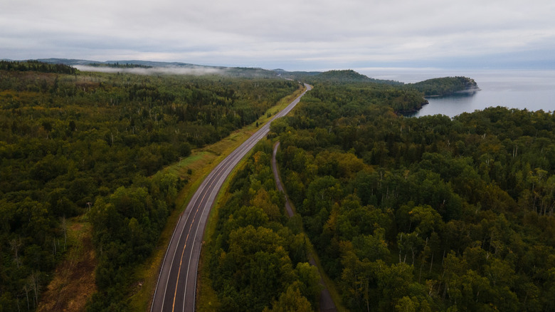
Going from the northern city of Duluth to the way-way northern town of Grand Portage near the Canadian border, Minnesota's Highway 61 is a scenic byway on Lake Superior's shores and an all-American adventure. It's a 150-mile drive featuring thick pine forests on one side and the grandest of the Great Lakes stretching to the horizon on the other, providing an anchoring energy to the scene as you drive in and out of rocky bays.
The drive takes about 2.5 hours to go from one end to the other, so it could be done in an afternoon, but consider spreading it out over a few nights by visiting the numerous lakeside towns along the way. Two Harbors, with its walkable waterfront, the oldest operating lighthouse in Minnesota, and the beloved Castle Danger Brewery, which makes its beers with water from Lake Superior. Another option is camping at one of the state parks along the route. Gooseberry Falls State Park (45 minutes from Duluth) has a whopping 4.9/5 rating on Google across almost 11,000 reviews. It's got camping, hiking, the Gooseberry River cascading down a rocky gorge, and an untouched Lake Superior shoreline.
Not more than 10 minutes down the road from Gooseberry is the cliffside Split Rock Lighthouse, which is easily a top contender for the most picturesque lighthouse in the Great Lakes, if not the entire nation. Split Rock is surrounded by a state park with more camping, mountain biking trails, yet more waterfalls, and, of course, lighthouse tours on an unforgettable shoreline. Further north, you pass the town of Silver Bay, Tettegouche State Park, and too many stop-worthy sites to list before reaching the artsy town of Grand Marais and then Grand Portage at the end of the iconic Highway 61.
Badlands Loop State Scenic Byway
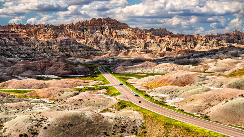
Whether you're visiting the inimitable South Dakota Badlands, a wild national park with free, scenic campsites, or heading to see Mount Rushmore, the Badlands Loop State Scenic Byway is well worth cruising. At just 39 miles, the byway connects the towns of Wall and Cactus Flat and is technically drivable in just an hour. But with 12 scenic overlooks, it's worth taking it slow, hiking a bit, and enjoying the views of the million-year-old rock layers that have eroded into jagged ridgelines punctuated by steep canyons. Safety is another good reason to take things slow here, as wildlife like mule deer or buffalo can wander onto the road.
"The Badlands Loop Scenic Drive is a fantastic experience with "other worldly" views and the opportunity for hikes that bring you close to the landscape," summed up one visitor on Google Reviews. "This drive is best suited for those who are willing to slow down and enjoy their time." Stop by the Big Badlands Overlook, and then get maps and information — especially if you're looking to hike — at the Ben Reifel Visitor Center. The Notch Trail hike features a fun ladder section, but isn't advisable for those with a fear of heights.
At the end of a day hiking and cruising the byway, take a pause at the historic Wall Drug Store. Grab some western apparel for your travels, take the kids to the "Backyard" for a cool down at the Train Station Water Show, and then grab a hot beef sandwich and mashed potatoes with a piece of homemade pie for dessert. It's an eclectic, old-school spot, making it the perfect end to a drive on the byway.
Wisconsin's Great River Road
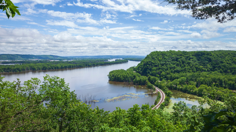
In southwest Wisconsin lies the Great River Road, one of America's oldest scenic byways you can still drive on. For 250 miles, with green bluffs on one side and flowing blue water on the other, this road snakes along the hip of the Mississippi River. The majority of the surrounding wilderness is part of protected natural areas, as the scenic byway eases through 33 charming riverside communities, many scenic overlooks, and more than a dozen vineyards for wine-tasting stops.
The town of Prescott (30 minutes from Minneapolis-St.Paul) is the launching-off point in the north, while Kieler sits on the other end. Itineraries often break the journey into 3 days; the only problem would be choosing which riverside towns brimming with charm to stop in. Alma is quaint and tucked at the base of some high bluffs. The town is home to the beautifully renovated 19th-century Burlington Hotel and to a relaxing 1.5-mile hike along the Buena Vista Trail featuring sweeping views. Danzinger Vineyards is also atop the bluffs in Alma, offering locally-made wine on a terrace with unmatched Mississippi River views.
The village of Trempealeau and a visit to Perrot State Park are great additions to the agenda. Hike or bike the trails on the towering bluffs of the park, then relax and grab a bite to eat on the deck at the Trempealeau Hotel. Consider heading to Cassville and Prairie du Chien next. The historic mansion Villa Luis in Prairie du Chien will transport you back in time, while The Depot restaurant and bar, located in a renovated railroad depot, will add to the old-school vibe.
Illinois' Shawnee Hills and the Ohio River Scenic Byway
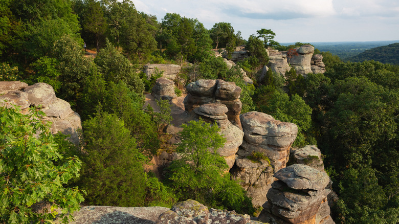
In southern Illinois, tucked between the Mississippi and Ohio Rivers, is Shawnee National Forest, Illinois' most scenic wilderness destination. Within its 280,000 acres, there are many miles of quiet forest hikes, but there are also plenty of beautiful drives. The Ohio River Scenic Byway stretches almost 1,000 miles through three states, and 188 miles is in Illinois and the Shawnee Hills area. It's the perfect Midwest spot to blend morning nature walks with short drives to riverside towns, where you can spend the afternoon learning about the area's history and enjoying a meal on a terrace by the water.
The Garden of the Gods (pictured above) is the most famous hike in the park. There's a short quarter-mile jaunt to an observation point, or you can stretch the trip out into 5 miles of wilderness exploration if you're feeling ambitious. Cave in Rock State Park is another popular stop, where you can camp, hike, and check out the large cave carved into the bluffs overlooking the river, which once served as a drinking hideaway for outlaws. Downriver 15 minutes is Elizabethtown, where you'll find a scenic waterfront perfect for a riverside picnic, or you could have some catfish nuggets on the deck at the E'Town River Restaurant.
The number of historic monuments, scenic stops, and riverside towns to explore only depends on your time frame. Further along the byway, there's the town of Golconda, where you can grab a meal at the Levee Lounge, which has hosted guests since the 1920s. Learn about life on the frontier at Fort Massac State Park and then head to the Mound City National Cemetery, created in 1864 for Civil War soldiers.
The Yoop Loop in Michigan's Upper Peninsula
Michigan's Upper Peninsula is vast and remote, comprising more than 16,000 square miles (80% of which are covered in forest), yet it has a population comparable to Wichita. That size makes it tough to define as a single destination, and there are many scenic drives and trip-worthy spots throughout the area. The Yoop Loop (the Yoop being the informal nickname for the U.P.) is a good way to see the best of the region. There's no official route, and various sections are available to drive, depending on your timing and sightseeing dreams.
To the east, there's the 63-mile Tahquamenon Scenic Byway. It features Tahquamenon Falls, one of the largest waterfalls east of the Mississippi, and the Great Lakes Shipwreck Museum at the end of Whitefish Point. Moving west, Pictured Rocks National Lakeshore could easily be its own multi-day excursion, full of incredible cliffs, hiking, beaches, and boat tours. From there, State Highway M-28 cruises along the Lake Superior shore, offering scenic turnouts to bask in the views as it takes you to Marquette. It's the largest town in the U.P., and where you'll find plenty of sailing, hidden waterfall hikes, and tasty dining.
A further 2 hours west, and you reach historic Houghton, a good base for exploring the Keweenaw Peninsula (pictured above). A final leg of a full Yoop Loop tour could be a picturesque drive from Houghton to Copper Harbor at the top of the peninsula. Stop in tiny villages like Eagle River for some brisket on the deck at Fitzgerald's Restaurant, and then grab a muffin from The Jampot bakery, a local establishment run by monks. Make a day of it, then head back at sunset, pausing on a blanket in Great Sand Bay to watch the sun slide behind the lake.