Canada's 10 Deepest Lakes Worth Visiting
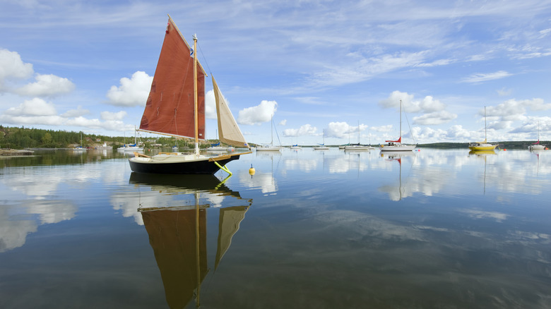
Canada is a country of staggering scale. It's a wilderness of granite peaks, frozen tundra, and skies that ignite with color. On top of that, it's the most lake-filled country in the world. In fact, if we're only counting lakes that measure over 0.2 square miles each, Canada has 879,800 lakes total — more than four times as many as the next country on the list, Russia. But the official number of lakes can vary depending on how they're being defined. If you count the number of lakes of any size, that number jumps up to around 2 million — 14% of the planet's total. So, suffice it to say that there are quite a lot of them — and many of them are extremely deep.
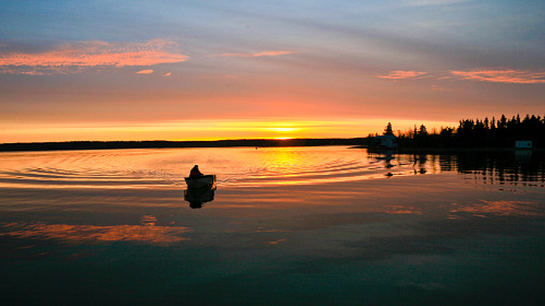
But why does depth matter? Well, deep lakes are cold, clear, and largely untouched under the surface. They sustain ecosystems that shallower water simply can't support, harbor fish of extraordinary sizes, and, in some cases, inspire legends of creatures lurking below. But depth alone doesn't make a lake worth visiting. Some of Canada's deep lakes are too remote, featureless, or simply inaccessible. That's why we've researched deep Canadian lakes that deliver on world-class fishing, hot springs, northern lights, and volcanic peaks, as well as providing excellent facilities and an abundance of activities spread across some of the most dramatic wilderness on Earth.
We built this list by pulling figures from multiple authoritative sources, including the Canadian Encyclopedia, B.C. Lake Monitoring Network, NASA, and peer-reviewed scientific literature. The Great Lakes, shared with the United States, were excluded on the basis that their deepest points lie in American waters. We also excluded certain lakes that lacked infrastructure, scenery, or broader visitor appeal so as to only include lakes that are worth visiting as travel destinations.
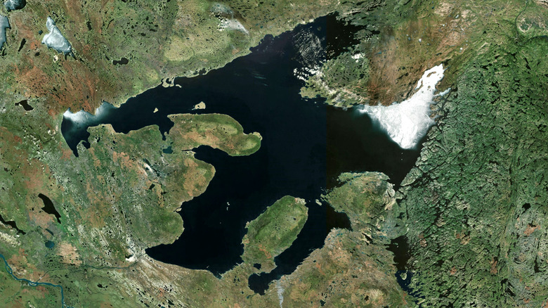
Great Slave Lake, Northwest Territories — 2,014 feet
Plunging to a depth of 2,014 feet at Christie Bay, Great Slave Lake, in the Northwest Territories isn't just deep; it's the deepest glacial lake in both North America and Europe. The scale doesn't end there. It spreads across more than 10,800 square miles, which means it's the second-largest lake that is completely within Canadian borders, yielding only to Great Bear Lake. The East Arm is where Great Slave Lake is at its most dramatic. It's a landscape of tight passages, sheer rust-colored cliff faces, and a boreal forest. Thaïdene Nëné National Park Reserve (which is nearly three times the size of Yellowstone) protects much of the East Arm's terrain, and you can explore it on a guided boat tour or take a multi-day paddling adventure.
You can also explore the lake independently by kayak, canoe, or paddleboard, while fishing is another activity the area is renowned for. In fact, the East and North Arms hold some of the finest lake trout and arctic grayling fishing in the country. Yellowknife serves as the main gateway. Everything you need is there, from hotels and restaurants to tourist services, and you can reach it via direct flights from Edmonton and Calgary.
Aside from summer activities, March is also a good time to visit. This is when the city hosts the Snowking Festival. At this time, a fairytale-like snow castle made with blocks of ice and snow on a stretch of the frozen lake acts as the centerpiece for a month of theater, music, and film. Come during the spring and fall equinoxes, and the northern lights reflect in silent ribbons of color, adding to the lake's spectacle.
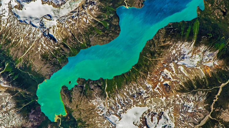
Quesnel Lake, British Columbia — about 1,676 feet
Quesnel Lake was carved out by glaciers thousands of years ago in the heart of British Columbia. It plunges down to a depth of about 1,676 feet at its deepest point and is considered to be the deepest fjord lake on Earth and the deepest lake in B.C. Its three arms push into the surrounding Cariboo Mountains, and each narrow ribbon is enclosed by thick walls of forest. The water is clear enough to see the lakebed in the shallows.
The North Arm is where you'll find sandy beaches and forests of cedar that have stood for centuries. The East Arm is where the glacially carved rock drops down to the water's edge, while the shoreline across the entire lake hides countless coves and hiking trails that climb up to viewpoints. This remote gem is also perfect for fishing. The wild rainbow trout here have a bit of a following among serious fly fishers. Anglers also come to pursue bull trout and kokanee, while Quesnel Lake sustains roughly 25% of B.C.'s entire sockeye salmon population — which is why, during the fall, the riverbanks fill with hungry bears and eagles seeking a fish dinner.
To get to the wider reaches of the lake, you can explore by canoe or kayak. If it's winter, heli-skiing is available, while snowshoeing and snowmobiling offer more accessible adventures. You'll find food and lodging in the community of Likely, on the West Arm — one of two gateways to the lake. The other nearby community, Horsefly, is another option for food, shelter, and a gas station.
Adams Lake, British Columbia — 1,499 feet
Adams Lake lies in south-central British Columbia and reaches about 1,499 feet at its deepest point. The shoreline includes sandy and pebbly stretches that invite lounging and swimming on warm, sunny afternoons. It's ringed by forest-covered mountains of dense conifers dropping down to shallow, turquoise water of exceptional clarity. Beneath the surface, the structure is equally compelling. It's an intricate network of underwater ridges and plunging depths sustaining populations of rainbow, bull, and lake trout, as well as schools of kokanee.
In the past, the long-running Squam Bay Fishing Derby has pulled in competitors from far and wide since lake feeds into the Adams River, home of one of the province's most celebrated sockeye salmon runs. In addition, the large area is exposed to strong winds — making Adams Lake great for windsurfing. Waterskiing, scuba diving, camping, and cycling are also available, while Grizzly Adams Lake Resort offers a few comfortable cabins and bunkhouses, as well as RV and camping spots. Nearby towns are well stocked with places to eat and shop, and the Adams Lake Provincial Park near the southern end of the lake is roughly 19 miles north of the village of Chase.
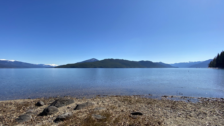
Great Bear Lake, Northwest Territories — 1,483 feet
At 12,096 square miles, Great Bear Lake is the largest lake entirely within Canadian borders, the fourth-largest in North America and the eighth-largest on the planet. It's also incredibly deep. At 1,483 feet, Great Bear Lake is the fourth-deepest on our list of visit-worthy lakes. It has also never been meaningfully touched by development. Vast and devoid of roads, the surrounding wilderness pushes out toward distant mountains and rivers. Where the northern shoreline meets the water, ancient rock has been carved into soaring cliffs, islands, and deep fjord-like inlets. Délı̨nę, on the southern shore, is the only settlement on the lake and is reachable via small plane and a single airstrip.
Great Bear Lake is locked in ice for much of the year, but on clear winter nights, the aurora borealis blazes across the sky. When the Arctic summer arrives, it brings weeks of continuous daylight, the thawing waters reveal fish that very few lakes can equal. It's not terribly hyperbolic to say that the trout here are monsters. In fact, the current world record for the heaviest lake trout was made here in 1995. It's a place for serious anglers, and there are some excellent fishing lodges along the shore. But it is history that truly defines this lake.
In 2016, the Great Bear Lake watershed was designated the largest UNESCO Biosphere Reserve in North America, and the Sahtúot'ine (the Bear Lake People) became the first Indigenous community in the world to steward a protected area of this kind (via the New York Times). Before then, Arctic explorer Sir John Franklin and his men took part in the small matter of one of the earliest known accounts of ice hockey in Canada.
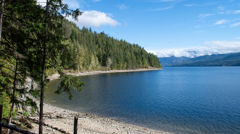
Chilko Lake, British Columbia — 1,201 feet
Chilko Lake is situated within the Ts'yl-os Provincial Park, on the traditional territory of the Tsilhqot'in Nation. Its depth is measured at about 1,201 feet, and its pure, glassy, and intensely blue-green water rests in a valley that glaciers spent millennia hollowing out from the Coast Mountains. At 3,855 feet, it's a natural high-elevation lake, and at about 69 square miles, it's the biggest of its kind in Canada. With snow-capped mountains towering beyond 7,200 feet pressing in on all sides, alongside alpine meadows, waterfalls, and glaciers, it's also a place of extraordinary beauty.
It's one more Canadian lake for those who love the outdoors. Wildlife lovers can take bear-viewing tours on boats and get close to grizzlies feasting on salmon while bald eagles patrol above. Moose, mountain goats, black bears, and cougars also move through the surrounding terrain, and hikers have every chance of spotting some of them. The Tullin Trail offers a three-to-five-hour hike each way with panoramic views of the lake, while the Yohetta/Tchaikazan multi-day wilderness loop takes in high passes and remote river valleys.
The lake is also a serious angling destination, with bull and rainbow trout caught in impressive numbers, while the Chilko River draws fly fishers to some of West Chilcotin's best wilderness trout waters. Lodges and campgrounds are available on the lake, but the drive in takes around four to six hours from Williams Lake, the Stampede Capital of B.C. with an artsy downtown, on rough gravel roads. A capable 4x4 is essential.
Slocan Lake, British Columbia — 978 feet
Slocan Lake is a long, narrow lake hemmed in by the Selkirk Mountains to the east and Valhalla Provincial Park to the west. The depth is measured at about 978 feet, and a trip here is well worth the effort — its vivid turquoise water has been likened to that of the Mediterranean. This lake is far from the crowds, although not inaccessible. You can reach it from Revelstoke via the Upper Arrow Lake ferry, among other routes from Vancouver and Kelowna.
The trail to get to Pebble Beach is a moderately challenging out-and-back hike of almost 5 miles, starting near the village of Slocan at the southern end of the lake. This opens onto a wide expanse of water flanked by steep, forested slopes. Bannock Point on the eastern edge is also reachable by foot, but it's a short-yet-moderately-steep hike from the parking area. Once there, the calm, clear water invites brave cliff divers to take a plunge. You may want to do this first thing, when you'll share your morning with eagles and ospreys hunting on the lake's surface.
Near the northern end of Slocan Lake, Wragge Beach offers a generous sweep of sand that's good for swimming, sailing, and fishing, where anglers have pulled out rainbow trout, kokanee, bull trout, and Dolly Varden. Kayaking and canoeing are popular pastimes on the lake, too, and you can rent canoes at the Silverton Resort, among other places. It is situated right near the water's edge and offers log cabins, fire pits, and a beach right on your doorstep.
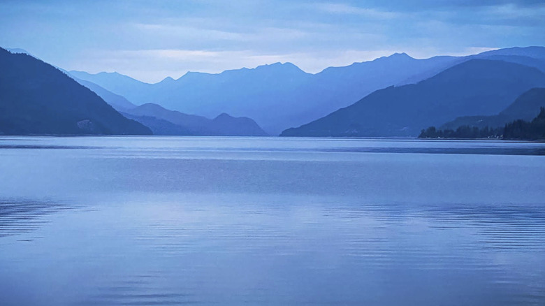
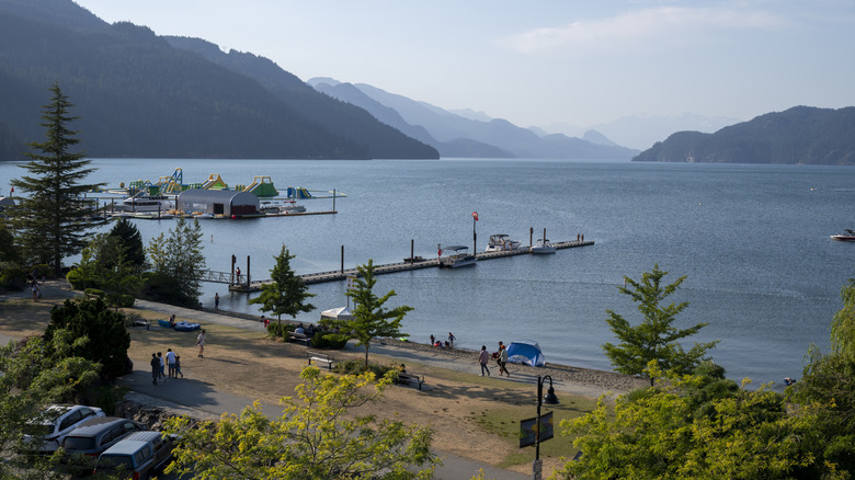
Harrison Lake, British Columbia — 916 feet
Harrison Lake reaches about 916 feet at its deepest point. It also covers around 97 square miles, making it the largest lake in southwest British Columbia. It sits only about three hours east of Vancouver, so it's a convenient location, especially if you're seeking a good winter soak in hot springs. At the southern tip of the lake, you'll find Canada's quirky Sasquatch Capital, a.k.a. Harrison Hot Springs, which is home to two natural mineral springs named Potash and Sulphur. Their waters emerge from the ground at temperatures between 120 and 150 degrees Fahrenheit and are among the richest to be found anywhere. They were used by the Indigenous population of the Salish Coast long before Europeans set foot in the area, but today, the Harrison Hot Springs Resort pipes these waters into five mineral pools. If you're not staying at the resort, a public soaking pool is available in the village.
In fall and winter, the Harrison River mouth fills with bald eagles drawn there to hunt spawning salmon. You can take a boat tour to enjoy this spectacle or take part in a range of water sports, including sailing, windsurfing, and kayaking. The seasonal Sasquatch Mountain Resort is around an hour away for skiing, but if it's just a relaxing time you seek, The Lodge on Harrison Lake sits directly on the water, with its own beach, fire pit, and cedar barrel sauna.
Okanagan Lake, British Columbia — 761 feet
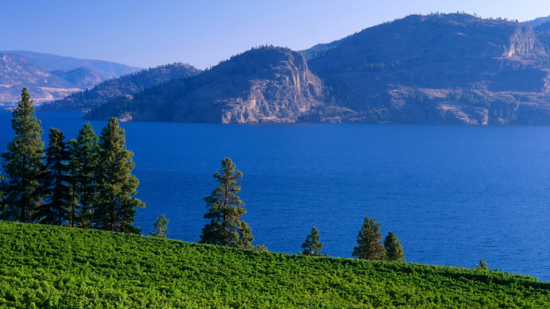
The Indigenous Okanagan people, also known as the Syilx people, have long called this lake nx̌ax̌aitkʷ, which is pronounced "n-ha-ha-eet-kw." In Syilx culture, it means "sacred spirit of the lake." When settlers arrived, they mistakenly started associating nx̌ax̌aitkʷ with a lake monster story, giving it the name "ogopogo." And at 761 feet deep and stretching for roughly 84 miles through the Okanagan Valley, it's no wonder why the lake has been considered a backdrop for incredible lore.
And thanks to its considerable depth, scuba diving opportunities are available for all levels of certification. Of course, with over 180 miles of shoreline, there's also plenty to explore on the surface, too. You can go at your own pace by renting a paddleboard, kayak, or pedal boat, with the Kelowna Paddle Trail offering a roughly 17-mile route along the eastern shoreline. If you're keen to try something more energetic, parasailing, jet skiing, waterskiing, and wakeboarding are also available. Swimming is also possible, with the lake warm enough between July and August for some comfortable splashing.
Okanagan Lake is also unique in that it sits in the heart of B.C.'s largest wine region. With over 200 wineries lining the Okanagan Valley, wine cruises combining lakeside views with onboard tastings are a popular way to discover both the water and the region's celebrated viticulture. You can reach Okanagan Lake via Kelowna International Airport, and the city of Kelowna offers hotels, restaurants, and all the tourist services you'll need.
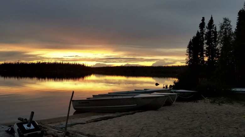
Reindeer Lake, Saskatchewan — 722 feet
There's a very deep, near-circular bay at the southern end of Reindeer Lake, almost 7 miles across. Deep Bay is the result of a meteorite strike that happened between 99 and 140 million years ago, making the lake's deepest point at about 722 feet. However, the rest of the lake reaches no more than 164 feet deep. But Reindeer Lake, on the whole, is still huge. It stretches for 152 miles from north to south and is 35 miles across at its broadest. This makes it Saskatchewan's second-largest lake and the ninth-largest in the country. Its 5,700 miles of shoreline are actually shared between Saskatchewan and Manitoba, and it's lined with beautiful pine, birch, spruce, and poplar trees, while around 5,500 islands turn the lake into a wilderness labyrinth. Above, eagles, terns, and ospreys hunt the shallows, and the lake surface mirrors the sky so completely that it has been likened to a giant infinity pool.
The Indigenous Cree people have long avoided fishing in Deep Bay. Local legend tells of a benign creature dwelling in the lake's depths, one that prefers to remain hidden from the world above. Despite this, fishing is the primary draw at Reindeer Lake. In fact, it's a world-class destination for pike, lake trout, grayling, and walleye, with reports of trophy lake trout up to 52 pounds and northern pike measuring 45.5 inches. To get to the lake, you can access it via Highway 102, which ends at the community of Southend on the lake's southern shore, or Highway 994.
Babine Lake, British Columbia — 610 feet
Babine Lake is the longest natural lake entirely within British Columbia's borders. It's set among the Babine Mountains in the province's north, and it reaches 610 feet at its deepest point. At one time, five First Nation villages located along its shores. Today, several small communities remain along the water, including Smithers Landing, Granisle, and Fort Babine to name a few. They also offer lakefront accommodations and campgrounds year-round.
With activities like swimming, bird watching, boating, and canoeing, there are plenty of activities to enjoy at Babine Lake. Hikers aren't left out, either. They can try the Old Fort Mountain Trail, which reaches a summit of 5,165 feet, and the Shoulder Mountain forestry lookout trail near Topley Landing.
Babine is also another excellent lake for anglers. Each year between August and November, its connected waterways fill with returning salmon, including sockeye, chinook, and steelhead. The lake also supports rainbow trout, whitefish, and char. Come winter, ice covers the lake, and heavy snowfall transforms the surrounding peaks into a backcountry playground. Snowmobiling is particularly popular in the surrounding areas, with snowshoeing and cross-country skiing rounding out the winter options.