All 11 US National Scenic Hiking Trails, Ranked By Difficulty
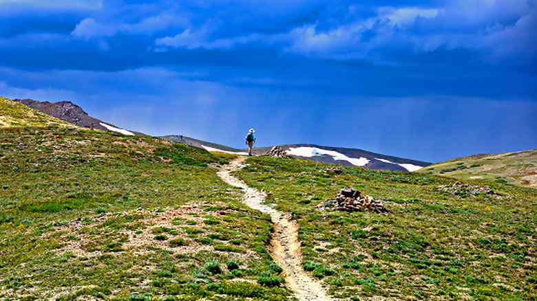
The United States has myriad trails across its vast and varied landscapes. There are 11 official National Scenic Trails, and they offer some of the world's most beautiful and ambitious walks. Ranging from 65 to 4,600 miles and covering all of the country's major mountain ranges, the U.S. National Scenic Trails system appeals to all skill levels, from beginners to veterans. But how challenging is challenging? It depends on how you look at it.
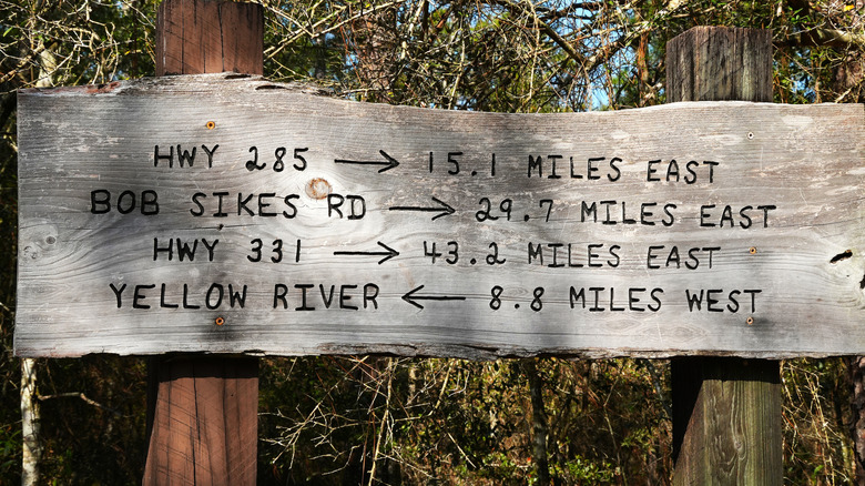
These trails are organized into sections, which can vary greatly in difficulty. The North Country Trail, for example, is nearly 5,000 miles long, but some segments are relatively flat. Mountainous trails, meanwhile, can be incredibly strenuous, even if distances are modest. Hikers have differing opinions about the difficulty of through-hikes on some of the most extensive routes, but a lot of that depends on weather, gear, preparedness, and personal preferences.
Below, we've listed all 11 National Scenic Trails in order of difficulty, based on their entirety. Through-hikes are as mentally challenging as they are physical. Endurance comes in many forms, and the experience will be unique for everyone, so this list approaches "difficulty" through the lens of both physical and mental toughness. We've compared reviews on sites like AllTrails and hikers' YouTube channels and blogs, and we consulted official resources such as the National Parks Service and trail associations. A longer trail is not necessarily a harder trail, so we also considered elevation gain and remoteness.
11. Natchez Trace National Scenic Trail
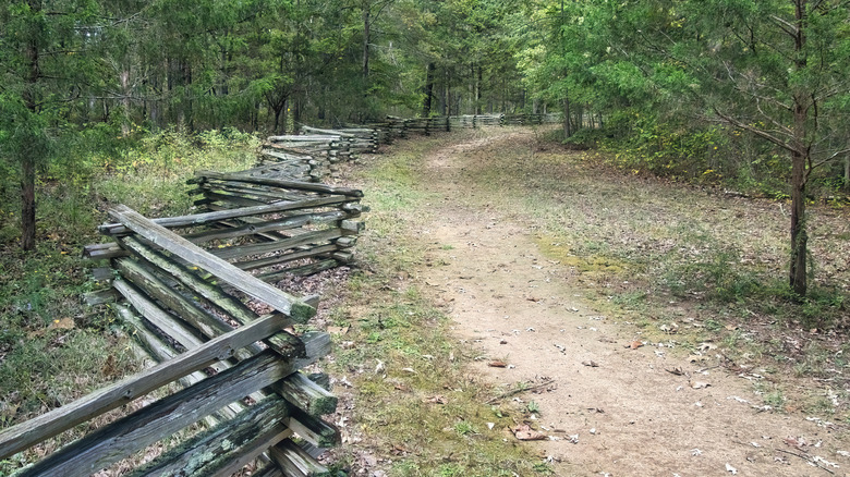
By far the shortest National Scenic Trail at only 65 miles, the Natchez Trace National Scenic Trail passes through Alabama, Mississippi, and Tennessee. It runs parallel to the beautiful Natchez Trace Parkway, a 444-mile byway in the Southeastern U.S., ideal for both longer hikes and drives. It's a stunning glimpse of history along with the region's forests, prairies, wetlands, and more.
The Natchez Trace Parkway follows a historic route, known as "Old Natchez Trace," which was used by a wide range of travelers throughout the centuries. The National Scenic Trail is organized into five developed segments that run alongside different parts of the parkway. It's easy to tackle different hikes at different times rather than completing a big thru-hike, although the parkway itself is always an option if you fancy something a bit more challenging.
Along the Potkopinu Section near Fayette, Mississippi, centuries of foot traffic have cut deeply into the soil to create, in some places, embankments more than 20 feet high. This section is only about 3.5 miles and is considered moderately challenging, per AllTrails. Up in Tennessee, the northernmost part of the route is known as the Highland Rim Section. It's also rated moderately challenging and a little more than 20 miles, but if you're not an experienced hiker, that'll feel like a challenge.
10. Potomac Heritage National Scenic Trail

More of a lengthy "braided" network than a single trail, the Potomac Heritage National Scenic Trail (PHT) covers around 900 miles through Pennsylvania, Maryland, Virginia, and Washington, D.C. It's situated along its namesake river, the deeply historic and beautiful Potomac. Depending on what type of walk — or bike ride, horseback ride, or paddle — you're in the mood for, you can take in some of D.C.'s most enduring monuments, explore nature's brilliance in the Laurel Highlands region of Pennsylvania, and traverse the Eastern Continental Divide in a loop — which is still in development — covering around 150 miles.
Because there are a few PHT connector routes in the planned or proposal stages, there are areas where you have to walk on the road or figure out the connections yourself. But it can be done! A hiker named Beans, in a trip report on The Trek, notes that she completed the whole thing in an incredibly fast 18 days, splitting it up into four major sections. If you take on the challenge, it's more of a logistical puzzle to solve, as trailside camping isn't an option in many areas. In that vein, most hikers will approach the PHT in small sections, most of which are rated moderate to easy.
9. New England National Scenic Trail
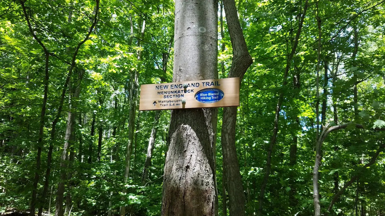
At 235 miles, the lovely New England National Scenic Trail (NET) covers a gorgeous north-south stretch from Long Island Sound, through Connecticut and Massachusetts, to the border of New Hampshire. It's something of a composite route, consisting of three historic paths known as the M-M-M, or Mattabesett, Metacomet, and Monadnock Trails. You'll take in some stunning hills, waterfalls, woodland, lakes, and meadows. And much of the route follows the Metacomet Ridge, a small, gorgeous mountain range that offers lovely views over the landscape.
Organized into a few dozen sections, some as short as a couple of miles, there are plenty of short trips along the NET that can be combined into easy-to-moderate day hikes. If you tackle the entire thing, it'll be a challenge, as you'll encounter more than 30,000 feet of elevation gain in total, and it'll likely take around two to three weeks, depending on your fitness level.
The NET was designated a National Scenic Trail less than 20 years ago, so work continues to make this route easily through-hikable, at least in the sense that you can easily camp along the way at reasonable intervals. The trail heads through 41 communities, so it's fairly easy to combine traditional stays in local motels or vacation rentals with campgrounds along the way. If you do complete a through-hike, or at least 200 miles in any configuration, you can register to receive a NET finisher patch.
8. Ice Age National Scenic Trail
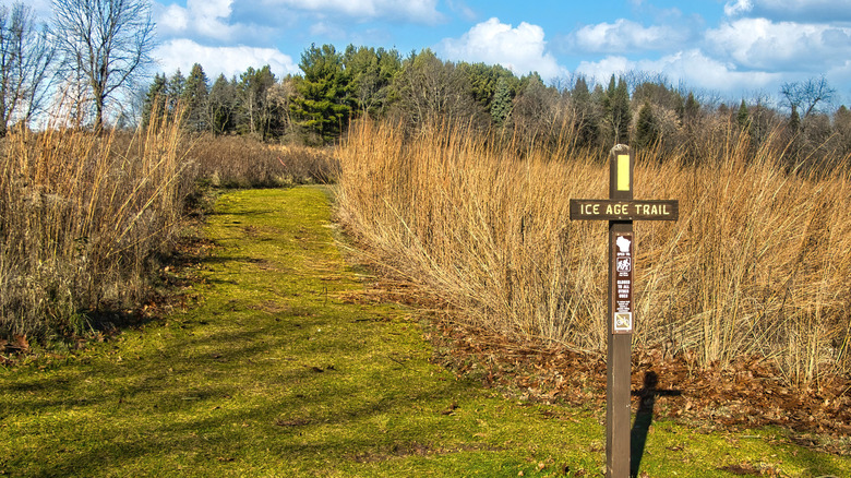
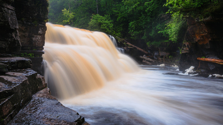
A lot of the National Scenic Trails trace remarkable geological phenomena, but Wisconsin's Ice Age Trail is unique among them, winding thousands of miles through the footsteps of woolly mammoths. The route is so called because it traces the edge of where a colossal glacier drifted around 12,000 years ago, creating a huge variety of landforms unique to glaciated landscapes, such as teardrop-shaped hills called drumlins, ridges known as eskers, and craters named kettles that formed when giant chunks of ice melted.
The Ice Age Trail is about 1,200 miles long, comprising almost 700 miles of official paths that are marked with yellow blazes, plus about 500 miles of other network trails that serve as connectors. The whole thing is still in progress, to some extent, but it starts on the shore of the Bay of Green Bay at Potawatomi State Park, drops south through Kettle Moraine State Park and Janesville before curving up around the west side of Madison and heading up north of Wausau, a riverfront Midwest city full of undiscovered charm. It then swings west, meandering its way to St. Croix Falls on the Mississippi River. Most of the terrain is relatively flat, and while some intrepid walkers have completed it in about 40 days, if you hiked an average of 20 miles per day, you'd be looking at closer to 60.
Due to its length and also Wisconsin's long, cold winters, some hikers complete the trail in sections, but plenty also tackle it as a through-hike. No matter how you complete it, you can apply for recognition as a "Thousand-Miler" to see your name added to the list of those who have also completed it.
7. Florida National Scenic Trail
Covering around 1,500 miles, including road walks and connector trails, the Florida National Scenic Trail (FT) begins at Big Cypress National Preserve in South Florida — one of the only spots in the state where the Milky Way can be seen without a telescope — and culminates in the northwest at Gulf Islands National Seashore. This striking, long-distance trail crosses a range of ecosystems, conservation areas, and state parks, such as Lake Okeechobee and Olustee Battlefield Historic State Park. Experience the Everglades headwaters at Kissimmee Prairie Preserve State Park, and camp on-trail in otherworldly backcountry woods and wetlands.
While it's mostly flat, the FT has a reputation for being deceptively difficult thanks to its swamps, humidity, bugs, and snakes. Through-hikes on the FT are certainly possible, but the distance requires planning and a fair amount of time to complete — usually two to three months, depending on experience and fitness level. "It's flat but not level," shares a Redditor. "In the 'uplands,' such as they are, do not underestimate the sand." Uplands in Florida consist of a kind of buffer area of land next to wetlands.
In addition to the Appalachian Trail and several others, the FT is also part of the southern leg of the Eastern Continental Trail (ECT), which is a hike of epic length that stretches well into Canada by way of the International Appalachian Trail and is more than 6,000 miles long. It's not a National Scenic Trail, but many who hike the whole FT have done so as part of the ECT.
6. Arizona Trail

The Arizona National Scenic Trail (AZT) is a true gem that covers about 800 miles between the state's northern and southern borders. The AZT moves through rugged red rock country, including the Grand Canyon, along with mountains and "sky islands" of ponderosa pines.
The AZT is organized into 43 sections, or passages, and finishers tend to do the whole thing in around a month or two. Despite its modest overall distance, at least in comparison to the next few on the list, the steep climbs through mountain ranges and harsher desert climate makes this more challenging than some of the longer-but-flatter or more temperate trails. "You'll spend a few days on a mountain and then go lower, but it's not pass after pass like the PCT. More like one mountain range after another," shares a Redditor. "You'll drink water out of a lot more cattle troughs and tanks."
The total elevation gain for this trip is nearly 105,000 feet, according to AllTrails, but certain areas are flatter than others. "The trail changes dramatically north of Pine (Mountain)," shares a hiker in the same Reddit discussion. "It's very flat, aside from the Grand Canyon." And yes, you do head right on down into the canyon itself to experience one of the most iconic national parks in the nation. The ultimate time of year to plan a trip to Grand Canyon may be in the fall, and that's a good time to also hike southbound (SOBO) on the AZT. A northbound trip (NOBO) is a good fit for springtime, when you can climb up to higher, cooler altitudes as the days heat up.
5. Appalachian Trail

Covering precisely 2,197.9 miles through 14 states in the eastern U.S., the Appalachian Trail (AT) is a bucket list trek for many. A through-hike will traverse the Great Smoky Mountains National Park and numerous other natural attractions between Springer Mountain in northern Georgia and Baxter State Park in Maine. The AT is well-connected to local communities and supply points, and it's hugely popular and communal. You'll always see other people on the trail, many of whom are day or section hikers who comprise its nearly 17 million annual recreation visits. In 2025, more than 3,000 of those were through-hikers.
The AT is one of three ambitious through-hikes that, when completed, add up to the so-called "Triple Crown" of hikes. The best time to hike the Appalachian Trail depends mostly on the season. The trail connects vastly different climate zones and should be approached NOBO in the spring and SOBO in the fall. Also, because it takes an average of six months to complete the route, getting a good system down that works for you is as much of a challenge as the trail itself. "New hikers focus way too much on pack weight instead of learning about their gear and refining their overall day-to-day routine," shares a Redditor. Gear is important, but with about one in three hikers bailing out of a through-hike before finishing, sticking to it is the real challenge.
4. Pacific Crest Trail
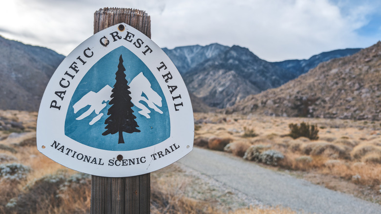
Across 2,650 miles, the Pacific Crest Trail (PCT) stretches from north to south across Washington, Oregon, and California, connecting the Canadian border to the U.S. border with Mexico. It heads through the vast Mojave Desert, the High Sierras, and the Cascades, following — as the name describes — the rarefied, mountainous crest of this vast Western region. Depending on the time of year, you may approach it SOBO or NOBO. You'll also encounter elements that can make it extra challenging, such as intense heat, cacti, snow and ice, and steep climbs. According to AllTrails, the entire elevation gain is about 430,000 feet.
The PCT brims with astonishing beauty, and it's certainly among the all-time best hikes in the Pacific Northwest. On the PCT, you might encounter wildfire damage, which one Redditor suggests skipping. The route is one of the most popular through-hikes in the country, and there are also tons of resources available in advance to help you plan, plus on-trail assistance thanks to other hikers and the PCT's network of trail angels — those who provide rides, shelter, food, and other help along the way.
3. Pacific Northwest Trail
Starting at the Continental Divide in Glacier National Park and running roughly parallel to the Canadian border until it hits the Pacific Ocean at Cape Alava in Olympic National Park, the Pacific Northwest Trail (PNT) covers about 1,200 miles. It includes extensive hikes through Montana, Idaho, and Washington, and crosses a huge variety of terrain. Some of it is exceedingly rugged, and the route is seen as quite challenging.
The PNT was only added to the list of National Scenic Trails in 2009, so despite the route dating to the 1970s, it doesn't have quite the cachet of the Triple Crown routes. That said, it's one of the most gorgeous and rewarding hikes a through-hiker can take on, working your way through the Rockies, the Cascades, and the Olympic Range. There are sections known as "bushwhack" routes where the trail is not built, so you have to work your own way through. The PNT is among the most challenging National Scenic Trails and contains some of the most remarkable Pacific Northwest beauty you're likely to come across.
"The PNT is definitely more challenging to complete than the PCT... but aside from the Idaho cross-country section, I think rumors of the amount of bushwhacking on the PNT are usually overblown," shares a through-hiker in the PNT Hikers Facebook group, adding: "The PNT is rarely flat. You're usually going up or down."
2. Continental Divide Trail
Covering about 3,100 miles from the U.S. border with Canada down to the border with Mexico, the Continental Divide Trail (CDT) is arguably the most ambitious Triple Crown through-hike. It's a mountain wonderland, but it also covers a huge range of other landscapes, from high desert to plains to forests. No matter what, elevation is the defining feature, as the continental divide is a geological boundary along the Rocky Mountains that separates North America's watersheds.
A few hundred people attempt a through-hike on the CDT every year — far fewer than the PCT or the AT, so you may not see many others during the day. It typically takes five to seven months to complete the trail, but it could easily take much longer depending on how you schedule your rest days or resupply stops.
When it comes to difficulty, one Redditor puts it this way: "The AT = High School. The PCT = College Undergrad. The CDT = Masters Degree Graduate Level." This is because of the length, the potential for snow and extreme weather, and huge elevation gains. As Katie Jackson shares on The Trek, "I climbed a staggering 401,648 feet and descended 404,702 feet — a reminder that for every brutal ascent, there was an equally tough descent waiting on the other side." Fortunately, the views are mind-blowing.
1. North Country Trail
It's a challenge unto itself to try to figure out where to place the expansive North Country National Scenic Trail (NCT) along the spectrum of difficulty when it comes to the National Scenic Trails. On one hand, it stretches a whopping 4,800 miles across the northeastern U.S., making it by far the longest hike. So few people have completed the entire NCT, though, that it's tough to gauge. Fewer than two dozen have hiked the entire thing. "At over 4,000 miles and lacking the 'cultural infrastructure' of other long trails...it's best done in sections with each section having it's own unique 'flavor,'" shares a Redditor. Indeed, that's how most people approach the NCT — bit by bit.
The NCT is connected in some places by roads or rail trails, which some hikers find less attractive than fully developed, independent trail systems like the AT or PCT. Some sections are more challenging than others, and much of it is flat. A walk around Pictured Rocks National Lakeshore, for instance, will feel very different from the Adirondack or Allegheny Mountains. And because it could easily take between seven and 10 months to complete, the seasons are a real issue up north.
The northern U.S. is characterized by full-on winters that could make certain segments very cold and strenuous. The extreme weather and length through nine states between Vermont and North Dakota certainly qualify the North Country National Scenic Trail as one of the most ambitious hikes in the world.