
7 Search And Rescue Hotspots To Beware Of In Great Smoky Mountains National Park
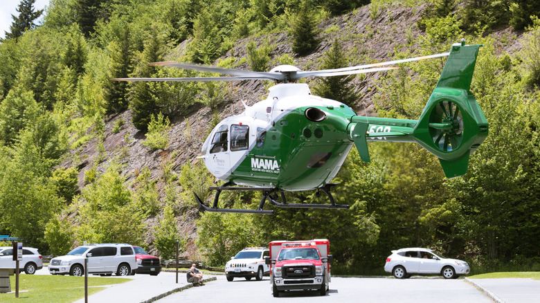
In spring 2026, officials in Great Smoky Mountains National Park handled several dozen emergency calls, according to WBIR 10News. "On average, we run 100 to 120 major backcountry search and rescue incidents every year," supervisory preventative search and rescue ranger Joshua Albritton told the news outlet. Add to that roughly 300 EMS calls for incidents in frontcountry areas like roadways, the visitor center, and campgrounds, and the GSMNP resources can be stretched pretty thin. That's why the park, which is along the North Carolina – Tennessee border in the ridges of the mountains, also sometimes receives additional help from the Tennessee Army National Guard and a local nonprofit called BUSAR, which stands for Backcountry Search and Rescue.
In March alone, Great Smoky Mountains search and rescue teams handled 38 search and rescue calls, including five that were resolved before teams dispatched. That means that they still undertook 33 missions, including hospital transfers via helicopter, two hoist extractions, and four technical rope rescues. Albritton named a few "hotspots" around the park that are among the most common deployment areas, typically because they simply see more visitors. And in a park that experiences the highest annual volume of recreational visits in the whole National Park System — to the tune of roughly 12 million visitors per year — that means visitors also encounter crowded trails and a higher likelihood of accidents.
We've tapped ranger Albritton's rundown in the 10News story as a starting point for this roundup of trails and areas in GSMNP to be especially aware of. We've consulted a number of news stories about specific search and rescue deployments, plus official incident report archives published on NPSHistory.com. We've also researched National Park Service press releases and data and considered visitors' experiences posted on social media. Throughout our roundup, we also shared practical information about popular areas and how to safely enjoy them on your next visit.
Alum Cave Trail
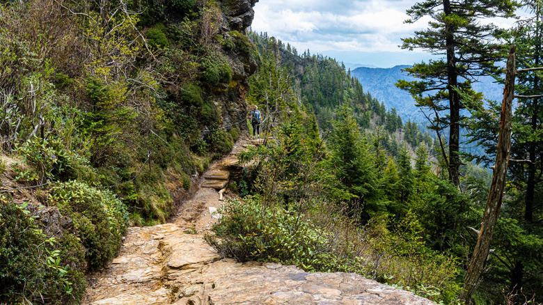
In March 2026, a hiker fell 60 feet to her death from a cliff on the Alum Cave Trail, one of GSMNP's most well-known hiking routes. This Smoky Mountain trail winds past wildflowers and bridges, offering dramatic views of surrounding mountains, valleys, and its namesake geology, which is actually a huge overhanging bluff that towers 75 feet over passersby. From there, the views are expansive, and it's the kind of place that makes you feel like you're really "out there" — and you have to work a bit to earn it.
Overall, the trail is 4.6 miles round-trip, so it's not the length that's the issue. A local guide named Vesna Plakanis told Outside Magazine that one of the reasons it can be treacherous is that it's more slippery, exposed, and steeper than many people realize. Plakanis said, "There are a lot of people who go up there that just have no business being on that trail." Arch Rock, a natural landmark along the way, is a great place to turn around for a more moderate hike that's less steep.
Over the years, incident reports archived on NPSHistory.com describe how hikers have broken ankles, sustained severe spinal injuries and other health emergencies, and even died during the trek. It's not unusual for hikers to lose their footing. But the nature of the terrain plays a significant role in the likelihood of accidents. "Those bluffs are a powdery, mineral-laden sandstone, constantly eroding," Plakanis said of the Alum Cave area. "It's basically like walking on baby powder." The National Park Service also advises that the trail can see extreme crowds, especially during the warmer months. In colder weather, ice can make the slippery areas even more perilous, so slip-on traction devices for your hiking shoes are highly recommended.
Mount LeConte
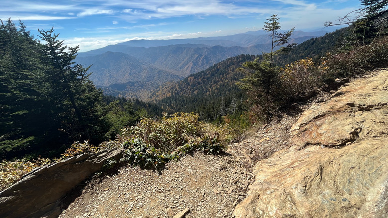
The Alum Cave Trail is one of six formal trails that ultimately lead to the summit of the beautiful Mount LeConte. The others are the Boulevard, Rainbow Falls, Trillium Gap, Bullhead, and Brushy Mountain Trails. Trails periodically close, sometimes just during the week, for maintenance, so check posted closures before heading out. In all, the routes cover 42.5 miles from their respective trailheads to the summit-top LeConte Lodge. They're all steep in places, and Boulevard is one of the most difficult, with lots of ups and downs for just over 8 miles.
At an elevation of nearly 6,600 feet, rescues on Mount LeConte can sometimes be dramatic, multi-unit operations. One life-threatening incident in 2022 involved a visitor who was taken seriously ill while visiting the lodge, resulting in a dual effort by helicopter hoist and ground teams because the cloud cover was so thick that the Tennessee Army National Guard medical crew couldn't access the summit.
Over the past few decades, search and rescue teams have been deployed to different areas around Mount LeConte to assist hikers who experienced dramatic falls, trouble breathing, broken bones, and more. In 2008, a man fell to his death on the Trillium Gap Trail, where he lost his footing from the top of the lofty Grotto Falls. One of the most common reasons for injury and death in GSMNP after motor vehicle crashes and drowning is falling. In general, the park strongly recommends staying on marked trails to avoid encountering unstable terrain. And the diverse types of incidents illustrate that emergencies can happen anytime, even to those of us who are most prepared. All that is to say, though, that the hikes up to Mount LeConte are also some of the most spectacular in the park.
Rainbow Falls Trail
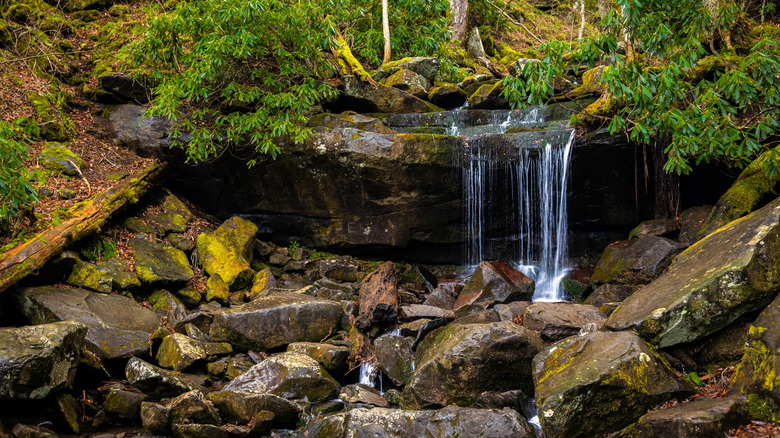
We're not leaving the Mount LeConte area quite yet. Another very popular hike in the park that ultimately heads to the summit is also known for beautiful views of Rainbow Falls, which lends the trail its name. There are also lots of areas of exposed rock, which can be slippery and even quite muddy beneath the tree canopy at any time of year, even if you're not right next to the creek. Creek crossings are required to complete the route in full, so hikers need to be wary of slippery areas and ice when the temperatures drop. "It's good idea to bring trekking poles or a walking stick, because you need them for balance when crossing the base of the falls if you're trying to get close," shared a hiker on Facebook.
Major search and rescue incidents have occurred when children have wandered off-trail and even been attacked by a bear, although instances of this happening are exceedingly rare. A rappelling accident in 2005 caused serious injury to an adventurer who fell 30 feet, and three years later, a group of hikers became trapped in Rainbow Falls Cave, right next to its namesake waterfall, when they were too cold and tired to get themselves out after a night exploring.
Rainbow Falls Trail is 5.6 miles roundtrip, starting from the Rainbow Falls parking lot in the Cherokee Orchard area. Its steep ascent conveys you about 1,500 feet in elevation by the time you reach the falls; from there, you can continue to the top of Mount LeConte. "The trail sign says very strenuous. I have to agree. It's a LOT of UP," says another hiker in the same Facebook post. Like the Alum Cave Trail, the National Park Service advises that hikers should also expect crowds.
Appalachian Trail
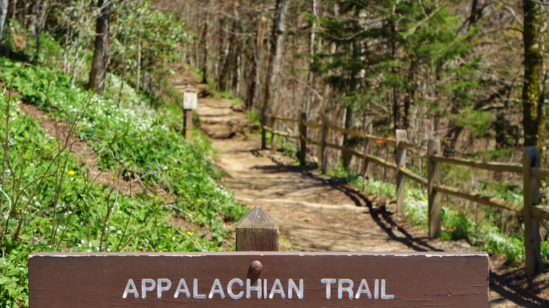
The Appalachian Trail, perhaps the most famous of the U.S.' 11 national scenic hiking trails, stretches nearly 2,200 miles through 14 states from Maine to Georgia, traversing some of the region's most beautiful mountain scenery. In Great Smoky Mountains National Park, 74 miles trace the rim of the range, leading hikers to the highest points along the entire trek right along the Tennessee-North Carolina state border. More than 3,000 people set out to thru-hike the trail every year, not to mention day hikers and those who take on shorter segments along parts of it.
Understandably, this legendary route is a draw for all visitors to the national park, but because it's so heavily trafficked, it sees its fair share of search and rescues. Ranger Joshua Albritton told 10News that early spring can be busy with emergency calls because there's still the possibility of winter storms, plus northbound hikers on the Appalachian Trail are beginning to reach the national park, "so March and April tend to be busy due to those two factors combined."
The Appalachian Trail typically takes around six months for thru-hikers to complete, so it's not too difficult to imagine a range of possible injuries and illnesses. Ticks are prevalent, which can mean the potential for tick-borne illness, which is on the rise. Of course, incidents on trail aren't limited to thru-hikers. In the Smokies specifically, rangers have responded to a wide array of incidents including a lightning strike, hikers trapped in the snow, cardiac incidents, falls, a variety of undisclosed illnesses, and more. Even if you're setting out for just a day or a few days, remember to check the weather beforehand and pack appropriately. The National Park Service's "10 Essentials" is certainly one of the best ranger tips for staying safe while hiking.
Kuwohi Area
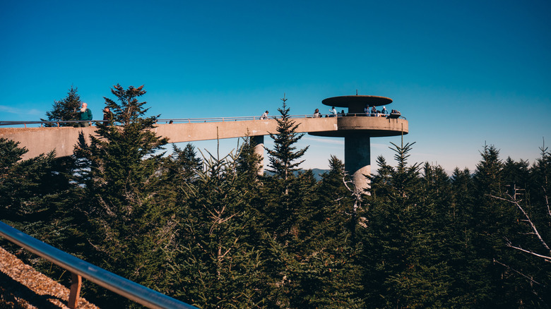
At more than 6,600 feet in elevation, Kuwohi — known as Clingmans Dome until it was returned to its original Cherokee name in 2024 — is the park's highest point. With its elevated observation tower and scenic walks, it's one of the most popular spots in the park for taking in 360-degree views of the mountains. And as we've seen, the more popular the area, the more frequent the search and rescue incidents. There's an accessible, paved trail directly to the observation tower, which is all very developed. However, the area is criss-crossed with numerous other trails that take hikers into the surrounding area's pristine mountains. That's where search and rescue teams head most frequently.
The Appalachian Trail passes directly beneath the observation tower, off of which there's a .5-mile bypass trail to avoid the crowded paved path, which in turn connects to the challenging 11.1-mile Forney Ridge Trail to Andrews Bald. To the east of the tower, from Kuwohi Road, the strenuous Noland Divide Trail stretches south for 11.4 miles. Due to the area's elevation, exposure can be a factor, so visitors should be prepared to bring an extra layer just in case it's cold or rainy.
Hikers should do their due diligence when it comes to realistically assessing their abilities on the trail, especially if taking on the area's demanding routes. One of the area's most thorough search and rescue deployments involved a German tourist who had no prior hiking experience and set out on a circuit route of combined trails that would have amounted to about 17 miles. When he didn't return, a search ensued for more than two days. Fortunately, he was found but still ended up being airlifted to a local hospital.
Cades Cove Loop area
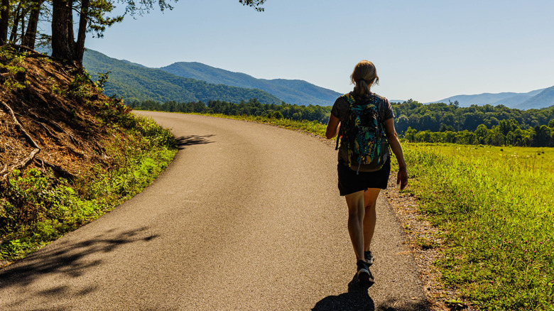
The park's top reason for fatalities is car crashes due to a combination of congestion, narrow two-lane roads, and weather conditions like fog, rain, snow, and ice. The number of fatalities, in addition to deaths from drowning, falls, and other medical issues, puts Great Smoky Mountains National Park among the national parks with the highest death rates. The Cades Cove area is popular for its 11-mile, one-way scenic loop road, from which numerous trailheads, picnic areas, and a visitor center and campground are accessible.
Even though it's not distinguished by steep drops of higher-elevation areas like Kuwohi or Mount LeConte, the Cades Cove area still sees incidences of exposure to the elements and injuries. Unfortunately, the region also sees rangers dispatched to investigate a larger number of suicides or attempted suicides compared to other areas in the park. In a few cases, search and rescue teams were able to reach the victim in time and have them transferred via helicopter to regional hospitals. There have also been instances of kids going missing when they wander too far, drownings, and hikers or trail runners who have simply gotten lost.
Overall, backcountry accidents in rivers and on hiking trails remain a concern like anywhere in the park, but Cades Cove is a hotspot for frontcountry road accidents, including those that have involved bicycles, motorcycles, and rented scooters. Although an occurrence on a well-traveled road likely will spur an EMS response, as opposed to search and rescue, it all depends on the call. Depending on the severity of the event, a helicopter rescue may still be the vital difference between life and death, but often, weather prevents airlifts when they're needed.
If you or anyone you know is having suicidal thoughts, please call the National Suicide Prevention Lifeline at 1-800-273-TALK (8255).
Abrams Falls Trail
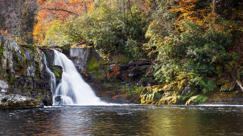
The Abrams Falls Trail is one of the most popular hiking routes in the Cades Cove area, and it's also one of the most dangerous trails in the Great Smoky Mountains. One of the reasons is the falls themselves, which cascade into a pool that may seem inviting, but the park strongly advises against swimming there due to its intense undertow. According to Knox News, in 2021, a visitor drowned at the falls when he was pulled under by the current. The official park incident report noted that he had become "entrapped in underwater debris." And in mid-2009, an international student drowned while visiting with a large university group, many of whom decided to go swimming. He was presumably pulled under by the current. "All sorts of unknown hazards lie at the bottom of our streams and waterfalls," park spokesman Bob Miller told Backpacker.
The Abrams Falls Trail is 5 miles out-and-back, so it's not necessarily very difficult for an experienced hiker, but one thing to keep in mind is the amount of rainfall the Great Smoky Mountains see. Average annual rainfall is 55 inches in the lowlands, with the high point of Kuwohi seeing an average of 85 inches. There aren't many other U.S. national parks that see that much rain throughout the year. So, when it comes to hikes along rivers and to beautiful falls in the Great Smoky Mountains, hikers need to be aware of the impact of rainfall as it flows into the park's waterways. Precipitation makes for stunning and dramatic cascades, but no one wants to get caught up in one.