California's 5 Longest Rivers Area Gorgeous Natural Landmarks Perfect For Outdoor Adventures
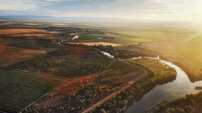
When you think of a day out in nature, enjoying water in California, you probably imagine lounging on the purple sands of Pfeiffer Beach in Big Sur or watching the waves crash on the rugged cliffs of the Channel Islands. There's more to California's waters than the Pacific Ocean, however. The state is home to some impressively long rivers, where eager prospectors sifted through the silt for gold, and steamboats once carried passengers all around the Golden State. If you're interested in seeing California's rivers for yourself, you have plenty to choose from, but the longest are the Pit River, the Klamath River, the San Joaquin River, the Sacramento River [pictured], and the mighty Colorado River.
Whether you're spending your day hiking through the canyons along the banks of the Pit River, out at dawn birdwatching in the wetlands around the San Joaquin, or paddling a canoe through the dusty red Mojave Desert and watching the setting sun reflected on the Colorado, California's rivers offer endless opportunities to see the wild beauty of the state's diverse landscapes. With more than 2,700 miles of rushing water to see, you could easily spend a lifetime exploring their banks — but if you are just booking for a great starting point for your adventure outdoors, any one of these long California rivers might be the perfect destination.
The Pit River
Some of the very highest peaks of the towering Cascade Mountain Range can be found in Northern California, including the ancient volcanoes Lassen Peak — a tall, rocky mountain dominating the wilderness landscape that surrounds it — and the jagged, pointy Mount Shasta, usually covered in snow and ice even when the land around it is lush and green. Between these two distant peaks, a long, winding river cuts through the mountainous landscape: the 207-mile Pit River. Don't picture a peaceful, slow-flowing river meandering between mountains. Despite the dams, powerhouses, and diversions used to moderate its flow, the Pit is a powerful, rushing river that surges through the canyon. Adventurous whitewater kayakers challenge themselves to paddle its turbulent blue waters. Some people fish here, but it's not a relaxing place to stand in the water. The rocky bottom is slippery, and the powerful current can easily knock you down.
One of the most beautiful places to see the Pit River is the Modoc National Forest. Hike the Lassen Trail to Hanging Rock, a relatively easy, two-and-a-half-hour trail route that takes you right along the riverbank. The trail can be overgrown and includes some stream crossings, but it rewards hikers with incredible views of the river flowing past the sheer, craggy rock formation known as Hanging Rock. This rock was once part of an ancient reef and is packed with the fossilized remains of the creatures that once lived there, but you can still see plenty of wildlife living in the area today, too. Keep your eyes open for bald eagles swooping overhead and river otters playing in the Pit.
The Klamath River
Born in the deserts of Oregon, the Klamath River quickly leaves populous areas behind as it reaches California. Once in the Golden State, branches of the Klamath flow through rainforest, around titanic mountains, and through wild landscapes like the underrated Trinity Alps Wilderness, before ultimately joining the Pacific Ocean. This breathtaking 263-mile natural landmark was once a very different place — its flow controlled by dams, its water quality harmed, and its fish struggling. Thanks to massive restoration projects that removed the dams and began addressing some of the impacts of agriculture, the river is returning to a wilder state, one where wildlife can thrive again.
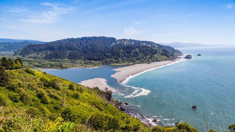
This fish-filled river is also one of the best places in America for bird lovers hoping to see raptors. The upper basin of the Klamath lies along the Pacific Flyway, a migration route, and serves as a hub for hungry and tired birds looking for a place to pause on their journeys. It is one of the top destinations to look for bald eagles. The most spectacular place to see the Klamath, however, might be in California's otherworldly Redwood National Park. The Klamath River Overlook [pictured] sits above the spot where the river flows into the ocean. This overlook is a favorite for gray whales and seals, and is an unforgettable place to watch the sun sink into the horizon. As an added bonus, the trail to the overlook features signs that tell the story of the Klamath River and how it has shaped the lives of the people who lived along its banks long before colonization.
The San Joaquin River
California's Sierra Nevada mountains are known for their ethereal beauty, high peaks, and staggering appearance. High in these mountains, the San Joaquin River forms from mountain streams before flowing down the slopes and rushing 366 miles to join with the waters of the Sacramento River and flow into the Pacific Ocean. This river is undeniably beautiful and creates habitats for diverse wildlife, but it is also vital for agriculture in this region. Its flow has been controlled by dams for this reason, causing serious damage to the ecosystem and pushing species that once thrived there to the edge of extinction. Despite its desperate need for protection and restoration, the San Joaquin remains a beloved natural landmark in the region and a hub for outdoor adventure.
To see the river, consider hiking part of the proposed San Joaquin River Trail, which is expected to one day be more than 100 miles long, mostly following the river, and leading travelers to destinations like the underrated Devil's Postpile National Monument and along a small portion of the iconic west coast thru-hiking route, the Pacific Crest Trail. To experience this river as it once was — and how it could be again one day if restoration efforts continue — consider a trip to the San Joaquin River National Wildlife Refuge. This refuge is a safe haven for migrating birds and home to wildlife of all kinds, including the once-endangered Aleutian cackling goose and the still-endangered riparian brush rabbit, both of which rely on this habitat to survive.
The Sacramento River
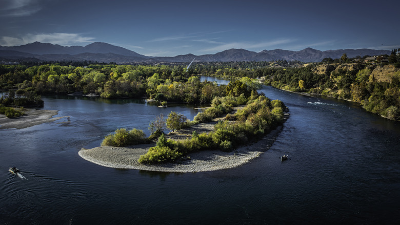
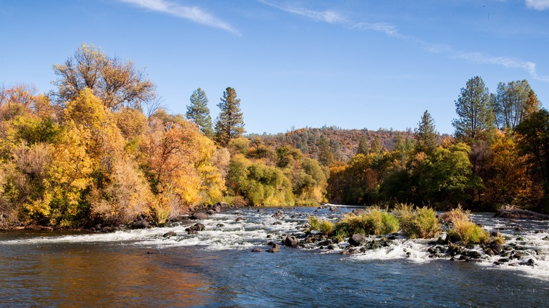
Sprawling an impressive 380 miles out of the Klamath Mountains to spill into the San Francisco Bay, the Sacramento River forms a massive network of rivers and creeks that makes up around a third of California's surface water. Unfortunately, the Sacramento is under threat due to development along its banks and changes in its course to support agriculture. In areas where forests are being restored, native species, from bald eagles to beavers, have begun to return to the river. You can view the river along its hundreds of miles, but the most beautiful stretches lie within protected lands rather than cities and towns.
Consider a trip to the underrated Castle Crags State Park for river and mountain views away from crowds and urban landscapes. You'll also encounter the 6,000-foot-tall sheer rock formations that, true to their name, do look surprisingly like the turrets of some fantasy fortress. The Upper Sacramento River Trail provides gorgeous views of the water without being too challenging. Another great destination is the Bidwell-Sacramento River State Park, where you can see the river in its natural state. Head to the Pine Creek Unit to explore the river and the forested banks, and keep your eyes and ears alert for birdsong above the rushing water.
The Colorado River
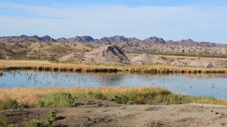
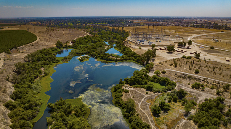
The Colorado River might take its name from the state where it originates, but it flows for a staggering 1,450 miles and supplies water to seven states in its basin, including California. Millions of people rely on the river for their water supply, with a large share going to Californians. In fact, across Southern California, about a third of its urban water comes from the Colorado. It also supplies drinking water to some of the biggest cities in the state, like Los Angeles and San Diego. The combination of this heavy use and the impacts of the climate crisis has led to a worrying loss of water in its basin and reservoirs — but when you see its powerful current flowing through the incredible California landscape, you wouldn't necessarily know it.
Given its length, it's no surprise that there are plenty of beautiful spots to view the Colorado River. A great place to start might be in California's Picacho State Recreation Area [pictured]. Once a small mining community, it now offers a gorgeous desert landscape where visitors can see rough, dusty mountains rising up from the river's blue-green waters. You can go kayaking here and paddle through the wilderness, and in the spring, you will be treated to a colorful, mesmerizing display of blooming wildflowers.