
The Midwest's 12 Most Beautiful Forests
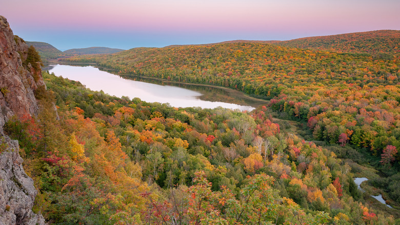
The Midwest may not have towering sequoias, redwoods, or even ancient bald cypresses like the ones found around Mississippi's serene Alluvial Valley. However, it's still renowned for its forests — especially in the north. While much of the region is also natural grassland or has been converted into agricultural fields, the forests preserved by state and national conservation groups and forestry units remain some of the country's most stunning wildernesses. Fortunately, they're also hot spots for hiking, paddling, camping, and a wide range of other outdoor recreation activities.
Below, explore 13 lovely forests, each with its own unique character, whether in its sheer scale, age, ecology, or scenic beauty. Often, you'll discover all of the above. We've emphasized well-known national forests along with some perhaps lesser-known state forests that are well worth a visit. Some are characterized by their water as much as the trees, while others center around second-growth forest or striking rock formations. Naturally, much of the list is centered on the Upper Midwest and Great Lakes region, as the further west you travel, the more woods give way naturally to sprawling grasslands and riverine expanses. (It turns out one of the quietest places on earth is in Nebraska.)
As a long-time resident of the Upper Midwest, I've visited many of the places on this list, and we also drew from resources like World Atlas and Osprey, which compiled helpful lists of national forests in the region, plus the U.S. Forest Service and the National Forest Foundation. We also, where possible, referred to visitor comments in reviews and noted where to find some of the best views. Read on for inspiration for your next nature-infused Midwest road trip.
Chequamegon-Nicolet National Forest (Wisconsin)
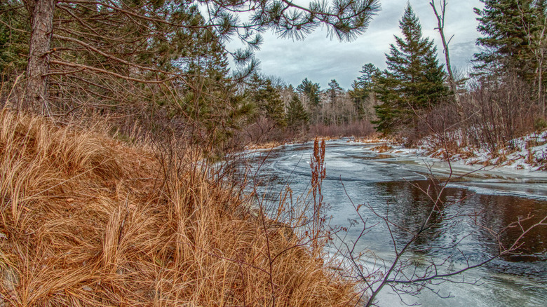
Spanning more than 1.5 million acres in northern Wisconsin, Chequamegon-Nicolet National Forest is a sprawling destination for camping, cabin stays, snowmobiling, and much more. Along with Northern Highland-American Legion State Forest, it practically defines the Wisconsin Northwoods, where vacation-seekers and outdoor recreationists have flocked for decades to fish on flowages — dammed rivers that often flooded several lakes to create chains of water bodies ideal for paddling and boating — and hunt, boat, canoe, and more. Hike a segment of the North Country National Scenic Trail, or climb to the top of the Mountain Fire Lookout Tower to see sprawling views over the treetops.
Ecologically, Chequamegon-Nicolet encompasses two distinct ecological regions: the North Central Forest and the boreal Northern Highland. The former is home to trees like birch, aspen, spruce, and fir, while the latter has more upland conifers. It's also separated into a few distinct units: west and south of Ashland, east of Park Falls, northwest of Medford, and a stretch from the border of Michigan's Upper Peninsula south to Mountain. Around 2,000 miles of streams flow through the forest altogether, and there are more than 800 miles of trails to explore. Camping is a fantastic opportunity to immerse yourself in nature, with dozens of recreation areas and campgrounds, such as Anvil Lake Recreation Area and Laura Lake. Boulder Lake Campground is the forest's largest and most popular option, with several shaded sites along the water.
Brule River State Forest (Wisconsin)
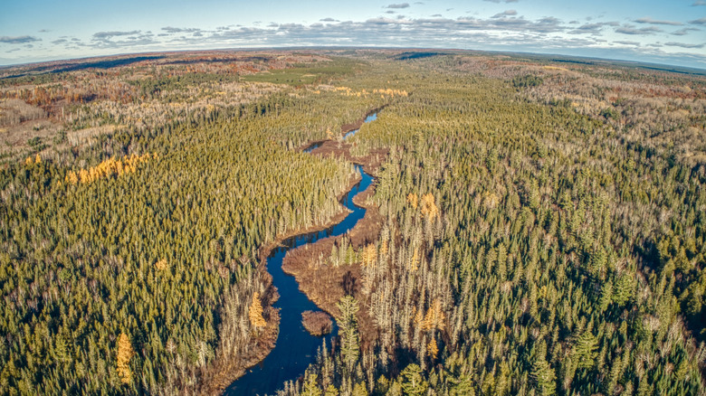
For another Wisconsin destination located roughly halfway between the cities of Ashland and Duluth, Minnesota, Brule River State Forest has it all: several miles of Lake Superior shoreline, the entire 44-mile stretch of the Bois Brule River, two campgrounds, and habitat biodiversity that ranges from wetlands and streams to grasslands and coniferous trees.
Photographers and naturalists love it here for the range of wild landscapes, as well as the possibility of spotting wildlife such as great gray owls, badgers, and even gray wolves. And outdoor recreation abounds with more than 20 miles of the North Country National Scenic Trail, snowmobile trails, hunter walking trails, and forest roads that provide ample places to horseback ride, hike, or bike.
Hoof it along the 1.7-mile Stoney Hill Nature Trail, where you'll find a viewpoint at the top overlooking the lush river valley. Or take to the water in a canoe or kayak. "We didn't see anyone else for the whole nine miles we paddled," shares a visitor on Tripadvisor. "The forest and the river are both pristine and full of wildlife." And while summertime is typically the busiest season, winter in the Northwoods is a spectacular sight. The forest is also known for its Afterhours Trails, a network of cross-country skiing and snowshoeing routes that are among the best in the region due to the DNR's partnership with the Brule Valley Ski Club.
Kabetogama State Forest (Minnesota)
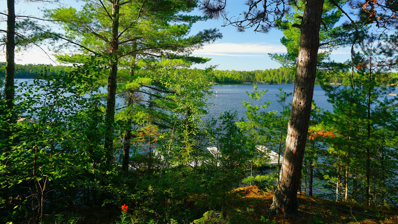
No list of Midwest forests would be complete without a mention of the spectacular Boundary Waters Canoe Area Wilderness and even Voyageurs National Park in northern Minnesota, with Kabetogama State Forest serving as a major gateway. It spans more than 620,000 acres and features dramatically exposed bluffs and hills along with numerous lakes and wetlands. Kabetogama Lake, which sits at the northern boundary, is where you'll find one of the visitor centers for Voyageurs, along with Woodenfrog Campground and Day Use Area, one of the state forest's four campgrounds.
Toward the southeastern edge of the forest, Vermilion Lake also hosts two campgrounds, one of which is boat-in only on Hinsdale Island. One visitor shares in a Google review that Vermilion Lake "offers some of the best scenery in Minnesota." Being out on the water is what people flock to Kabetogama for, where a mix of trees lines the shoreline of interconnected waterways that visitors can paddle and camp along for miles. Dispersed camping on the forest's many islands and remote shorelines affords the best views in the area, plus plenty of peace and quiet.
Superior National Forest (Minnesota)
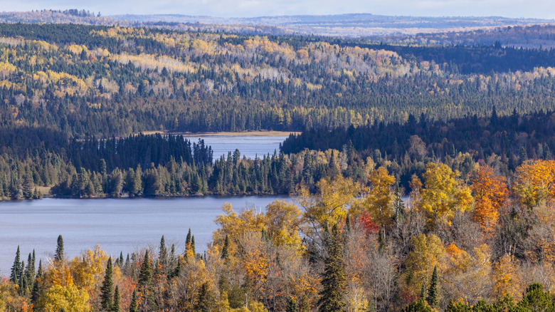
The largest national forest east of the Mississippi River, Superior spans a whopping three million acres, almost a sixth of which is water. Its northern third is designated as the Boundary Waters Canoe Area Wilderness, where visitors can navigate over 1,200 miles of scenic canoe routes and camp at any of hundreds of campsites along rocky, glacially-carved shorelines and islands. That's certainly not all, though. Superior National Forest has five districts that span Minnesota's Arrowhead region, so named for its pointed shape where it meets the Lake Superior shoreline and the Canada border.
You'll find stunning, secluded campgrounds like the secret lakefront Toohey Lake Rustic Campground, plus hiking trails covering more than 400 miles. Whether you canoe, camp, hike, snowmobile, or all of the above, this national forest brims with beautiful expanses of conifers, hardwoods with leaves that change vibrantly in the autumn, streams, and spectacular wildlife. Look for gray wolf or Canada lynx tracks, listen for hundreds of bird species, and fish to your heart's content for walleye, crappie, lake trout, northern pike, and more.
Porcupine Mountains Wilderness (Michigan)
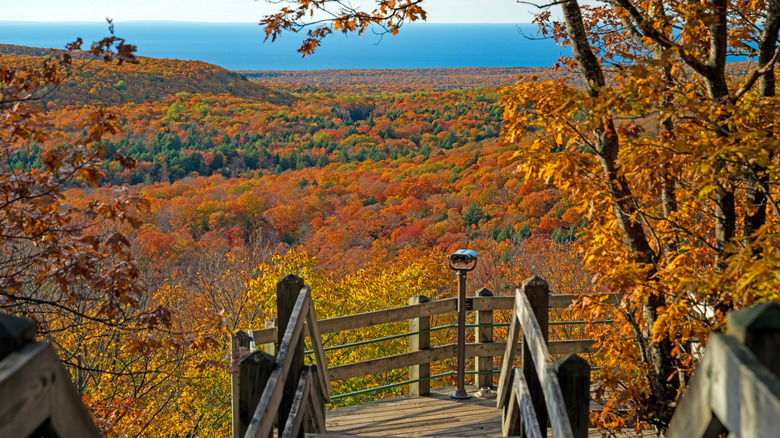
Spread over a hilly expanse of Michigan's Upper Peninsula, Porcupine Mountains Wilderness State Park — known to regulars as "The Porkies" — is a beautiful stretch of wilderness with stunning lakes, waterfalls, renowned hiking and hike-in cabin stays, campgrounds, and Lake Superior frontage. The whole park spans 60,000 acres, more than half of which is composed of old-growth northern hardwood trees that are incredibly rare at this scale due to aggressive logging of many forests throughout the 19th century and early 20th century, along with settlers' redevelopment of wooded land into farm fields. And thanks to the Porkies' hilly terrain, the views of the vast lake that the Indigenous Ojibwe people call Gichigami are simply incredible.
The Escarpment Trail is one of the most popular hikes in the park thanks to its elevated viewpoint overlooking one of the Porkies' best known features, Lake of the Clouds. You can hike the whole thing for a little more than eight miles out-and-back or take on just a small section of it toward the western end of the lake, combined with part of the North Mirror Lake Trail, for various vantage points. Hike to one of 19 rustic backcountry cabins — the furthest is a 9-mile hike and truly secluded — cozy up in a yurt, set up your own equipment in a campground, or stay at the historic Kaug Wudjoo Lodge.
Hiawatha National Forest (Michigan)
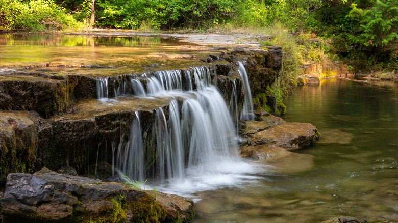
Another Michigan Upper Peninsula gem, Hiawatha National Forest spans 900,000 acres and touches three of the five Great Lakes: Superior, Huron, and Michigan. It's organized into two units: one toward the eastern side of the peninsula, which stretches north from St. Ignace to Whitefish Bay, and the other toward the center of the peninsula, stretching south of Munising to the Lake Michigan shoreline. This aptly nicknamed "Great Lakes National Forest" is a draw for kayaking through pristine waters and experiencing picturesque rocky beaches and tree-lined bluffs. You'll also encounter beautiful waterfalls and opportunities for rock climbing, hiking, fishing on 75 lakes and hundreds of miles of streams, and camping in dozens of campgrounds.
Some of the most beautiful vistas stretch along the Lake Superior shoreline, where turquoise waters lap against sandstone cliffs. On the northern shore of the eastern unit, Bay View Campground has pleasantly shaded sites and beautiful views of Lake Superior. On Grand Island in the western unit, pleasant rustic cabins nestle in sylvan surroundings and offer plenty of tranquility. "Absolutely beautiful, but be prepared for bugs," shares a visitor on Google.
Huron-Manistee National Forest (Michigan)
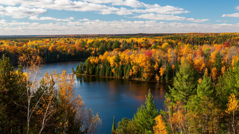
In the northern region of the Lower Peninsula of Michigan, Huron-Manistee National Forests encompasses two major units, one of which is known as the Huron Zone and spans an area between Grayling and Au Sable on the Lake Huron shoreline, and the other, called the Manistee Zone, sits roughly between Manistee, Muskegon, and Cadillac on the western side of the state. Between them, the forests boast four designated Wild and Scenic Rivers, and it's a popular spot for fall leaf-peeping scenic drives, camping, fishing, and more. Experience hikes like the Manistee River Loop, one of Michigan's top backpacking adventures, or dig into history at the log cabin-style Lumberman's Monument Visitor Center. You can even walk aboard a wanigan, a kind of floating cookhouse on a raft where loggers would have replenished their calories.
Scenic drives offer endless beautiful views in Huron-Manistee National Forests, including the River Road National Scenic Byway, which extends 22 miles through the Au Sable River Valley. High bluffs offer gorgeous elevated views, which are especially popular in the fall when the trees explode with color. In winter, the landscape is both striking and serene under a layer of snow. About 600 miles of trails are ideal for snowmobiling between both the Huron and Manistee Zones, with more than three dozen trails also ideal for cross-country skiing and snowshoeing.
Wayne National Forest (Ohio)
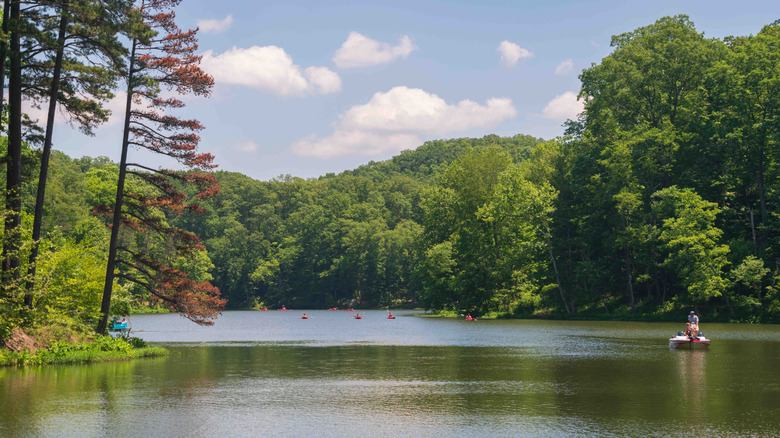
Ohio is home to only one national forest, which you'll encounter in a cluster of three units on the state's southeastern side. Overall, Wayne National Forest covers more than 240,000 acres, and its woodsy, rolling landscape is characteristic of the Appalachian foothills. While it doesn't contain any old-growth forest due to the area's conservation aim to reforest areas that were clear-cut during the 19th century, the oldest trees still reach about 100 years old and make for gorgeous views across lakes and from rock outcrops. Head to Lake Vesuvius Recreation Area for a couple of campgrounds, a swim beach, boating, fishing, and bucolic picnic spots. And for an eminently scenic drive, don't miss the Covered Bridge Scenic Byway, which traces the Little Muskingum River for 35 miles and features several historic, wooden bridges. You'll want to make sure to have your camera!
Wayne National Forest is popular for its nearly 150 miles of OHV trails, and mountain bikers will find a wonderfully rewarding ride along the Archer's Fork Trail, which is also ideal for a challenging overnight backpacking trip. Archer's Fork spans about 14 miles in a squiggly loop, passing by dramatic bluffs and local natural landmarks like the Irish Run Natural Bridge. The natural rock formation is over 51 feet long and 19 feet wide, and it's just one of a handful you can discover throughout the national forest. In total, hikers have access to more than 300 miles of trails.
Hoosier National Forest (Indiana)
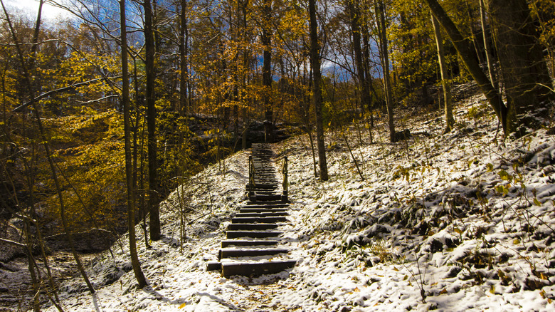
In the picturesque hills of southern Indiana, Hoosier National Forest is ideal for a rustic escape in nature. Visitors find lakes, sandy beaches for swimming, fishing, rolling hills, scenic trails, and endangered species. Three different species of endangered bats call the many hundreds of caves in the area home, and the karst formations — a geological phenomenon that results from thousands of years of water gradually dissolving bedrock into caverns and other features — create a subtly dramatic landscape. Take in the view from the water on the expansive Monroe Lake with a relaxing paddle or a swim at the beach, or head into the woods on more than half a dozen trails at three recreation areas around the lake.
With more than 260 miles of trails, there's plenty to explore in Hoosier National Forest, including the Hemlock Cliffs Special Place. Archaeological studies have revealed that Indigenous Americans lived in this area as far back as 10,000 years ago, and explorers can see small caves, towering cliffs, and disappearing streams. "The trail through the Hemlock Cliffs Special Place leads to waterfalls, hemlock-lined cliffs, and babbling brooks," shares a visitor on Tripadvisor. "The trail can be challenging in places, but the views are worth the effort." Another spot to take in the view is atop the Hickory Ridge Fire Tower, built in 1936 and now open to the public if you're willing to climb all 133 steps.
Shawnee National Forest (Illinois)
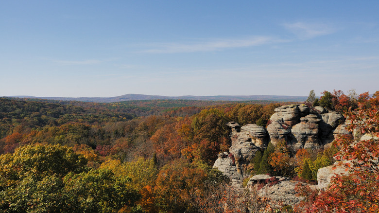
Across nearly 290,000 acres, Shawnee National Forest is a woodland oasis between the Ohio and Mississippi Rivers in southern Illinois. In a prairie state that doesn't typically pop to mind when you think of hills and dramatic vistas, the region nevertheless features beautiful weather-worn bluffs, winding rivers, numerous lakes, and rolling vistas that can be viewed from elevated areas along more than 300 miles of trails. The national forest encompasses the beautiful Shawnee Hills, sprinkled with waterfalls and canyons, plus a portion of the northern Ozarks, where the forest is a haven for photographers in the fall when the leaves glow with fiery hues.
Take a drive along the LaRue Pine Hills scenic route, where you can look over the distinctive landscape atop high bluffs, or cruise along a part of the Ohio River National Scenic Byway, which passes by the striking Garden of the Gods. Here, a short trail leads to a stunning overlook of rock formations and the distant horizon. And after a day well spent, several campgrounds offer a range of different types of sites and amenities, all of which are first-come, first-served. The most developed option is Oak Point Campground within the Lake Glendale Recreation Area, where both electrical and water hookups are available. Take in lake views from a boat or kayak, or strike out on an easy hike around the water along the 3-mile Lake Glendale Trail.
Mark Twain National Forest (Missouri)
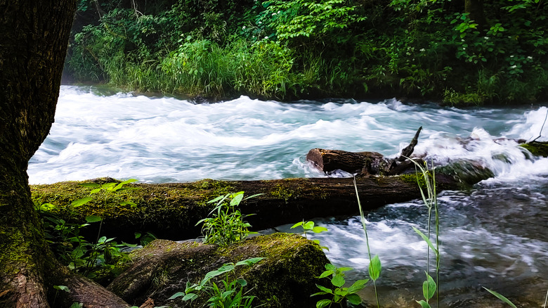
Across nine units scattered throughout southern Missouri, Mark Twain National Forest showcases the northern Ozarks' stunning landscapes of trees, water, hills, and glades. In total, nearly 1.5 million acres are alive with myriad trees, hundreds of miles of streams through lush glens, and over 750 miles of trails, including parts of the Ozark Trail. This sprawling national forest offers crystal-clear springs and horseback riding, plus a handful of scenic drives like the Glade Top byway, which follows a high ridge and offers gorgeous views of its namesake clearings and long views from pull-out viewpoints along the way. At 23 miles, it's a popular option for road cyclists, too.
Camping is an age-old pastime in Mark Twain National Forest, where most campgrounds are open between April and October. One of the most popular spots to pitch a tent or roll in with the RV is the Silver Mines campground and day use area, which sits along the St. Francis River. This energetic waterway offers ample opportunities for paddling, especially when spring flows make for good whitewater kayaking. And if you're headed to Chadwick Riding Area, popular with dirt bikers and OHV drivers, head to Cobb Ridge for a campground tucked idyllically in the trees.
Black Hills National Forest (South Dakota and Wyoming)
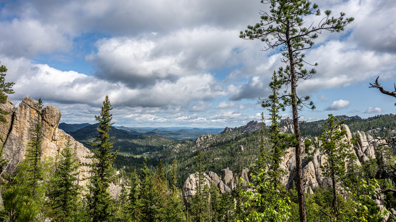
South Dakota sits in a unique transitional zone where the Midwest gradually gives way to the West, but opinions vary on which region people consider themselves to live in. A survey by the journal Middle West Review found that over 90% of respondents in the Mount Rushmore State consider themselves to live in the Midwest, and more than half of respondents in Wyoming thought the same. So, we'd be remiss if we didn't mention one of the area's most striking landscapes: the Black Hills. The landscape brims with beautiful lakes, bluffs, pine trees, and historic communities like Deadwood, Lead, and Hill City, a hidden paradise for adventure-lovers.
Spanning the border of South Dakota and Wyoming across 1.2 million rocky, mountainous, tree-crested acres, Black Hills National Forest is a storied and stunning place. To the Indigenous Lakota people, the area is sacred and known as Paha Sapa, which literally translates to "the hills that are black" — the cosmological heart of their culture. It's also home to Mount Rushmore and the in-progress Crazy Horse Memorial, where, on occasion, you can hike up the world's largest mountain carving.
Drive up to the northern part of the forest to the beautiful Spearfish Canyon, where you can stop to view waterfalls. Then head to the aptly named Sylvan Lake for paddling, hiking, and picnicking within view of its unique rock formations. And when you're ready to relax, head to the tranquil Horsethief Lake Campground, which is only a 10-minute drive to Mount Rushmore but is tucked in the trees and feels a world away.