
The Most Breathtaking Scenic Drives In Popular National Forests For Fall Foliage
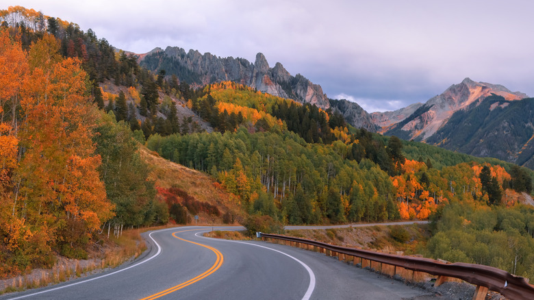
Every year, as summer wanes, we look forward to the forest's big end-of-season show. The days shorten, temperatures cool, and trees' production of chlorophyll — the green pigment fundamental to photosynthesis — calls it quits so energy can be stored up for the coming winter. Leaves already have the pigments in them that generate the glowing yellows, oranges, and reds we see in the autumn, but it's not until the green fades that we get to see these colors in all their glory. And what better way to enjoy their diversity and stunning contrasts than on scenic drives through some of the U.S.'s most beautiful national forests?
Below, explore 12 scenic drives through national forests across the U.S. that are known not only for their scenery in general but also for amazing fall colors. They span numerous states and geographic features from Colorado's southernmost national forest to Missouri's rolling northern Ozarks to Southern California's San Bernardino Mountains. Depending on their latitude and elevation, colors will peak at different times. Farmer's Almanac has a handy interactive map that can help you plan. We've noted when the best times are to visit these iconic byways for the most vibrant hues, but be forewarned: These popular routes can be busy during that time of year. Two-lane roads and winding mountain drives can mean slow traffic or limited parking, so just come prepared with a little extra patience, especially if you're traveling on a weekend.
To compile this list, we've relied primarily on resources published by the U.S. Forest Service and the National Scenic Byway Foundation. We've also consulted articles from Travel+Leisure, NationalForests.org, and regional tourism sites. For the best places to stop along the way, we've trawled visitor ratings on Tripadvisor, Google, and Recreation.gov to make sure we're sharing the best.
Glade Top Trail, Mark Twain National Forest (Missouri)
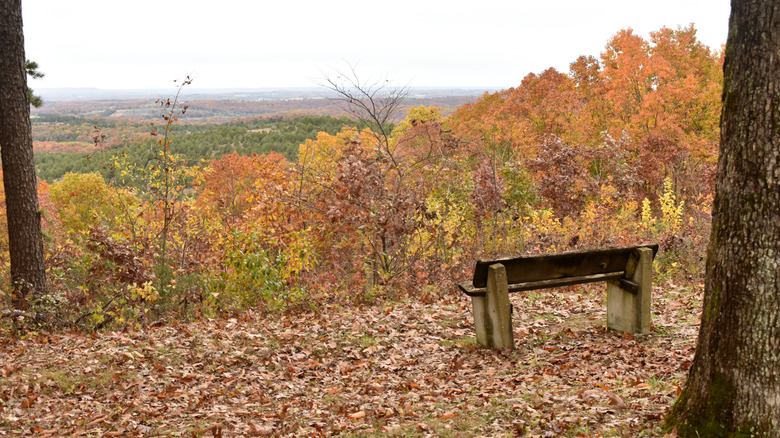
Along a 23-mile stretch in southeastern Missouri's Mark Twain National Forest, Glade Top Trail National Forest Scenic Byway is a gem at the northern reaches of the Ozarks. Peak color usually pops between mid- to late October as oaks, hickories, and sassafras — with its characteristic triple-pointed leaf — transform into a sea of oranges and reds. The Glade Top Trail has seven pullouts to take in panoramic views of its titular natural features, which are defined by a type of grassland with hundreds of species of native plants. To the south, you can even see as far as the Boston Mountains in Arkansas.
From a practical standpoint, the route is gravel, just as it was when it was constructed by the Civilian Conservation Corps in the 1930s, and it's open all year. It's also very rural and makes a kind of upside-down "y" shape, so there's a main northern leg and then east and west branches toward the south. You'll find picnic spots along the way, and if you have overnight equipment, dispersed camping is permitted at the Corbitt Potter and Willie Lee stops. From Willie Lee, you can also strike out on the Bateman Trail, a 16-mile route popular with hikers, horseback riders, and mountain bikers. Lined with oak and hickory trees, it's a great way to see foliage up close on an atmospheric walk, whether you're camping in the forest or just passing through for an afternoon.
Talimena National Scenic Byway, Ouachita National Forest (Arkansas and Oklahoma)
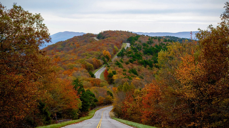
Unique from any other mountain range in the U.S., the Ouachita Mountains (pronounced "wash-it-ah") run east-west rather than north-south, and most of the gentle summits and ridges fall within the 1.8-million-acre Ouachita National Forest. It's here in western Arkansas and southeastern Oklahoma that you'll find one of America's best fall foliage drives, illuminated with the warm hues of maples, oaks, sweetgums, and more. The Talimena National Scenic Byway is a winding 54-mile route that stretches from U.S. Highway 271 north of Talihina, Oklahoma, to U.S. Highway 59 in Mena, Arkansas — hence, Talimena. Since we're a bit south, expect to see peak color between late October and early November.
Although the scenic drive bypasses nearby towns to head over the ridges of Winding Stair and Rich Mountains, the area's nearby communities are worth a visit to grab lunch or use as a basecamp for further exploring the region's attractions such as Winding Stair Mountain National Recreation Area — which Talimena Scenic Drive goes right through — or Lake Wister State Park to the north. In Mena, Skyline Cafe has been running for more than 100 years, and it's a great place to fuel up with breakfast before making your first stop at Arkansas' Queen Wilhelmina State Park. On the other end, in Oklahoma, stop at Talimena State Park for a picnic.
River Road National Scenic Byway, Huron-Manistee National Forest (Michigan)
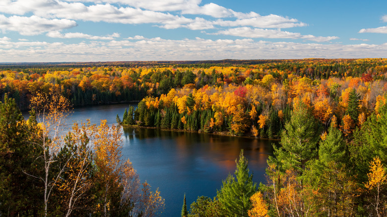
The beautiful River Road Scenic Byway conveys joyriders for 22 miles through Huron-Manistee National Forest, one of the Midwest's most beautiful. This northeastern Michigan gem is home to four nationally designated Wild and Scenic Rivers, one of them being the Au Sable River, which the byway traces. Along its southern bank, a number of scenic pullouts and overlooks offer spectacular views from atop high dunes, plus access to hiking trails, monuments, and interpretive sites. Peak color is usually seen between late September and early October, and Pure Michigan's Fall Color Map can help you plan.
One of the best ways to really soak in the fall atmosphere is to camp along the riverbank, where the U.S. Forest Service manages more than 100 dispersed sites accessible from the River Road Scenic Byway and beyond. At the end of the route, near Hale, you'll also find the small, more developed Rollways Campground, which provides elevated views over the river. And whether you begin, end, or loop back to the eastern gateway towns of Au Sable and Oscoda, where you'll also find an under-the-radar scenic marshland, choose from a range of vacation rentals and budget-friendly hotels, perfect for further exploring the Lake Huron shoreline.
Nicolet-Wolf River Byway, Chequamegon-Nicolet National Forest (Wisconsin)
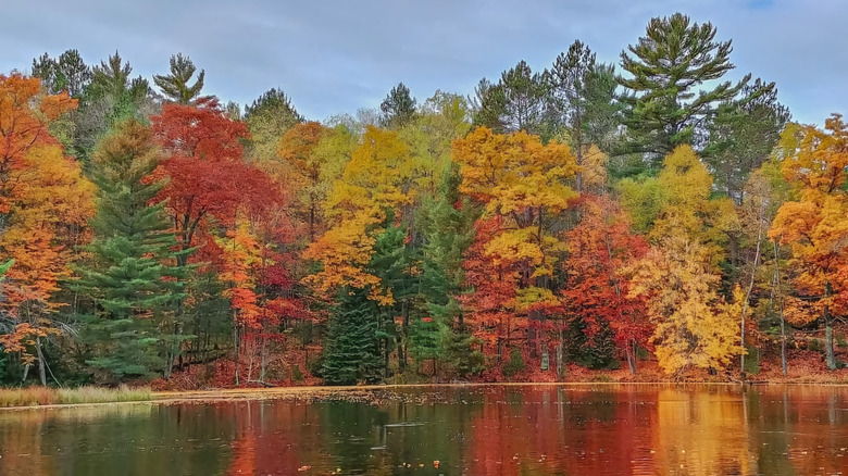
More than 1.5 million acres of forest, rivers, and lakes fall under the banner of Chequamegon-Nicolet National Forest. Originally two separate national forests that are now managed as one, it has two areas: the Chequamegon region to the west and the Nicolet region to the east. The latter is where you'll encounter the Nicolet-Wolf River Scenic Byway, which covers 145 miles around a pair of loops connecting the communities of Langlade and Carter in the south to Nelma in the north, which sits at Wisconsin's border with Michigan's Upper Peninsula.
Rather than a straight shot, you can meander around one loop of the Nicolet-Wolf River Scenic Byway, do a figure-eight, or head up one side and back down the other — it's up to you. And along the way, you'll drive along picturesque two-lane roads, through inviting small towns, and past myriad lakes. Hardwoods like maple, birch, and oak turn vibrant reds, oranges, and yellows, which are set off by evergreens and look stunning reflected in the region's hundreds of lakes and streams. You can typically expect colors to start changing by mid-September. The byway is also a great choice for those who love to casino-hop. Stop at the Potawatomi Carter Casino Hotel or Mole Lake Casino Lodge for either a place to stay or an excuse to try your luck.
Gunflint Trail, Superior National Forest (Minnesota)
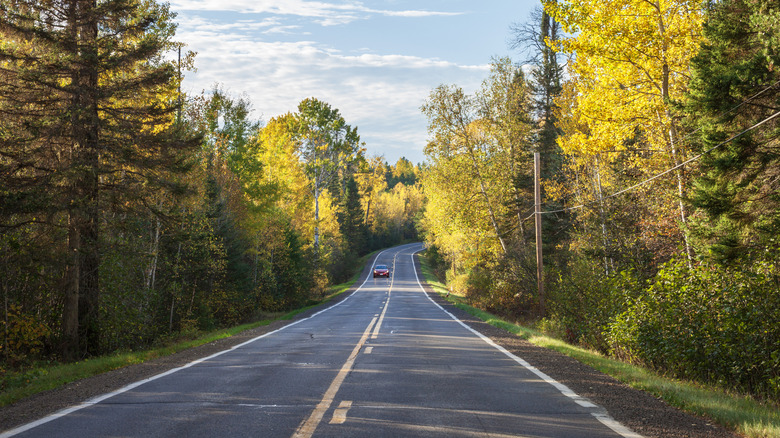
In the northeastern portion of the vast, 3-million-acre Superior National Forest, you'll find prime fall foliage viewing opportunities along the historic, 57-mile Gunflint Trail. The area skirts the Boundary Waters Canoe Wilderness Area, which, as its name suggests, is generally best experienced on the water. But the route doesn't have the nickname "driveway to the Boundary Waters" for nothing, as it's a time-honored way to explore northern Minnesota's woods and lakes with historic resort stays along the way. Here, birch and aspen turn bright yellow, and tamaracks take on a golden glow before dropping their needles. Along this "out-there" route, who knows, you might even see a moose.
Even though it's pretty far north, peak color may not arrive until October, but by mid-September, you'll already start seeing change. At Saganaga Lake, the route's northern terminus, stop by the Chik-Wauk Museum and Nature Center to learn about the Gunflint Trail, which was once an important trade route for Indigenous Americans. On the other end of the byway is the inviting North Shore artsy haven of Grand Marais, where you'll find endless Lake Superior views and quaint shops. Make sure to grab a doughy treat from World's Best Doughnuts, a quaint local icon since 1969.
White Mountain Trail, White Mountain National Forest (New Hampshire)
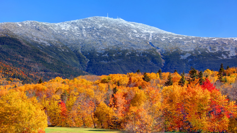
Striking mountain vistas and small towns await along the 100-mile White Mountain Trail National Scenic Byway. Named for the mountains it rolls through, plus White Mountain National Forest, this New Hampshire tour is a jewel in the fall as it heads through three passes, or what New Hampshirites tend to call "notches." Overall, it makes a kind of wonky "m" shape that can be linked via the equally splendid Kancamagus Scenic Byway in the south to complete a loop. And it connects communities like Bretton Woods, where you'll find the state's largest ski area with the "best downhill skiing," to Conway and Woodstock.
Colors tend to be at their most brilliant in the White Mountains between late September and early October, with vibrant beeches and other hardwoods turning golden, orange, and deep red. As the landscape climbs to boreal and alpine zones, trees transition to conifers, creating a stunning contrast with the lower elevations. Coast through covered bridges, stop into quaint shops like Fadden's General Store & Maple Sugarhouse in North Woodstock — is there anything more "New England?" — and stop at one of a handful of overlooks for panoramic views.
Scenic Route 100 and Molly Stark Scenic Byways, Green Mountain National Forest (Vermont)
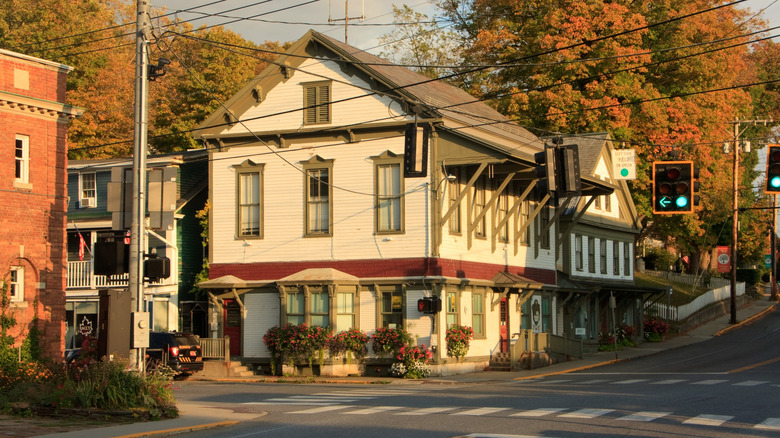
Green Mountain National Forest in Vermont covers nearly 400,000 acres around its titular mountain, encompassing hiking trails, 1930s Civilian Conservation Corps (CCC) structures, and a wealth of other historical and archaeological sites, plus numerous wilderness areas and opportunities for great views. There's hardly a driving route that isn't scenic in this region, but by combining parts of a couple — the Scenic Route 100 Byway and the Molly Stark Scenic Byway — you'll see some of the best fall views. Scenic Route 100 skirts the eastern edge of the mountains and is a popular route for skiers heading to the slopes in the winter. Molly Stark heads through the southern region of the national forest, and it intersects with Scenic Route 100 in the underrated artsy town of Wilmington.
From an ecological standpoint, Vermont's forests share a lot in common with New Hampshire's, so you'll find glowing maples, oaks, and birch along the way. On that note, the best time to see the brightest hues will also be between mid-September and early October. Post up in Bennington for New England charm and boutique stays like The Four Chimneys Inn or South Shire, plus well-loved restaurants like The Publyk House. Scenic Route 100 then swings through picturesque, historic towns like Weston and Ludlow, with access to attractions like Camp Plymouth State Park and the well-preserved President Calvin Coolidge Historic Site in Plymouth.
Highland Scenic Highway, Monongahela National Forest (West Virginia)
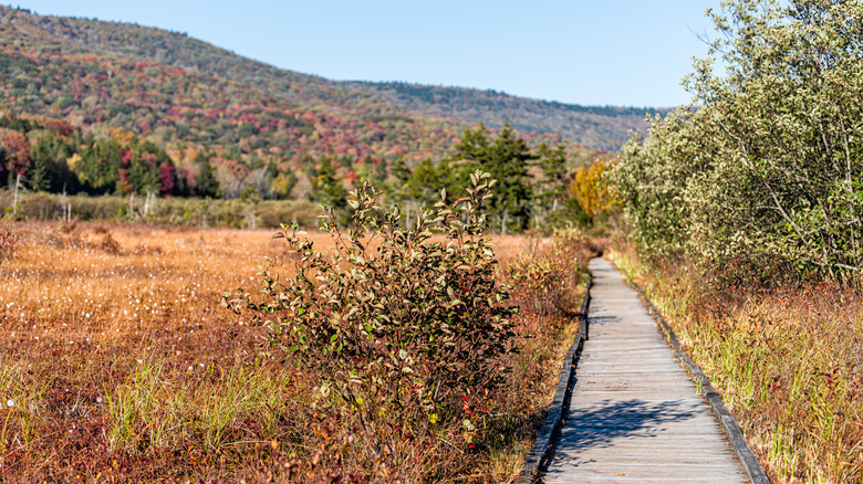
For an easygoing scenic drive in West Virginia's Monongahela National Forest, look no further than the Highland Scenic Highway, a 43-mile national scenic byway that makes the most of the rolling landscape. Verdant greens turn to glowing yellows and reds in the autumn, which you can make the most of from viewpoints at four pullouts along the way. About half of the route follows State Routes 39 and 150, where the speed limit is 55, but then it turns onto a parkway as it continues along State Route 150, where the speed limit is 45 — ideal for a leisurely afternoon tour. It's also closed to large commercial vehicles, so you're in for a quieter drive that's ideal for motorcycles.
The primary gateway to the Highland Scenic Highway is the welcoming town of Richwood, which is also a great basecamp for exploring the area's beautiful mountains, rivers, hiking trails, and more. One unique spot just a half-hour's drive from town is the Cranberry Glades Botanical Area, the state's largest bog with unique plants and terrain that mimics Northern Canada. Depending on the weather throughout the year, which can affect the timing of color changes in any region, oranges and reds can start appearing as early as mid-September in higher elevations, continuing into October.
Russelltown-Brasstown Scenic Byway, Chattahoochee-Oconee National Forest (Georgia)
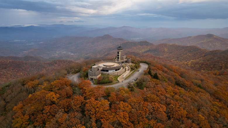
Winding through the southern Appalachian Mountains of northern Georgia, the Russelltown-Brasstown National Scenic Byway is ideal for seeing fall colors a little later in the year. You can usually count on vibrant color throughout October and into early November. The 40-mile, upside-down-lollipop-shaped loop traverses the beautiful Chattahoochee-Oconee National Forest, which spans 867,000 acres. At the route's northernmost point, which branches off the main loop to create the lollipop "stick," you'll ascend Brasstown Bald, Georgia's highest peak, for stunning views over the landscape. At the top, Brasstown Bald Visitor Information Center and its surroundings are a great place to grab a picnic, peruse exhibits, or set off from one of three trailheads. Make sure to climb to the "cloud level" observation deck for 360-degree views.
The Russelltown-Brasstown route encompasses the Mark Trail Wilderness, where trails lead to beautiful waterfalls and dispersed camping opportunities. At the opposite end of the route from Brasstown Bald is the outdoorsy town of Helen with its quaint Bavarian-style architecture. Hop onto a tube on the Chattahoochee River with an outfit like Cool River Adventures, which also features ziplines, a climbing wall, and more. When you're ready to refuel, dig into some German fare at Hofbrauhaus Restaurant or grab European snacks and pastries to go at Hofer's of Helen.
San Juan Skyway, San Juan National Forest (Colorado)
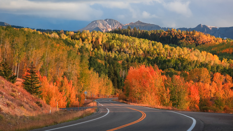
Colorado's San Juan Skyway is an incredible route to see blazing aspens and cottonwoods in the fall, which dot the alpine slopes in bright contrast to the pines. At a total of 236 miles, it's also a great excuse to build an entire getaway itinerary around stops at natural features and mountain towns like Ouray, Silverton, Ridgway, and others. For the most dramatic views, stick to the stretches between Stoner and Sawpit on the western side of the loop and Ridgway to Durango on the east side. These areas are deeper in the mountains, where you'll find switchbacks, the occasional overlook, and stunning views of some of the Rockies' famous 14ers, or peaks over 14,000 feet.
For an even tighter itinerary, if you don't mind steep drops and no guardrails to speak of, the stretch of U.S. 550 between Ouray and Silverton, known as the Million Dollar Highway, is a real treat. You'll follow the same route that gold and silver miners used in the 19th century to haul ore. If you stick to this rarefied area, plan to see peak colors around mid-September. At lower elevations, such as around Pagosa Springs, they can still be pretty vibrant until mid-October.
Alpine Scenic Loop Backway, Uinta-Wasatch-Cache National Forest (Utah)
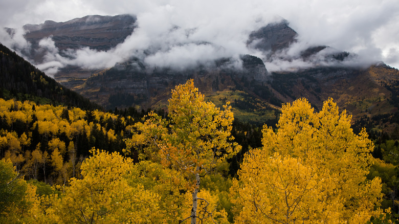
Utah is a state of contrasts, from its vast red rock canyons and plateaus that characterize the Mighty 5 national parks, which also make for a scenic, unforgettable road trip, to the soaring Wasatch Mountains that rise east of the Great Salt Lake. It's amid these dramatic peaks in Uinta-Wasatch-Cache National Forest, easily accessible from the city of Provo, that you can climb for a drive on the Alpine Scenic Loop Backway. The route heads into lofty peaks generally dominated by conifers, except that in the fall, the region's aspens paint the slopes with vibrant yellow streaks. At higher elevations, colors usually begin changing by mid-September, peaking in early October.
The Alpine Scenic Loop Backway is relatively short at only 20 miles long, so it makes an easy afternoon jaunt on a crisp fall day. It begins on State Route 92 at the opening of American Fork Canyon, shortly after which it passes through Timpanogos Cave National Monument. This unique attraction is well worth a stop to see its otherworldly geological formations, weather permitting, but you'll need a reservation for a tour to enter the cave. Continue on to Sundance, the jaw-dropping mountain ski resort that Robert Redford once owned. Overall, you'll ascend to an elevation of 8,000 feet before heading back down via Provo Canyon toward the city of Orem.
Rim of the World Scenic Byway, San Bernardino National Forest (California)
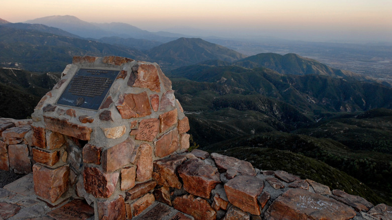
For a late-season show in Southern California, where you might not necessarily expect to find dazzling autumn colors, the San Bernardino Mountains are a must. One of California's best road trips offers forest and alpine views in addition to desert expanses, and that's the Rim of the World Scenic Byway, which heads through San Bernardino National Forest. It traces the mountains' rim for 110 miles, leading to postcard-worthy panoramas and a change in ecological zones that feels so different from the valley floor that you'll wonder if you're still in SoCal. It's also a great place to spot color later in the year, as foliage usually peaks from late October into November.
A couple of the best places to explore autumn colors along the Rim of the World byway are around Lake Arrowhead, Big Bear, and Big Bear Lake. By the time you reach these beautiful resort communities, you'll have ascended to an altitude of more than 5,000 feet, meaning evergreens mixed with aspens and trees planted around the towns that glow in a range of hues. Hike some of the area's many trails, then check in at one of the area's luxury resorts such as The Club by Bluegreen or cabins at N+P. Don't miss dinner at Captain's Anchorage, which has been serving up surf 'n turf along with lodge-style dining since 1947.